No doubt, June and Spring in general was colder and wetter than average for a lot of places in and around Colorado. In fact, several mountain locations saw significant snowfall this past week while the front range was buried in moisture, low cloudiness and severe weather.
The good news (for summer weather and warm temperature lovers) is we are spying a rather large weather pattern shift starting this week. For the past several months low pressure systems have been riding the jet stream across the mountain west into Colorado, this has made for very unsettled weather so far.
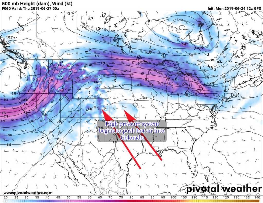
The change is becoming very apparent in a lot of long and medium range models:
As you can see from the GFS snapshot above, high pressure is beginning to establish to the Southeast of Colorado. This is something we tend to see in typical summertime patterns in Colorado. As such, we’d expect our weather to shift away from cold and unsettled, to hot and summer-like.
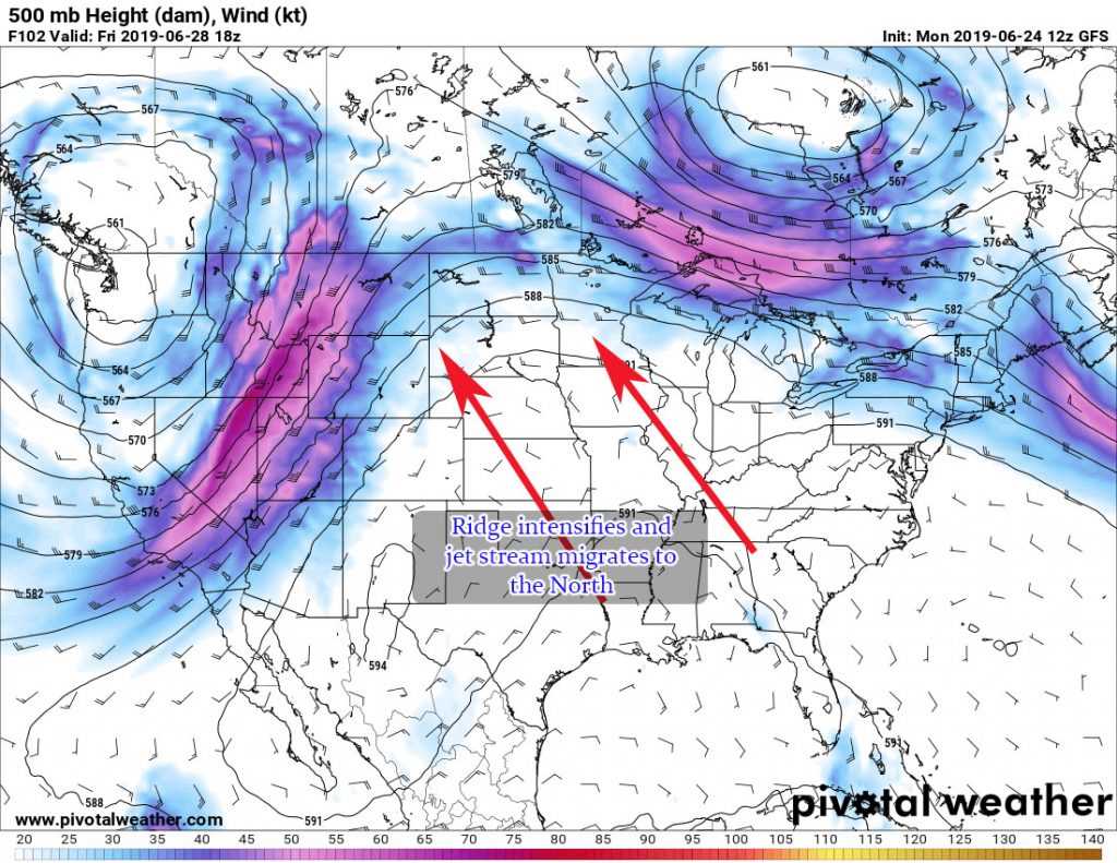
As we move into the weekend we see the ridge intensify and shift the jet stream and thus the storm track away from Colorado. Notice the trough moving into the Northwest? That feature will struggle to make it into Colorado so while we may see a slight chance of storms from it over the weekend (very small, think 10% or less chance)
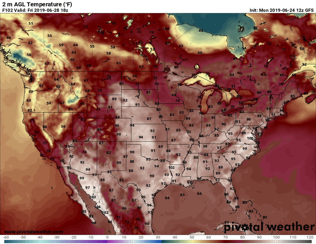
Here’s peak at the GFS forecast temperatures on Friday…
Notice that hot air making its way up into the middle part of the country… right about where the high pressure ridge establishes. Now keep in mind, this model shows at noon on Friday so these aren’t the “true” high temperatures… probably need to add a few degrees to the ones in Colorado at least.
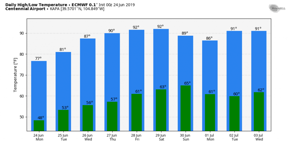
For those of us closer to home along the Palmer Divide, the Euro Ensembles show a pretty toasty week and weekend across our area as well. The official station for our area is Centennial Airport, so if you are higher elevation than there (most of us are) maybe subtract a degree or two.
True Long Term Shift or A slight Reprieve Before Back to Cold and Unsettled?
Stay tuned for another post, now that summer is finally here I’ll be crunching the data and looking at some models to see if this is just a short term pattern swing or if summer is truly here to stay.
For now, enjoy the warm temperatures and generally dry conditions for the next 5-7 days!

