
As is typical this time of year, we will start off the day very nice, sunny and cool. We will quickly see temperatures warm up in the afternoon and with it will come our daily chance for showers and thunderstorms. Here's a quick update of what to expect today:
Severe Weather Possible
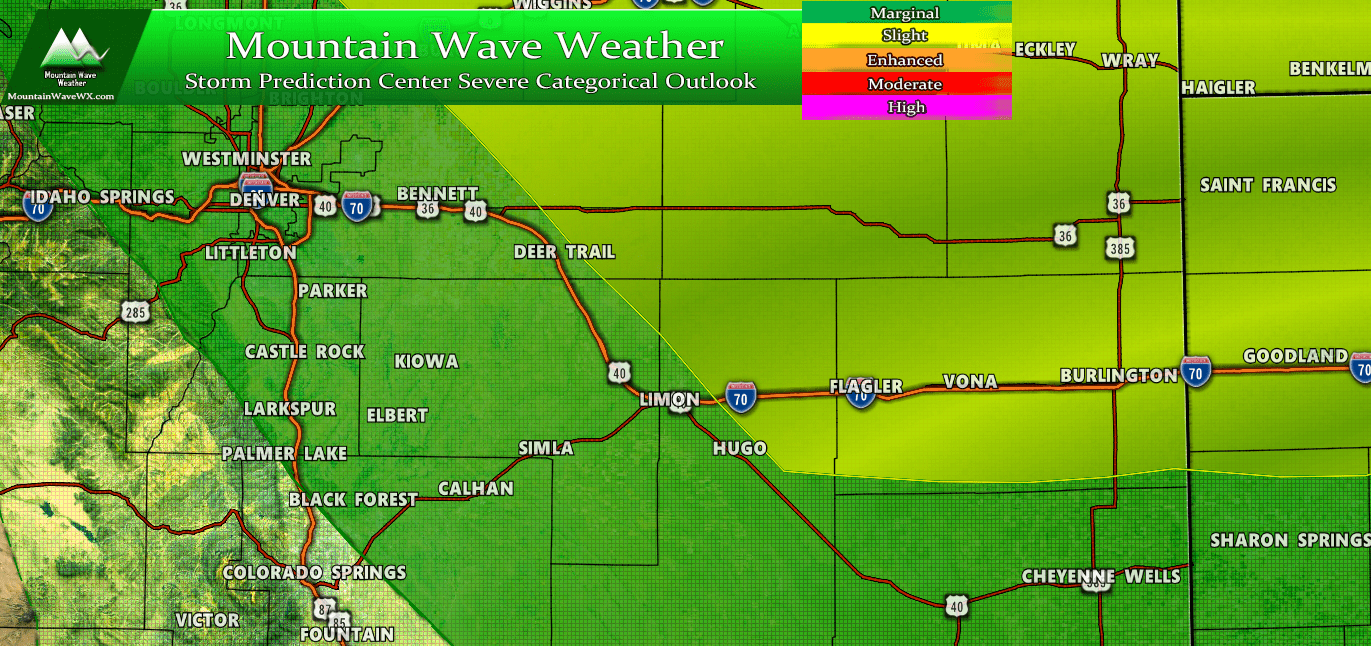
SPC Severe Outlook as of this morning 7/4/2019
Severe thunderstorms will be possible across Northern, Northeastern and Eastern Colorado today. A marginal risk extends across the Palmer Divide meaning a stray severe storm is possible but most storms seen in the area will remain below severe limits. As you move Eastward into Eastern and Northeastern Colorado the risk is upgraded to slight, again meaning severe weather will be scattered in nature, but is a slightly higher chance than the green shaded areas.
Primary threats to watch out for with these storms:
- Large hail
- Damaging wind
- Heavy Rain
--A slight risk of tornadoes exists, but mainly in areas well Northeast of Denver.
Temperatures - It's Going to be a Scorcher!
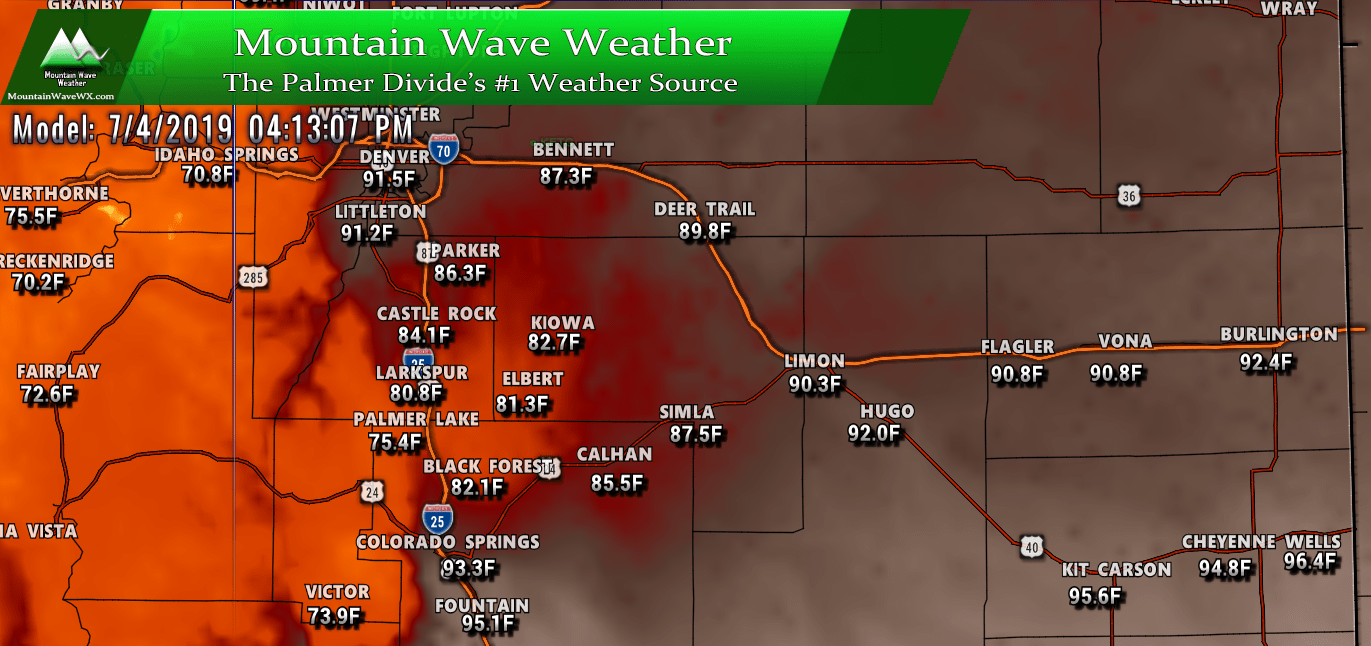
HRRR predicted high temperatures for today
High temperatures for many areas along the Palmer Divide will top out in the mid to upper 80's today. As you move lower in elevation things will heat up a bit more with lower elevation areas along the Palmer Divide (Lone Tree, Parker, Calhan, Simla) all seeing temps in the upper 80's to low 90's. Not the hottest temperatures we've seen this year, but you will definitely notice how toasty it is if you spend time outside this afternoon.
Make sure to drink plenty of water and sunscreen is a must today!
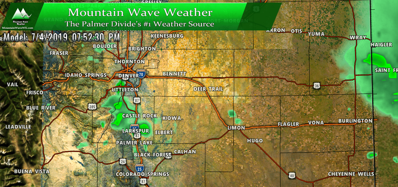
Afternoon Thunderstorms - Have a Plan to Move Inside
Models have pinpointed the 3PM-8PM timeframe as the most likely time we see thunderstorms along the Palmer Divide so keep that in mind. There is disagreement amongst the models as to how strong those storms get, as we know models can't exactly pinpoint when or where a storm hits; they can only give us general areas to look out for.
Nam3K simulated reflectivity
The Nam3k shows weaker storms over Douglas and Elbert counties with a later timeframe, closer to 7-8PM.
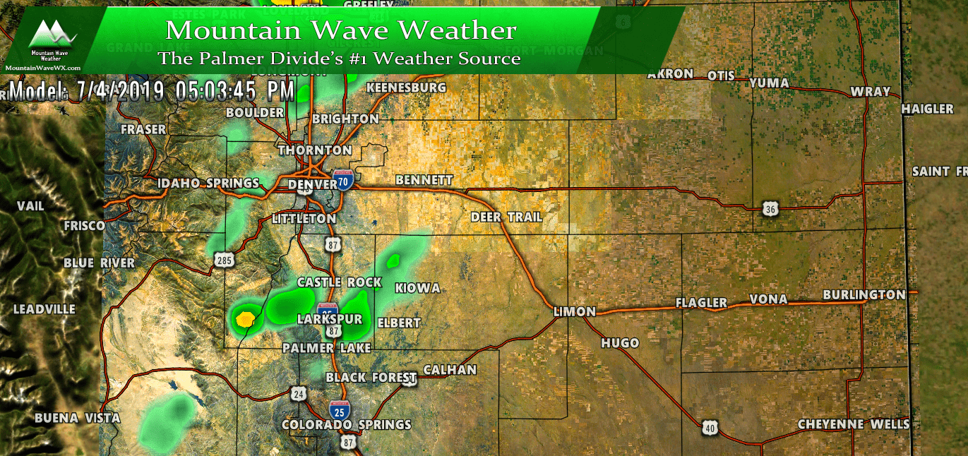
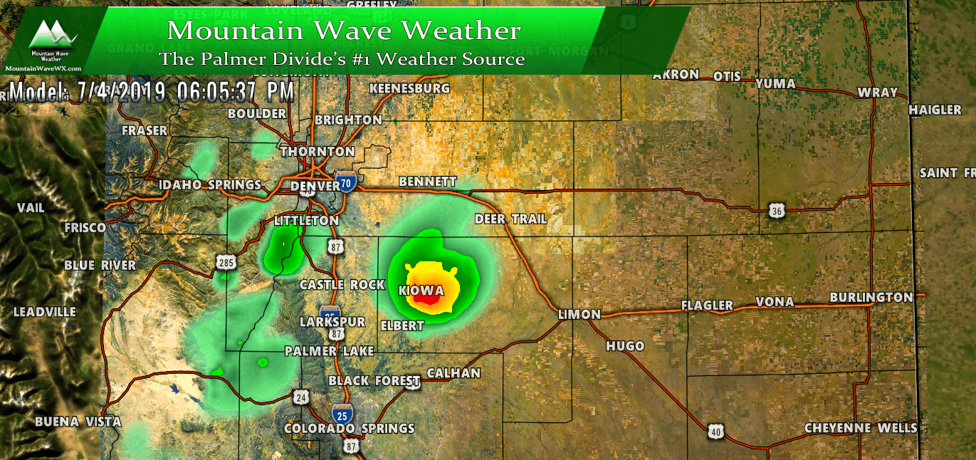
HRRR simulated reflectivity at around 5PM
HRRR simulated reflectivity at around 6PM
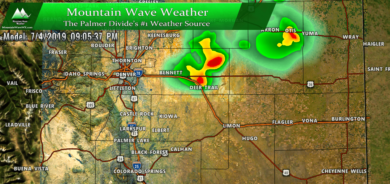
HRRR simulated reflectivity at around 9PM
By a bit later in the evening we should see a lot of the storms shift off to the Northeast. If these models verify they all have a pretty decent evening for the area after 9PM.
We will keep an eye on this throughout the day and be sure to pass along any updates. We will also forward along the 11AM SPC update if it looks like the severe weather area is shifting westward and closer to home.
Hope everyone has a happy and safe independence day, remember to keep an eye out for lightning this afternoon!

