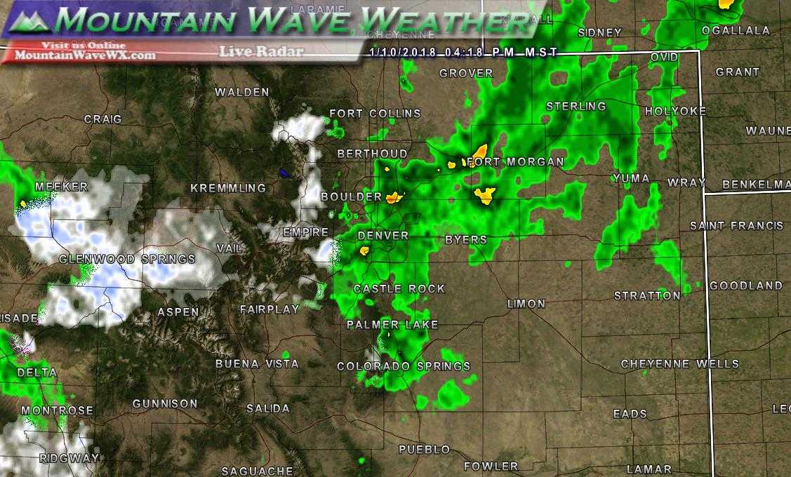
4PM Radar on January 10, 2018
Despite a quick hitting storm that brought beneficial rain to the plains and a bit of snow and ice to some areas along the Palmer Divide, it simply wasn’t enough to make a dent in our longer term dry conditions. We will need several more storms with much more moisture and longer durations if we hope to start catching back up to where we should be.
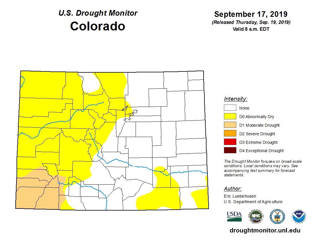
Drought Worsens Across Colorado
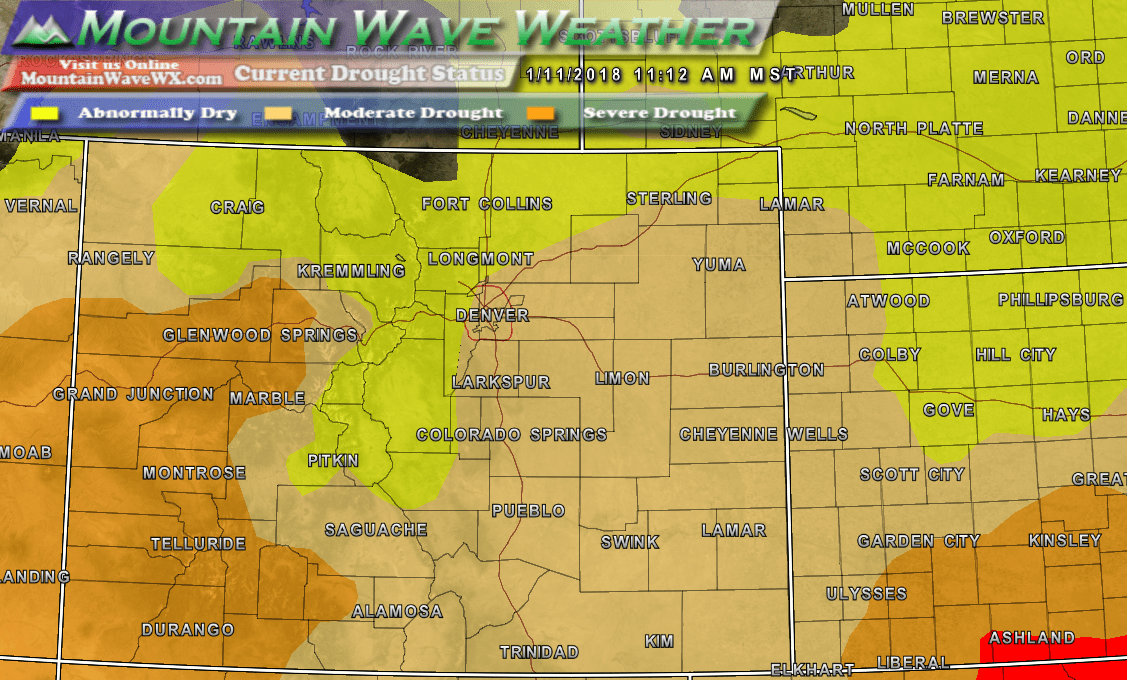
Current drought status across Colorado
Expanding from last week, abnormally dry conditions cover most of the central and northern mountains as many of those areas are well below their average snowpack numbers for this time of year. Moderate drought expands to cover most of the front range and Southeastern Colorado. Finally, severe drought was expanded to encompass larger portions of Southwestern Colorado.
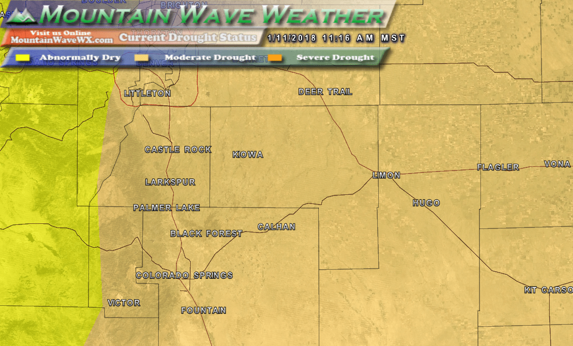
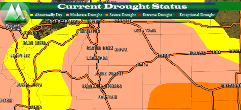
Drought status along the Palmer Divide region as of January 11, 2018
If we zoom in closer to home, you can see nearly every community across the Palmer Divide is now included in the Moderate Drought status designation.
What Does Moderate Drought Mean?
According to the Climate Prediction Center:
This level of drought involves “some damage to crops, pastures; streams, reservoirs, or wells low, some water shortages developing or imminent; and voluntary water-use restrictions requested,” according to the monitor.
For us in Colorado it means expect very dry vegetation and higher fire danger. Expect Fire Weather Warnings to be more common, especially on warm and windy days.
We will continue to keep an eye on conditions but sadly many models are pointing to continued dry conditions, especially East of the Continental Divide for the near and medium term.
