You’ve no doubt heard the local media starting to ramp up about the possibility of our first snow coming in the next 7-10 days along the front range. As always, these stories tend to be “exagerated” a bit to enhance ratings and get viewers and while they may be right it’s not going to be the drought busting, winter inducing snowstorm they’d make it out to be. So with that said, let’s take a less exagerated, no B.S. look at what this storm system is actually looking like as of right now…
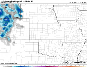
The first hint of snow I see is on the GFS model for Thursday November 17. You’ll notice the mountains look to benefit most out of this system at first look but you’ll also notice the snow amounts are nothing to shout at there. This is the first sign that makes me question this storm system, despite it’s more favorable track the amount of moisture it looks to bring into the area looks questionable. One other thing I notice is the pronounced drier slot against the foothills, this could be a sign of downsloping and would help further kill the chances of moisture getting across the divide.
A few other things give me pause about this system.
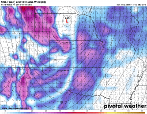
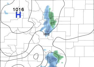
A quick snapshot of the surface map and winds shows the approximate positioning of the low during the time we are supposed to get precipitation. First of all, for a significant precipitation event, this low is way too far North from what we’d like to see. Secondly, the presence of stronger Northerly and Northwesterly winds confirms the presence of downsloping conditions.
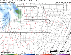
The GFS’ own precipitation type forecast keeps a lot of the better precipitation North of the metro area and to the West of the continental divide. One thing to point out with this image is the tight gradient lines over the eastern half of Colorado. This is a sign that we can expect pretty strong wind conditions if this forecast verifies, it is corroborated by the image above with the surface winds up around 30-40 knots.
The Takeaway
While this storm system is still a long ways out with plenty of time to change, it doesn’t scream snowstorm at me. If the forecast were to actually verify exactly how we are seeing it now, I would expect windy conditions with a chance for rain. The point here overall is that even though this thing looks unimpressive right now it’s worth keeping an eye on. I stress this every winter, but the track and positioning of winter storms is everything and a slight shift can change everything.
Here’s what I’m going with right now:
Chance for snow with this storm system as of today: 10-30% chance
If it should snow, accumulation: 0-1 inches
Interestingly enough, if it doesn’t snow with this storm system, we will most likely break the record for latest first snow (November 21) as it looks dry again after this storm system for several days.
Since this is still so far out, the forecast is subject to change as we get more data. Stay tuned to Mountain Wave Weather and we will pass along any changes with this storm system.



Trackbacks/Pingbacks