A lot of folks are waking up this morning and asking, “where is the storm?”, “did the storm miss us?”
The answer is no, it is just not here yet. Sunday night into Monday’s snow featured initial bands of snow that pushed into the area ahead of the storm, it was never going to be the main focus.
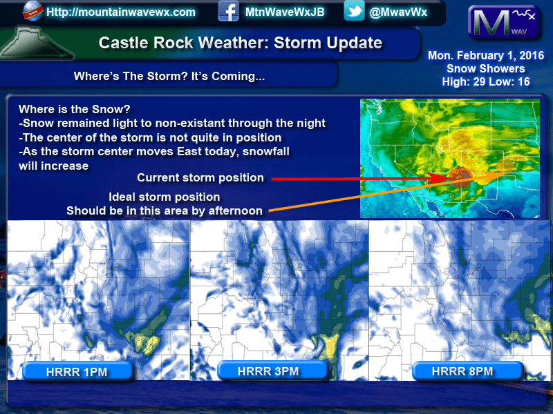
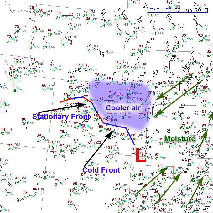
You can see from the graphic below the storm position as of this morning versus where it will be this afternoon. The position it is in this morning is not favorable for snow along the front range of Colorado so we are waiting for it to move Eastward. Once it makes it East of the divide and into Southeastern Colorado we should begin to see more and heavier bands of snow push into the area. This could start as early as this afternoon, so be aware about that with the evening commute.
The bottom row in the graphic shows the HRRR at various times this afternoon, you can see that it is predicting some heavier snow between the 1-8pm hours, so as of right now this storm is mostly on track to bring good snow to the area this afternoon and tonight.
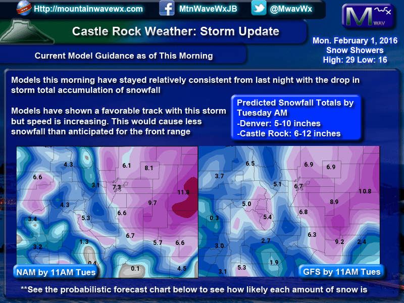
We had a quick look at the models this morning and they remained mostly on target as to where they were late last night. Snow totals have decreased overall mainly because of an increase in the speed of the storm. If there is nothing out East to block it or slow it down, it moves through Colorado very quickly. The quicker the storm moves through, the less time it has to drop significant snow over Colorado.
The models still snow significant snow by Tuesday morning. Due to the elevation Denver may see slightly less, probably in the 5-10 inch range. Castle Rock and areas along the Palmer Divide will see 6-12 inches with possible higher amounts East of Castle Rock towards Limon.
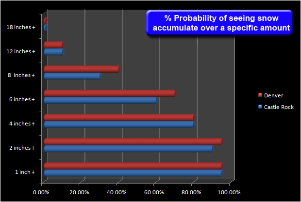
The 6-12 inch range looks likely for the Castle Rock area, but as you can see from the probabilities below, the lower amount of this range is most likely. A total accumulation over 4 inches is likely, over 6 inches is even decently likely but you can see as you try to accumulate over the 8 inch range your probability is only about 40%. This doesn’t mean it won’t happen, it just means it is less likely to see over 8 inches of snow. Accumulation over a foot is very unlikely based on this data.
Keep in mind if this all verifies (likely it will) tonight’s commute home may be a rough one!
Stay tuned and we’ll have further updates if any of this changes by this afternoon.

