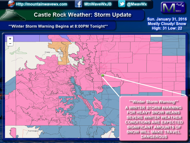
The National Weather Service in Denver has pulled the trigger and upgraded our Winter Storm Watch to a Winter Storm Warning. They have also adjusted the start time from midnight to 8:00pm Sunday.
A Winter Storm Warning means that a winter storm containing heavy snowfall will make travel conditions dangerous. They specifically mention the Monday morning timeline, Monday during the day, overnight Monday and into Tuesday morning.
You can read the NWS Warning Statement here for extra details
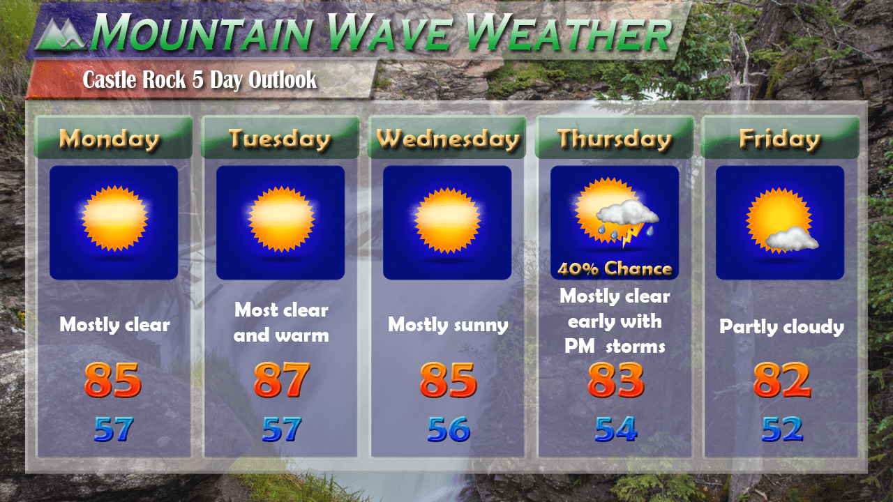
Castle Rock's Snowfall Prediction
Monday Morning: 3-6 inches
Tuesday Morning: 8-14 inches
*Don't let the low totals fool you on Monday AM, roads may get quite bad very quickly!
Synopsis
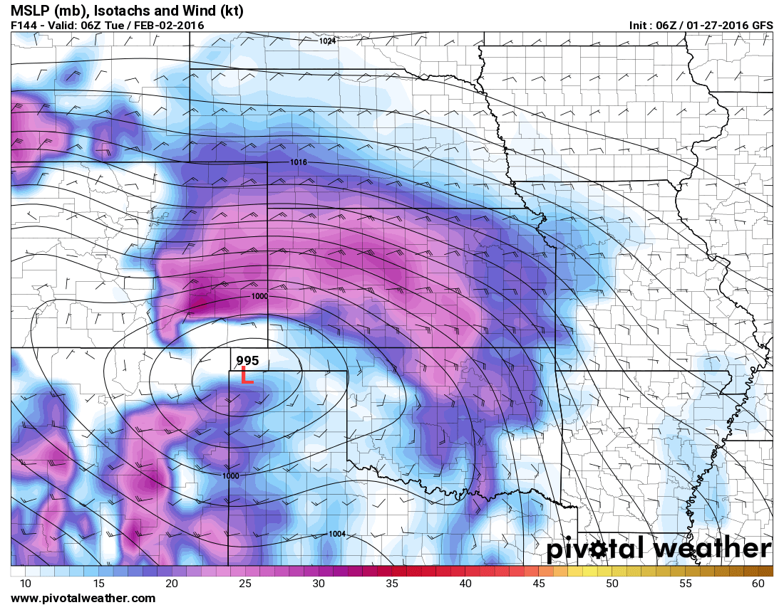
Model guidance as of this afternoon continues to hone in on this storm. They are still not completely in agreement with some significant out-liers either way but two of the ones I tend to trust more in this time frame are pretty close together in agreement.
Snow will begin Sunday evening and become a bit heavier overnight into Monday morning. Don't expect a huge amount of snow Monday morning for the commute but do expect icy roads, stronger winds and tough travel conditions.
If you make the trek into work on Monday morning, please keep in mind conditions are expected to deteriorate throughout the day. The Monday evening commute could be one heck of a mess.
Snowfall is expected to continue through the day Monday and will become heavier later in the day into the evening. The Monday evening commute could be a very messy one if this verifies.
Snow will continue overnight Monday and into Tuesday morning. The combination of cold temperatures, continued snowfall and strong winds could make travel dangerous through this period.
Modeling Updates
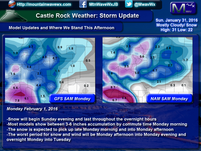
First we look at the projected snowfall totals through Monday morning. Most agree on the 3-6 inch range by morning, this along with strong winds could make the roads icy very quickly.
When looking at total storm accumulation by Wednesday morning:
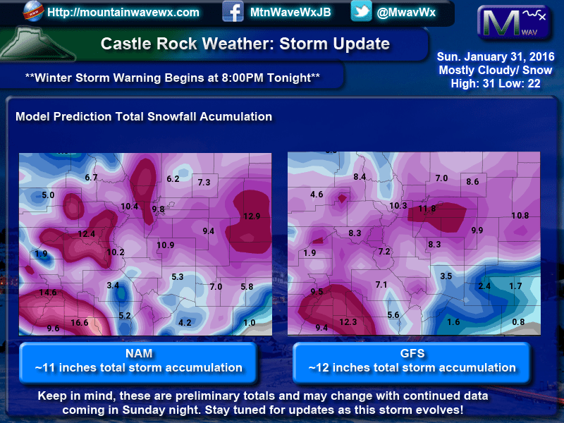
I cannot stress this enough but, these are preliminary model runs and I expect these totals to change going into Sunday night. I will have updates as necessary.
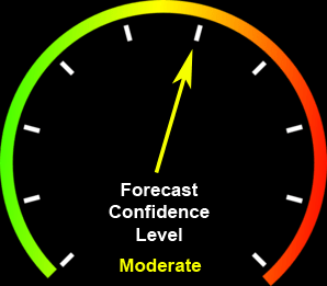
The forecast confidence right now is moderate. This mainly because there is still uncertainty between models on the overall positioning of this storm. Any wobble going into this evening could mean much higher or lower snow totals.
Stick with us as we will have updates this evening with any changes with this storm; higher or lower.

