If you remember yesterday, there was quite the buzz about a storm swinging a bit further South and bringing more energy that anticipated. As soon as we mentioned the thought of snow falling the internet was off! We know that it has been super dry and snow has been very hard to come by this year, we’ve gotten to the point where the mere mention of the word “snow” sends people in a tizzy! That’s ok, it’s weather!
We need any moisture we can get very badly, but this storm will not be a “drought buster” by any means of the imagination. In fact, this storm looks meteorologically very similar to the past several storms we’ve had. Given that information, what we can expect with this storm is similar; lots of wind, a quick shot of accumulating snow and not large amounts of accumulating snow. Let’s dive into the details:
Wednesday Night/ Thursday Morning Storm
The thing to remember about this storm is that the main energy is coming out of the West/Northwest and if you’ve been following us for any amount of time; you know that we don’t get excited about storms like this. We simply do not get big accumulating snow from storms like this.
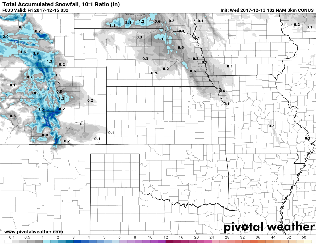
Most models are in agreement with snowfall being mainly a foothills/mountains event with some accumulation on the front range. The Palmer Divide is one area we are watching as our chance of accumulating snowfall will be notably better than most areas in and around Denver. Still, all models are in agreement that this is not a major snowfall event. We can’t ignore however; just like the last storm the accumulation will hit quickly and could cause travel difficulties late Wednesday night and into Thursday Morning.
Timing
Most models have snow beginning to accumulate after midnight so expect snow falling sometime around then give or take an hour or two. This storm shouldn’t affect the Wednesday evening commute in any capacity.
Area
Along the Palmer Divide, areas in and around Castle Rock should see snow accumulation by Thursday morning. Areas South and West of Castle Rock should see slightly higher snow accumulations.
Hazards
Slick roads will be possible, especially in areas South of Denver on Thursday morning. Areas between Castle Rock and Monument will have the highest chance of larger travel impacts with roads improving as you move further North.
Snowfall Accumulation
- Castle Rock
- 0-3 inches total accumulation looks good as of right now. Most models have snowfall right in the 1-1.5 inch range but any cooler trend in temperatures could bump those numbers up slightly.
- Areas South and West of Castle Rock (Palmer Divide, Sedalia, etc…)
- 1-4 inch range for snowfall
- South Denver Suburbs
- 0-3 inch, should see similar amounts to Castle Rock but slightly lower due to elevation
- Elbert Area (Southeast of Castle Rock –have to throw this one in now as we have a few people in and around this area following us now!)
- 0-3 inches, most models have similar amounts to the Castle Rock area
Summary
Be ready for the potential of a slick drive Thursday morning, this storm won’t snow enough to cause closures or major travel impacts but will cause enough moderate impacts for some headaches.
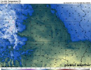
Temperatures won’t be super cold with this storm system but it will be quite a shock to the system after several days in the 60’s!
We’ll have updates on another potential storm around Saturday that may bring us another chance of snow later this week. Additionally, you can read our medium range weather outlook here if you missed it:
And here’s some more fun reading:

