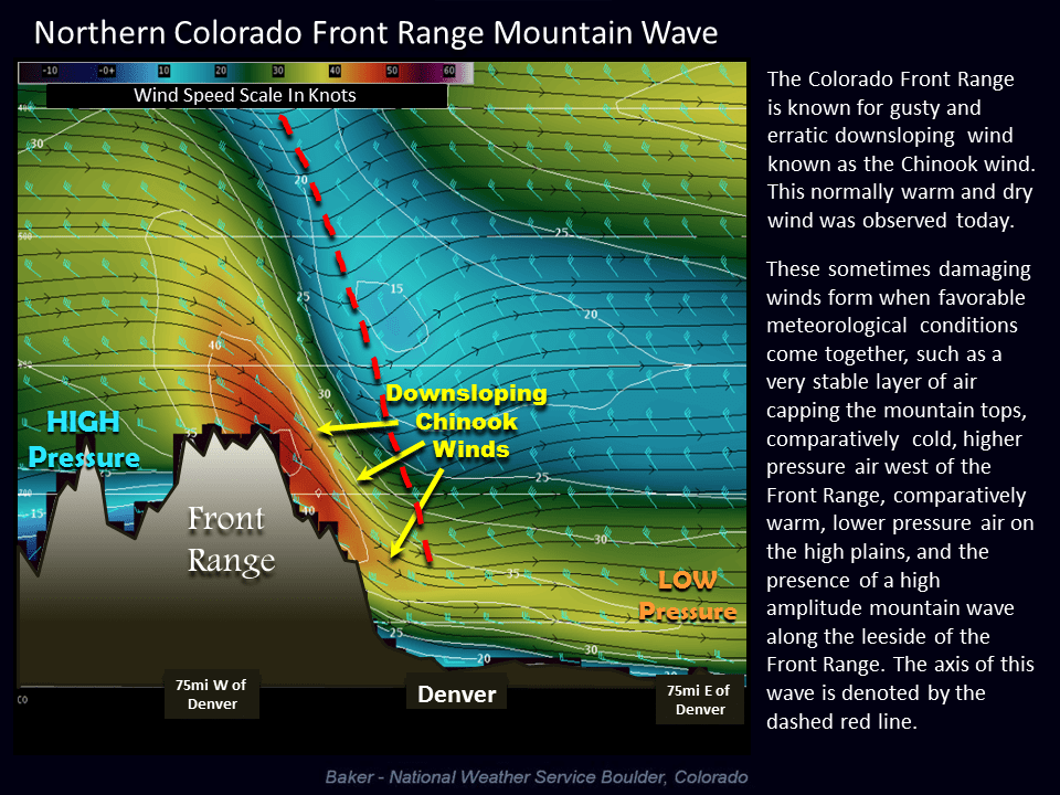
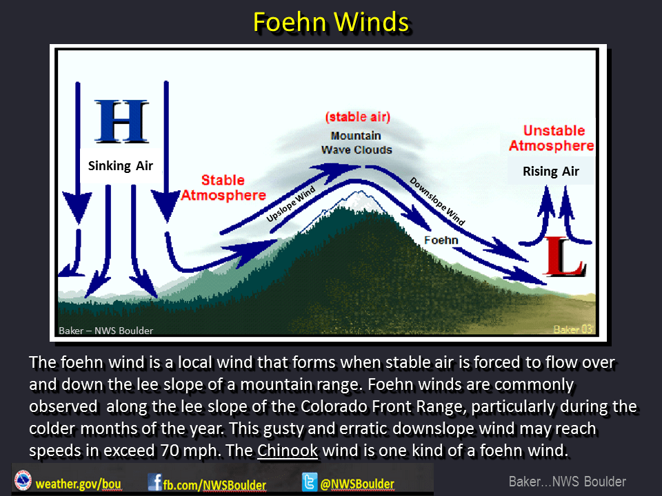
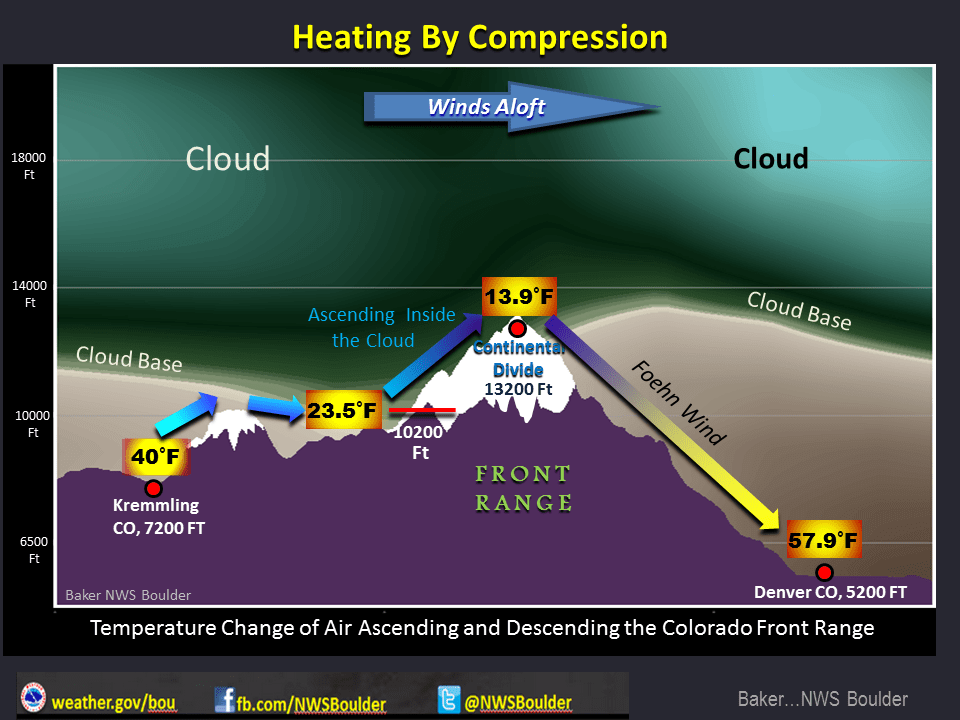
Strong downslope winds will cause warm and very windy conditions throughout the week along the front range. The National Weather Service in Denver put together a neat graphic on how this process works to keep us very warm and dry:
This setup is commonly called “Chinook Wind” as strong winds come up and over the mountains and as they roll down the foothills of Colorado the air compresses and warms. This causes very windy conditions, especially along the foothills and breezy conditions in most other areas along the foothills. “Chinook”, by the way is the inuit word for “snow eater” as these warm winds commonly melt our snow very quickly.
A Note About our Sunrises and Sunsets
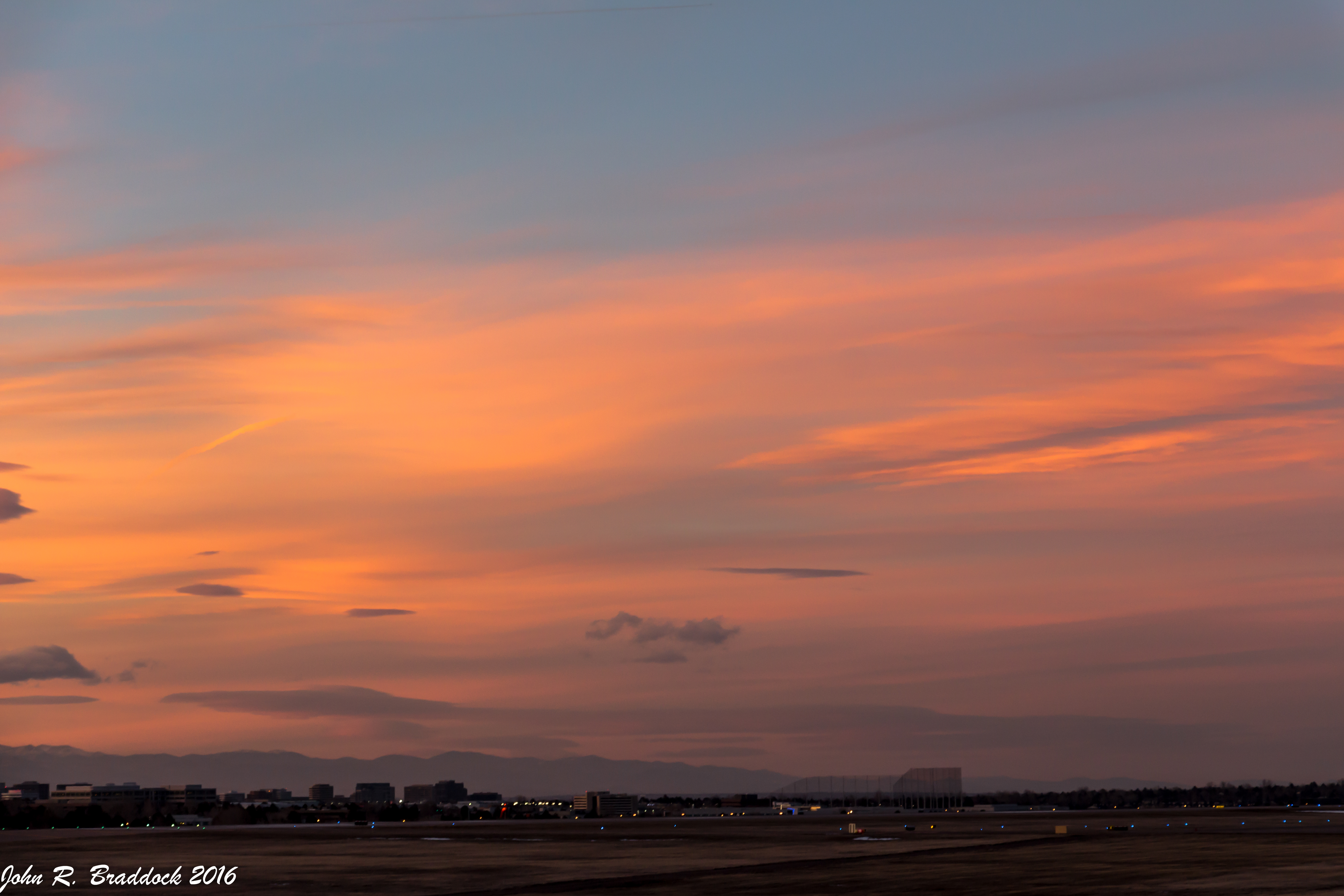
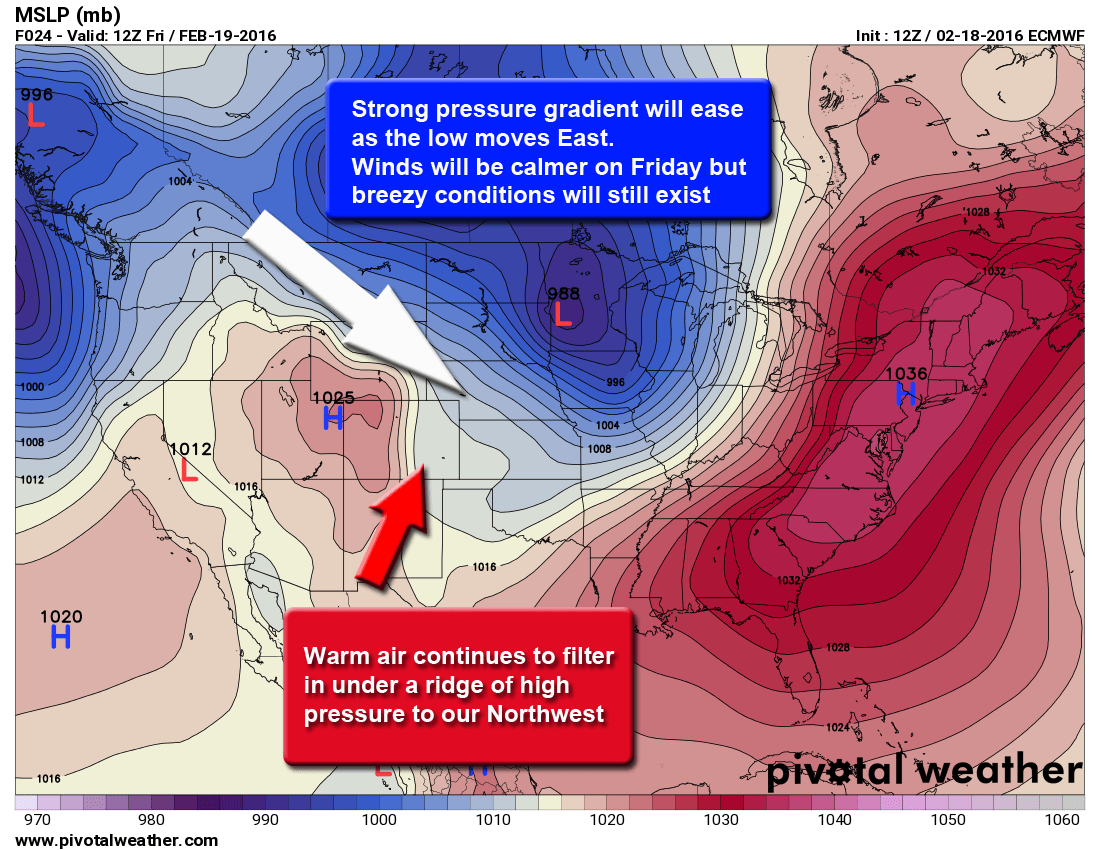
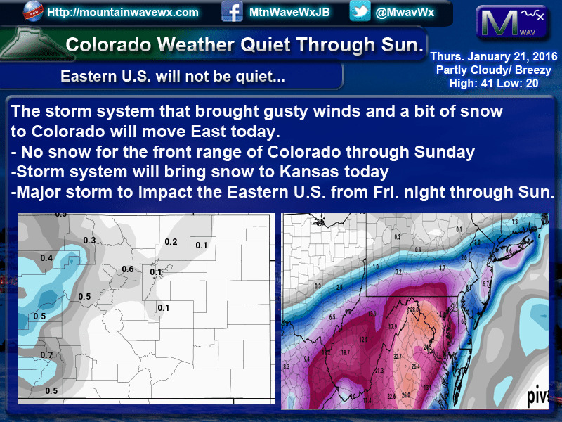
If you’ve been along the front range of Colorado this past week, you’ve probably noticed the amazing sunsets and sunrises we’ve had nearly every day for the week. The mountain wave clouds that have parked over us for the past week are due to the current weather pattern. Again, the National Weather Service has some great graphics that explain a couple of the setups we have seen this week.
As long as these patterns continue, we will continue to see a wave or wave clouds parked over the front range. This means continue to look for those great sunrises and sunsets, but also continue to look for very warm days and very windy conditions.
How Long Will it Last?
The above model is a look at the upper level wind pattern across the United States from today till about March 6. You’ll notice the large ridge to our West and the jet stream overhead, this will ensure our warm and windy weather for a long period of time. The models for lower and mid level winds show a very similar setup for this period so I feel pretty confident in saying that our chances for any types of large snowstorms are pretty low the rest of February. Even when the ridge breaks down next week, our winds remain westerly which would mean better chances of snow in the mountains but not much for anything East of the divide.
Not to say we won’t get any storms at all, but the chances are quite low. The model shows a couple of disturbances that may provide a bit of spotty rain or snow activity here and there.
One note; the last few days of the model we begin to see some troughs establish in the jet stream signaling a possible weather pattern change. Being at the far end of the model view, it is way too early to take this to the bank but if it materializes, it could be the pattern change we would look for to see possible blizzard type storms in March. This will need some close watching as if it holds and strengthens into March we could be looking at much more energy entering the state.
The rest of February looks very warm and dry, expect above average temperatures and higher winds. Areas East of the divide will most likely not see snow until sometime in March.

