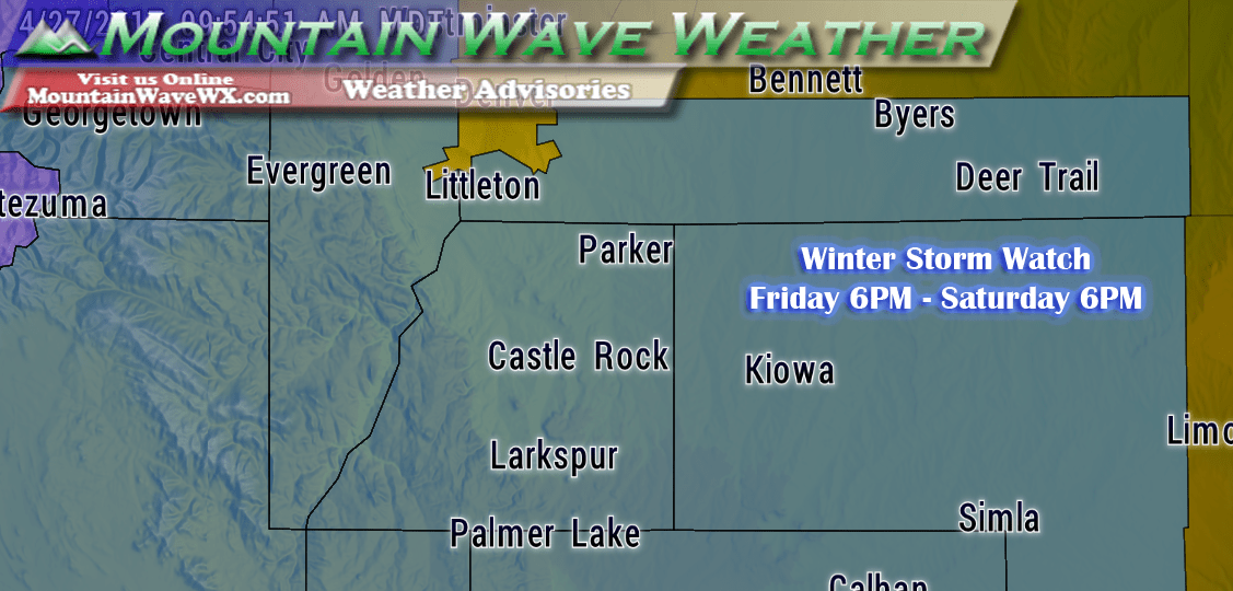
Colorado Winter Weather Watch/Warning/Advisory Information as of This Morning
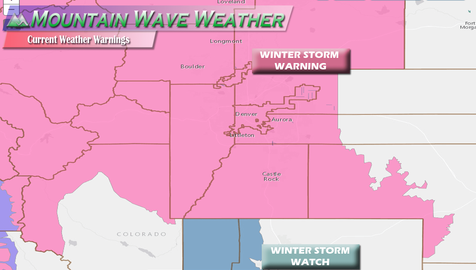
***Winter Storm Warning***
INCLUDING THE CITIES OF AURORA, BRIGHTON, CITY OF DENVER,
DENVER INTERNATIONAL AIRPORT, HIGHLANDS RANCH, LITTLETON, PARKER,
CASTLE ROCK, ELBERT, FONDIS, KIOWA, LARKSPUR, EATON, FORT LUPTON,
GREELEY, AND ROGGEN
...WINTER STORM WARNING IN EFFECT FROM 2 PM THIS AFTERNOON TO
11 AM MST THURSDAY...

THE NATIONAL WEATHER SERVICE IN DENVER HAS ISSUED A WINTER STORM
WARNING FOR HEAVY SNOWFALL, WHICH IS IN EFFECT FROM 2 PM THIS
AFTERNOON TO 11 AM MST THURSDAY.

* TIMING...SNOW WILL DEVELOP LATE THIS AFTERNOON AND CONTINUE
  THROUGH THURSDAY MORNING. THE SNOW MAY BE HEAVY AT TIMES
  OVERNIGHT.

* SNOW ACCUMULATIONS...8 TO 12 INCHES.

* WIND/VISIBILITY...WEST 10 TO 20 MPH IN THE MORNING BECOMING
  NORTHEAST 10 TO 15 MPH IN THE AFTERNOON. VISIBILITIES WILL BE
  REDUCED TO LESS THAN ONE QUARTER MILE DURING PERIODS OF HEAVIER
SNOWFALL.

* IMPACTS...TRAVEL WILL BECOME HAZARDOUS DUE TO SNOW COVERED
  ROADS AND POOR VISIBILITY. IF TRAVELING INTO THE COLORADO HIGH
  COUNTRY, BE SURE TO HAVE ADEQUATE SNOW TIRES AND ALLOW EXTRA
  TIME TO REACH YOUR DESTINATION SAFELY.

PRECAUTIONARY/PREPAREDNESS ACTIONS...

A WINTER STORM WARNING MEANS SIGNIFICANT AMOUNTS OF SNOW...
SLEET...AND ICE ARE EXPECTED OR OCCURRING. THIS WILL MAKE TRAVEL
VERY HAZARDOUS.
Latest Forecast Update
So far everything remains fairly on track this morning. The National Weather Service shows our area getting closer to the 8-12 inch range of snow with its latest update this morning. Most likely the snowfall will end up somewhere in that range but I'm still skeptical of the 12 inch mark as many of the models this morning have held steady or even decreased snowfall amounts from last night.
With that, we are holding steady on our forecast from yesterday except with a few changes in the timing of the arrival of the storm:
Timing
- The storm is still mainly on track to affect the Castle Rock area late Wednesday night, into the day Thursday and possibly into the late evening or early morning hours of Friday. Some models have shown snow lingering a bit later than expected and any areas under the snow bands could see decent snow totals by the time exits the area.
- Snow has already been reported in some areas across the front range as of this morning. While many models still don't snow the brunt of the snow until later Wednesday night, we can't ignore that an earlier arrival will make for a tricky Wednesday evening commute. As such, the worst road impacts are still expected Thursday morning but keep a close eye out for deteriorating conditions on Wednesday afternoon.
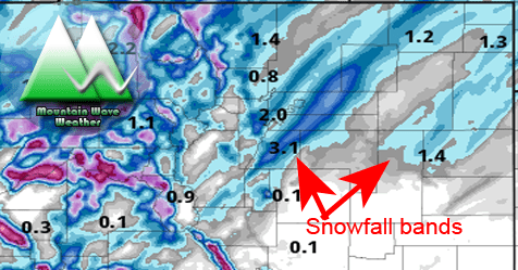
Snowfall
- This is going to be a very tough storm to predict snow for, mainly because where the snow bands set up will dictate who gets a ton of snow and who doesn’t. Try not to focus too much on the snow range but more on the impacts the snow and cold will bring.
- 5-10 inches is the range most likely in Castle Rock at this time. I cannot see enough supporting data to confidently say a foot like the NWS says is possible. I do believe snow amounts will be highly variable depending on where you live (I’ve seen some areas in Castle Rock show 8 inches while areas only a few miles away see 4 inches…) Some areas in Southwestern Douglas County could see totals closer to the 7-14 inch range.
-
Impacts
- The cold air has already arrived from the arctic front to our North. An additional shot of cold air will come late int he day Wednesday so expect very cold temperatures. It will remain cold through at least Friday so expect any snow that falls to stick rather quickly
- Travel conditions look to deteriorate later in the day Wednesday though the exact timing is still a bit in question. We are not sure if the snow will arrive early enough to make Wednesday evening’s commute slick but we are pretty confident travel will be difficult on Thursday morning and possibly throughout most of the day on Thursday.
- Stay tuned through the day Wednesday and we will update ASAP if we see something coming that may affect travel Wednesday evening.
Latest NWS Probabilistic Snow Range Chart
| For cities in Douglas, CO county |
| Location | At least | Likely | Potential for | 0" | 0.1-1" | 1-2" | 2-4" | 4-6" | 6-8" | 8-12" | 12-18" | >18" |
|---|---|---|---|---|---|---|---|---|---|---|---|---|
| Castle Rock, CO | 2 | 6 | 9 | 4% | 4% | 5% | 17% | 23% | 23% | 21% | 3% | 0% |
| Deckers, CO | 1 | 4 | 7 | 6% | 5% | 9% | 26% | 27% | 18% | 9% | 0% | 0% |
| Franktown, CO | 2 | 5 | 9 | 5% | 3% | 6% | 19% | 25% | 22% | 18% | 2% | 0% |
| Highlands Ranch, CO | 3 | 6 | 9 | 3% | 3% | 4% | 16% | 24% | 25% | 23% | 2% | 0% |
| Larkspur, CO | 1 | 6 | 10 | 9% | 4% | 6% | 15% | 19% | 19% | 23% | 5% | 0% |
| Monument Hill, CO | 1 | 7 | 11 | 11% | 3% | 5% | 13% | 16% | 17% | 26% | 9% | 0% |
| Parker, CO | 3 | 6 | 10 | 3% | 2% | 4% | 15% | 22% | 22% | 26% | 6% | 0% |
| Roxborough Park, CO | 2 | 6 | 12 | 3% | 3% | 4% | 13% | 19% | 18% | 27% | 12% | 1% |
For Castle Rock the highest probability as of this morning, is that we end up somewhere between the 4 to 12 inch range. I don't see a ton of supporting data that gets us up to a foot of snow but the possibility is there none the less.
We will keep a close eye on this storm through the day on Wednesday and be sure to pass along any updates as they come in. Stay warm today!

Trackbacks/Pingbacks