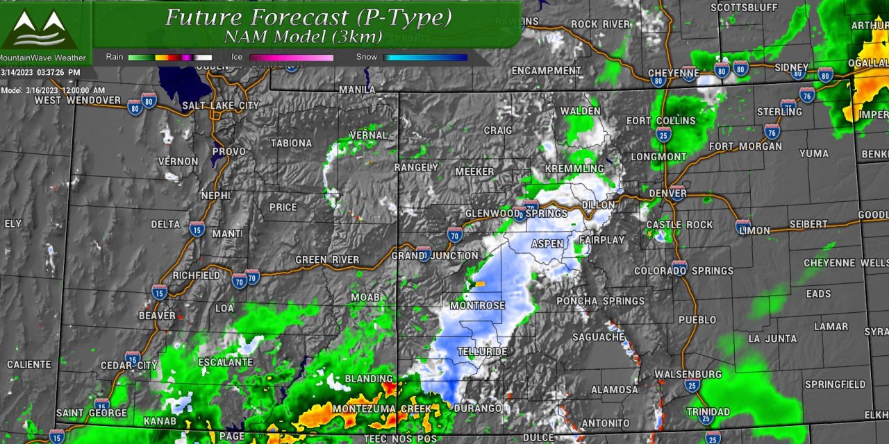
A "Spring-Like" storm takes aim at the state for Wednesday and into Thursday. Some areas will see significant snow, but others will not. We break down what areas have the best chance, where the problem areas could be along with discussions of timing/impacts/severity with the latest model data in as of today.
Here's a quick look at Winter Weather Highlights around the state for this next storm:
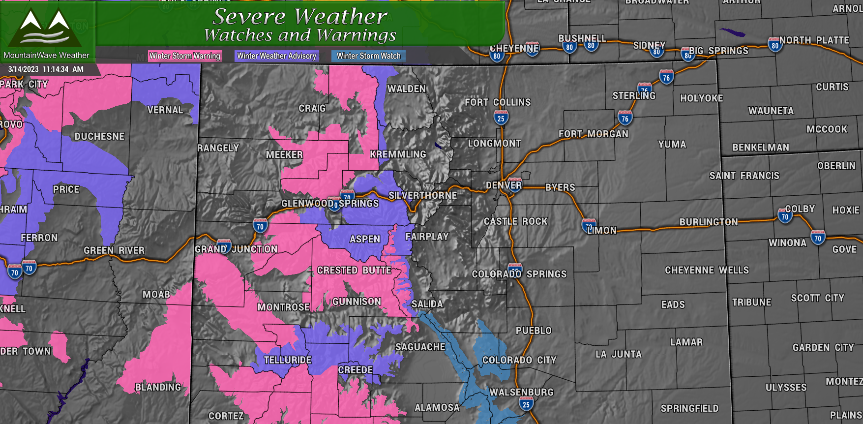
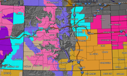
Statewide Weather Alerts
 For the mountains:
Winter Storm Warnings in effect (pink shaded areas)
- In effect Wednesday and most of the day Thursday
- Heavy snow with some places seeing up to 2 feet of total accumulation
- Strong winds at 40-50mph with blowing snow and poor visibility
- Dangerous travel conditions, travel not recommended
Winter Weather Advisories in effect (purple shaded areas)
- In effect Wednesday and most of the day Thursday
- Snow accumulations between 6-12 inches
- Wind gusts at 40-50mph causing blowing snow and poor visibility
- Travel will be difficult through these areas
Currently there are no winter weather highlights for Colorado Front Range or Palmer Divide
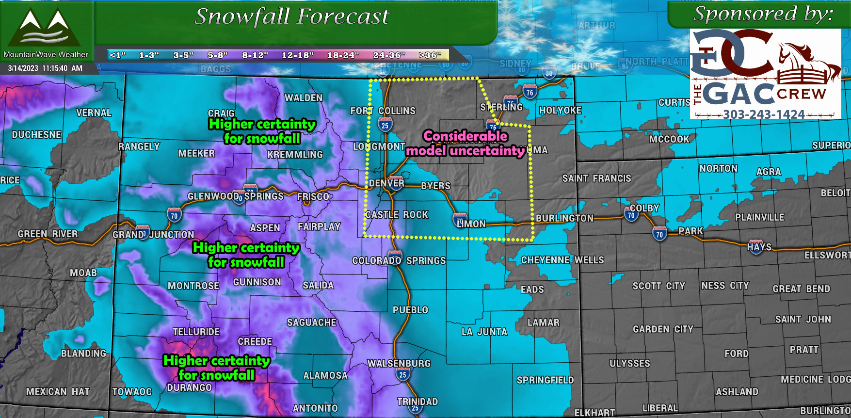
Snowfall and Storm Uncertainty
I've posted the following graphic to highlight the considerable uncertainty shown on the latest model runs. Most of Northeastern Colorado including the Palmer Divide has low confidence and high uncertainty for total snowfall amounts. This amounts to a couple of things:
- Temperatures will be cooler but marginal for snow accumulation
- Timing and strength of the storm system
- Moisture setup and best upslope - many models still struggling with this
As such, here's the trend we are seeing in the models:
- Sharp North/South and East/West gradients in snowfall accumulation - this will make a lot of totals for specific areas difficult to nail down
- Only very favored upslope areas will see decent snowfall accumulation - this will ultimately come down what direction the wind comes out of and how intense it is for the best upslope. This means snowfall amounts could be highly variable over relatively small geographic areas
- Most models are not excited about snow at all with this system East of the Foothills - except for the Euro. Will be watching these trends into Tuesday night and Wednesday morning
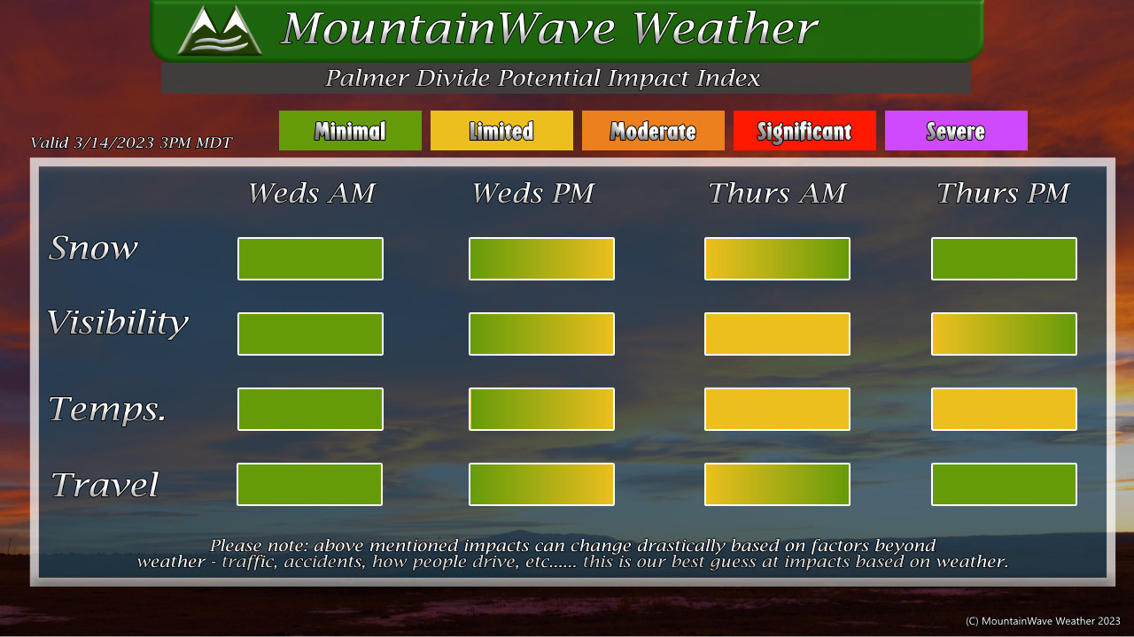
Timing and Impacts
Attached below is a impact index graphic that should give you a bit of an idea of the times we are watching and the level of impacts. Keep in mind, the timing and severity of a forecast like this can shift based on forecast data, so keep an eye out for any changes.
The main impact time with this storm looks to be late Wednesday and through Thursday morning. Exactly when things start to get rolling Wednesday and when they stop Thursday is still a bit up in the air - but the trends I've seen so far don't give me a lot of confidence in thinking that we see much impact on Wednesday night until much later into the overnight hours.
As such, I would expect the Thursday morning commute to have a better chance at seeing some impacts than the Wednesday evening commute. That being said, you'll notice the impacts remain fairly limited in all categories - in other words this isn't looking like much of a storm that does anything outside of causing a few headaches.
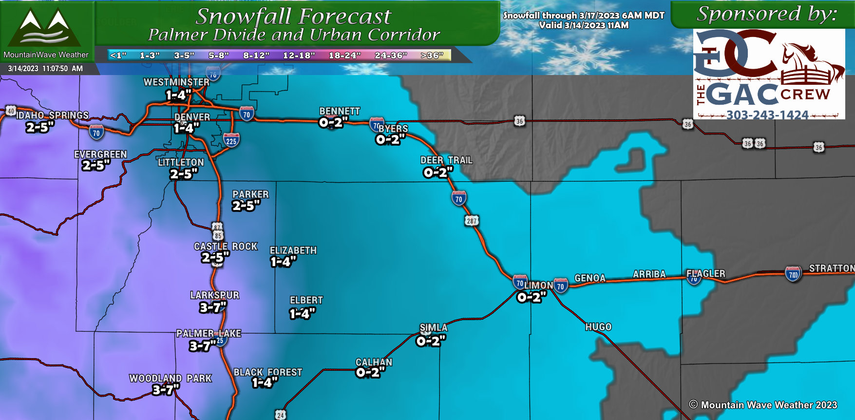
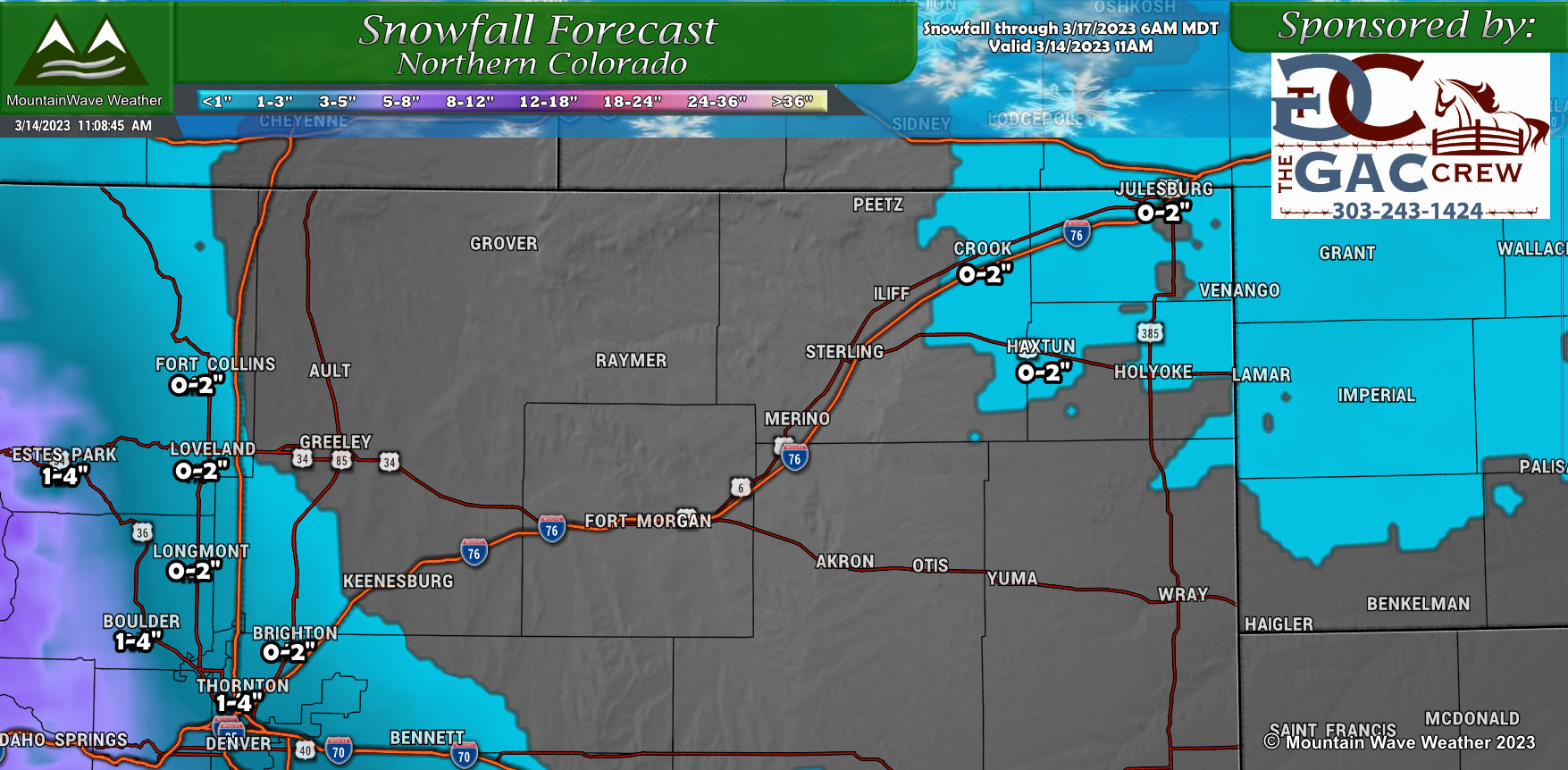
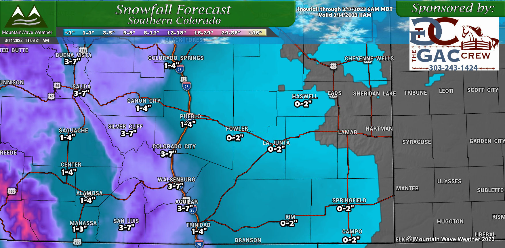
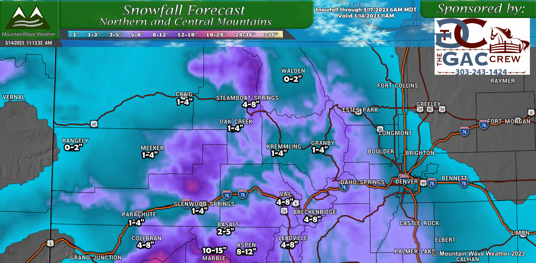
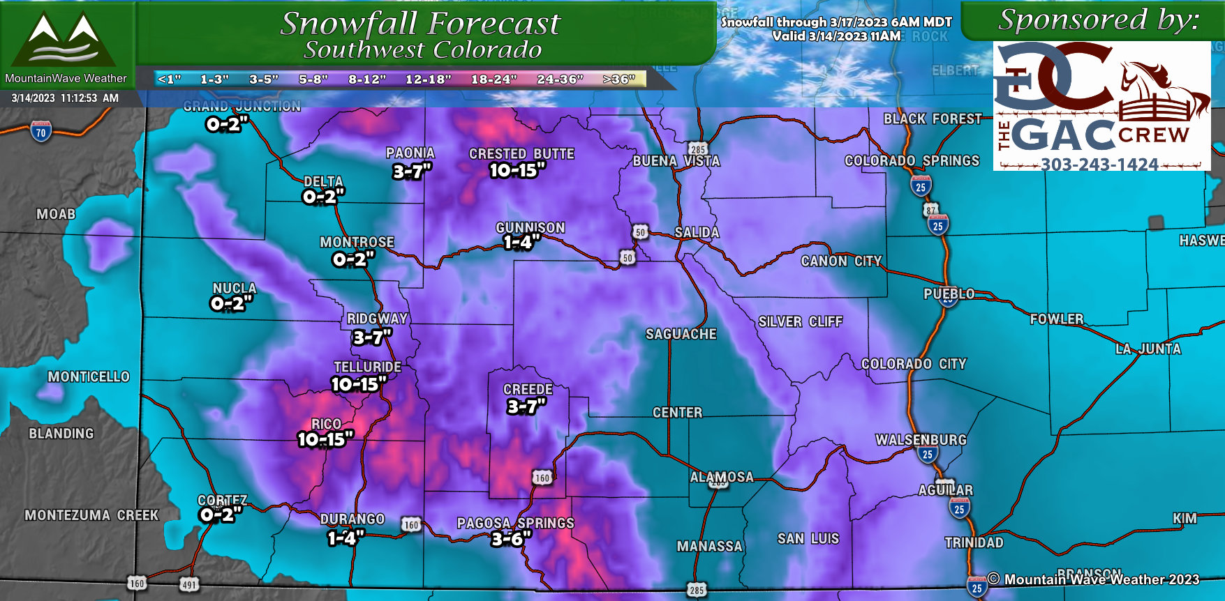
Snowfall Forecast
The snowfall forecast for the major regions of Colorado is below. You'll notice the wide spread in snowfall ranges, this is because of two things:
- Warm air temperatures (relatively speaking) and warm ground temperatures could mess with how much accumulation we see
- Models are still bouncing a lot on these snowfall numbers
The numbers you see below represent a best guess/blend of the data I've seen so far. If any adjustments are to be made in the next 24-36 hours, I'd imagine we adjust towards the lower end of these ranges rather than the higher end.
Regardless, these spring storms can throw curveballs every now and then so we'll have to keep an eye out for that.
Palmer Divide
Northern Colorado
Southern Colorado
Northern/Central Mountains
Southwestern Mountains
Summary
Not much to get excited about with this one, but the colder weather will shock some folks after the warm days we've had recently.
I'll keep watching the data as I imagine snow totals will need to be adjusted downwards if the model trends continue.
Any additional updates on this storm probably won't come until sometime on Wednesday, so stay tuned!
