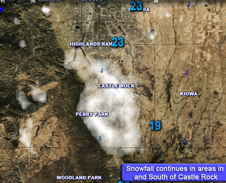
As our weekend storm system continues to evolve, we are getting a better picture at what areas are likely to see significant snowfall accumulation and what areas will see a less impactful event. Modeling has still been a bit mess but overnight nearly every one has trended upwards with snowfall along the Palmer Divide. Why is that? A strong northerly wind may allow enhanced upslope across most of the Palmer Divide region, meaning as you get into areas South of C-470 you could see atmospheric conditions that enhance snowfall.
Current Watches/Warnings
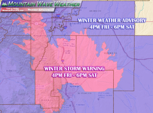
***Winter Storm Warning In Effect***
Locations Included:
Jefferson and West Douglas Counties Above 6000 Feet/Gilpin/Clear Creek/Northeast Park Counties Below 9000 Feet- Elbert/Central and East Douglas Counties Above 6000 Feet
Including the cities of Castle Rock, Elbert, Fondis, Kiowa, and Larkspur
Timing:
4PM MDT Friday April 28, 2017 through 6PM MDT Saturday April 29, 2017
Preparedness Actions:
A Winter Storm Warning for heavy snow means severe winter weather conditions are expected or occurring. Significant amounts of snow are forecast that will make travel dangerous. If you must travel…keep an extra flashlight…food…and water in your vehicle in case of an emergency.
–Full Winter Storm Warning Details–
Analysis – What Changed Overnight?
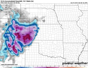
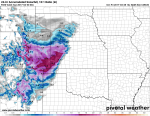
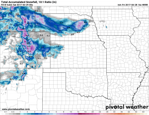
Models are still all over the place but nearly every one has trended upwards with snowfall along the Palmer Divide and front range foothills.
Here’s a quick look at the latest operational model runs:
Why suddenly the more snow when the storm track looked pretty bad yesterday? Well the storm track has stayed pretty much the same since yesterday’s models but the one big change is how rapidly it strengthens as it moves East. Most models now have the storm system intensifying sooner, which means we will see a stronger upslope component earlier than anticipated.
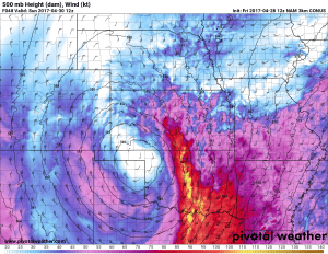
Notice how strong the low gets as it moves Eastward. This will bring strong Northerly and Northeasterly winds with an upslope profile that will favor the Palmer Divide and foothills… Denver not as much.
The most important thing to remember is the models have not been very good this year with snowfall forecast, they’ve overdone snow totals in nearly every case. This combined with how the storm system is expected to behave is why we are only upping the snowfall totals slightly on our own forecast. This may contrast with the NWS a bit, but it’s what we got!
For what it’s worth, here’s the probabilistic spread for snowfall in Douglas County.
| For cities in Douglas, CO county |
| Location | At least | Likely | Potential for | >=0.1″ | >=1″ | >=2″ | >=4″ | >=6″ | >=8″ | >=12″ | >=18″ |
|---|---|---|---|---|---|---|---|---|---|---|---|
| Castle Rock, CO | 0 | 9 | 18 | 88% | 86% | 83% | 77% | 71% | 64% | 49% | 29% |
| Deckers, CO | 2 | 8 | 17 | 93% | 91% | 89% | 82% | 74% | 66% | 49% | 27% |
| Franktown, CO | 0 | 8 | 19 | 88% | 86% | 84% | 78% | 71% | 65% | 51% | 32% |
| Highlands Ranch, CO | 0 | 7 | 18 | 85% | 82% | 79% | 73% | 66% | 59% | 46% | 28% |
| Larkspur, CO | 2 | 11 | 20 | 91% | 90% | 88% | 83% | 77% | 71% | 57% | 37% |
| Monument Hill, CO | 2 | 11 | 22 | 92% | 90% | 88% | 84% | 78% | 72% | 59% | 40% |
| Parker, CO | 0 | 7 | 18 | 86% | 83% | 81% | 74% | 68% | 61% | 47% | 29% |
| Roxborough Park, CO | 0 | 10 | 23 | 88% | 86% | 84% | 79% | 74% | 69% | 57% | 40% |
You can see for Castle Rock the chances drop off considerably at and over a foot of snow, but they are still there. Up to a foot of snow is not out of the question, it’s about 50/50 at this point…
Latest Forecast and Impacts
Timing
- Showers will likely begin after 4-6PM on Friday afternoon. Initially as rain but very quickly changing to snow
- According to model guidance, heaviest snow looks to fall in the Friday evening hours, overnight Friday and through mid-day Saturday
- Temperatures will drop through the day Friday and end up in the mid to lower 20’s late Friday night into Saturday morning. Temperatures this cold will promote snow accumulation.
- Snow looks to continue through a good chunk of the day Saturday coming to and end in the afternoon or evening hours
Precipitation Accumulations
- Castle Rock and Northern Palmer Divide: Early snowfall estimates are in the 5-10 inch range for storm total accumulation. Some localized areas may see up to 12 inches.
- Castle Rock, Pinery, Franktown, Elizabeth, Kiowa
- Areas over and near Monument hill will see slightly higher snowfall accumulation likely in the 8-16 inch range
- Larkspur, Palmer Lake, Monument, Black Forest
Wind/Visibility
- With the storm passage breezy Northwest winds in the 10-25mph range are expected
- Wind combined with falling snow will make visibility low in wind prone areas as the heavier snow is falling
Impacts
- The Friday evening commute looks to be impacted. Don’t expect roads to be too bad initially in Denver but areas South of Denver with higher elevation could experience snow accumulation on the roads quicker
- Expect slushy and snowpacked roads to cause travel issues in the areas between Denver and Colorado Springs in the evening and overnight hours Friday
- Hard Freeze is expected Saturday night and Sunday night; this will lead to damage to sensitive vegetation and unprotected above ground sprinkler systems.


