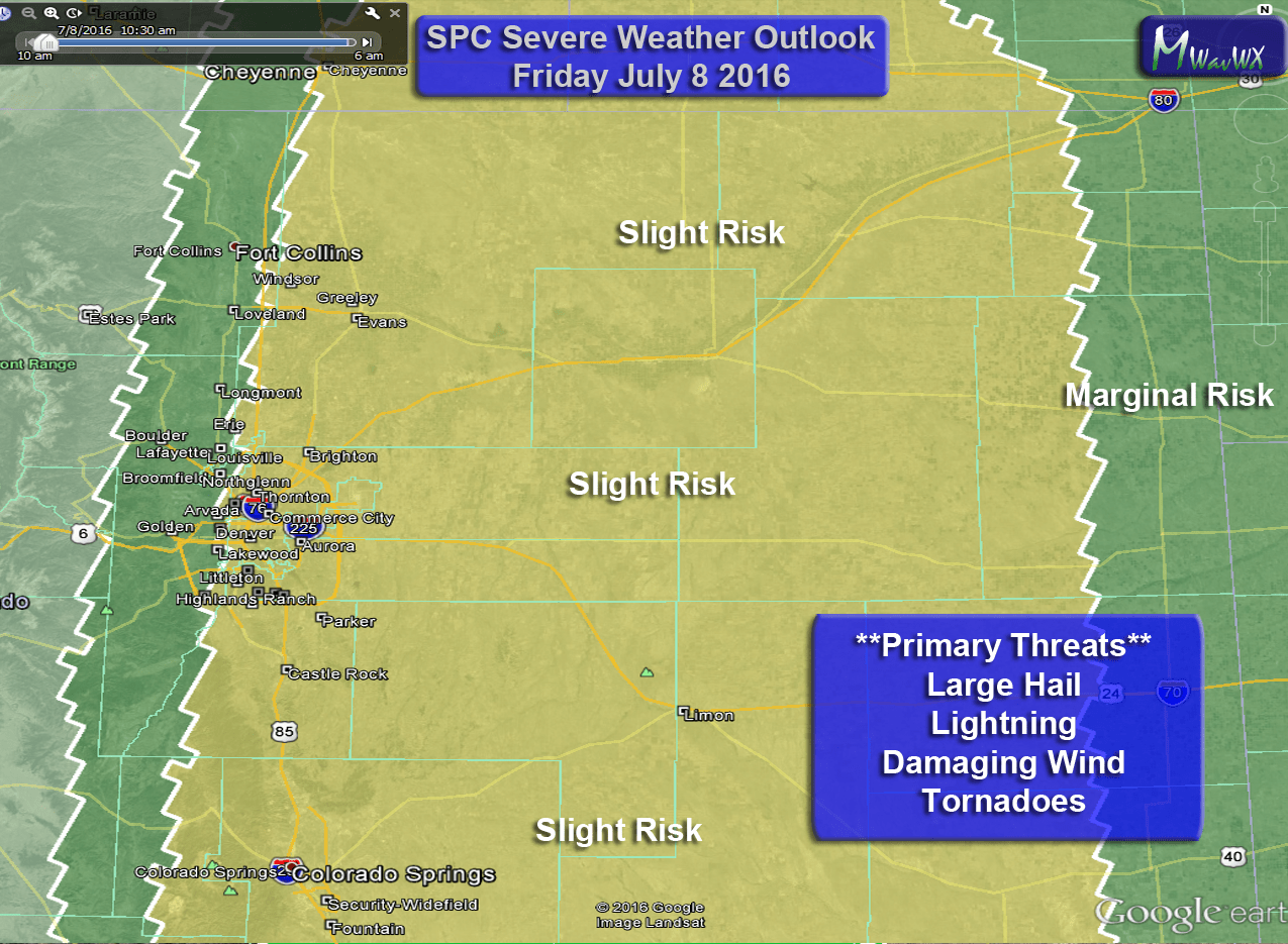
The latest Storm Prediction Center outlook has another marginal risk area for severe weather centered right over Colorado again tomorrow.

Cities Included in the Marginal Risk: Denver, Aurora, Highlands Ranch, Parker, Castle Rock, Kiowa, Elizabeth, Limon, Fort Lupton, Fort Morgan… essentially all of Eastern, Central and Northeastern Colorado
Interestingly enough the marginal risk today (Monday June 6) was not expected to do much in the way of severe weather, especially in and around the Denver area. Originally most of the storms were projected to fire well South of Denver and Castle Rock. Obviously that wasn’t the case, storms fired over the mountains and as they moved into a very unstable atmosphere they grew very quickly with strong enough updrafts to produce larger hail.
Updrafts, Hail and the “Green Thunderstorm”
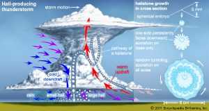
As was the case with our storms on Monday, strong instability caused strong updrafts. This occurs when the air near the surface becomes warmer than the air aloft. That air becomes buoyant and begins to rise into the atmosphere in what is known as convection. If there is enough moisture the air will condense into water droplets and form clouds and eventually thudnerstorms. If the upward motion of the storm (the updraft) is strong enough it will cause precipitation to cycle in the storm, eventually freezing and becoming hail.
You can see how hail cycles in the storm (from the image above) and grows larger until it eventually is heavy enough to overcome the upward motion of the air and fall to the surface. This is a great example of what happened Monday. The more the hail cycles, the bigger it gets and the more you will notice a blue-ish or green-ish color coming from the storm.
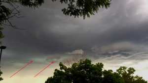
This picture I took of the storm that hit Highlands Ranch earlier shows a green color coming from the storm. These green and blue colors are often seen in storms with hail or large amounts of precipitation, when the sunlight hits them just right, the light scatters and the red and yellow wavelength light is lost, leaving behind blues and greens.
Interestingly enough, a green or blue storm does not always mean hail. It’s considered a bit of folk-lore that a green thunderstorm always means hail or a tornado, scientific research has not shown a correlation. Myself having chased tons of storms across the plains; I can verify this. I have seen many storms with a strong blue or green color that didn’t really produce any hail. Very large water droplets in the storm can cause the same affect so green storms are not a sure sign of hail.
Tuesday’s Threats
Just like Monday, the main threat from these storms will be large hail, gusty winds and lots of lightning. Due to the slow moving nature of the storms some flooding may occur in areas where the storms park for awhile.
The tornado threat will not be 0% but it will again be very, very low. Today I believe we had only one tornado warning based on a radar, no funnels or tornadoes were spotted. You need very specific atmospheric conditions for tornadoes to form and today we didn’t have good ones at all. Tuesday will be much of the same.
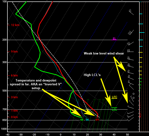
How do we know the tornado threat is low and the hail threat is high? This requires a bit of meteorology:
- (Left) Temperature/Dewpoint spread
- The green line is your dewpoint and the red line is temperature
- We can use these to calculate instability in the atmosphere but also moisture content
- The setup seen here is what is known as “Inverted V”. It means drier air at the lower levels of the atmosphere
- It usually is a strong signal for high based storms with hail and microbursts (if instability is strong enough)
- (Middle) LCL
- The LCL or Lifted Condensation Layer is where a lifted parcel of air will first condense
- In a nutshell it is the base of the clouds
- This usually needs to be below 1Km for a stronger tornado signal, Tuesday it is above that level
- (Far Right) Winds
- We want stornger winds at the surface to help create rotation at lower levels of storms
- The winds predicted at the surface on Tuesday look quite weak
- Another indicator of not favorable conditions for tornadoes
***Note: When storms fire, they can change these conditions and make certain areas more favorable for tornadoes based on increasing low level winds. So while we always say tornado risk is low, the possibility is never 0% with these kind of setups. Colorado especially has a way of doing some funny things in the atmosphere based on where storms form and how the terrain shapes the winds.
What to Know/Do for Tuesday
- If you have sensitive plants, move them inside Tuesday. Not all areas will see hail but those that due could see some larger stuff.
- Be prepared to take shelter if outdoors after about 12PM. These storms will fire up quickly and if you can hear thunder you can be struck by lightning.
- Keep a close eye on weather forecasts through the day Tuesday.
We will have a new update Tuesday morning with any changes in the forecast. Stay tuned!

