Many of us are familiar with the astronomical seasons, this year spring starts on March 20, Meteorological spring starts today however. The main difference between these is the astronomical seasons are marked by position of the Earth relative to the sun. Meteorological seasons are marked more by temperature and weather fluctuations on the planet for certain times of the year.
Meteorological Spring and Colorado
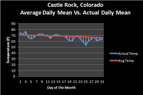
As we transition into the spring season in Colorado it usually means big changes in our weather. Spring (both astronomical and meteorological) is a time of transition for our state. I often reference roller coaster to explain weather in Colorado during meteorological spring (march-may.) because this period features wild fluctuations in temperatures and weather conditions. We may see several days of 70’s and near 80’s followed by a strong cold front and blizzard that drops feet of snow and features temperatures in the 20’s and 30’s. If you have lived in Colorado for any decent amount of time, you are not surprised when we get dumped on with inches if not feet of snow in May.
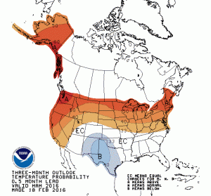
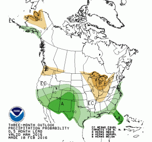
The Climate Prediction Center has issued an outlook for Meteorological spring and it can give us a glimpse of what we expect overall this year for spring in Colorado:
The setup we see here is pretty typical of what we would expect for an “El Nino’ type spring, warmer than average temperatures and above average precipitation. The CPC really says there are equal chances of being above or below average for temperature for most of Colorado minus the far Southern and Southeastern areas. I tend to agree with this thinking given the data I’ve seen so far, I think March will start off very warm and dry but transition into a cooler wetter period in the mid to second half of the month.
See Also: Western Ridge Over U.S. to Keep Colorado Warm and Dry for First Half of March
April and May are less clear, but if we go with what we would expect in an El Nino year, we should see some big temperature swings and above average precipitation. There are some concerns about how quickly the El Nino breaks down as that could drastically alter what we see for weather in Colorado this year, breaking down too slowly or quickly could alter our weather pattern for the spring quite drastically. This is a topic I’ll cover another day, but one to keep in mind.
Start of Severe Weather Season
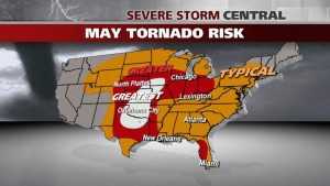
In Colorado we don’t often see much severe weather early in Meteorological spring, but we do get quite a bit more active towards April and May. The rest of the U.S. however, the changing position of the jet stream, combined with greater daytime heating and a colder atmosphere aloft begins to kick of some nasty weather in areas of the country.
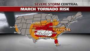
March severe weather generally occurs in the Southeastern part of the country (commonly referred to as Dixie Alley.) By later in the month with better heating and moisture return, states like Texas, Kansas and Missouri begin to see greater risk of severe weather.
Colorado doesn’t see too much severe weather in March as we tend to still be transitioning out of winter, however we do get the occasional front and energy combination for severe weather.
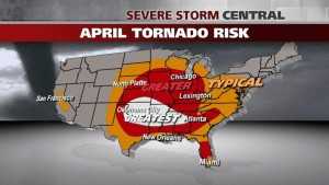
As we reach April, the severe threat tends to shift to the Northwest a bit. States such as Oklahoma and Texas tend to see a much greater threat with a lingering threat of severe weather over Louisiana and the deep south.
Again, for Colorado we tend to see more thunderstorms but usually the heating is not quite enough to get severe storms on a large scale basis. That being said, we still have a bit of a risk through most of April.
May, the final month in Meteorological spring is when things begin to get interesting across the great plains and Colorado. This is the first month where we typically have a good combination of heating and energy available in Colorado to sustain decent severe storms.
Typically, Colorado sees most of its severe weather (relating to tornadoes and hail) in the months of May, June and in some cases July.
Colorado Severe Weather Signs to Look For
There are a few signs the atmosphere will give us that could foretell whether or not we have an active severe weather season in Colorado and all these signs pertain to specific ingredients that severe weather needs:
- Heating/ Instability
- Severe storms need warm air and lots of it as energy
- If we have a colder April and May, we can expect a lot of severe weather to struggle to form. In years like this we can have a more active late severe weather season if it warms up quickly into May
- Strong heating allows warm air to rise at the surface into the cooler environment above, creating thunderstorms.
- Moisture
- This is a big one for Colorado as we are usually quite dry
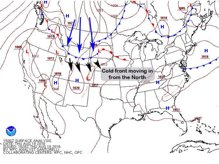
- The storm systems and fronts that move through Colorado need to set up in such a way that moisture is pushed into the state. This generally means a low sitting to our Southeast moving moisture into the state with a cold front behind it for lift and energy
- Upper Level Winds/ Lift
- This is a topic I can spend an entire article on (and I will soon) as Colorado has some unique features that allow us to get severe weather when most states wouldn’t
- Generally we want the jet stream either overhead or slightly to our West. A surface low to our Southeast meaning winds near the ground are coming from the Southeast or East and winds aloft are out of the West. This would create wind shear that allows our storms to begin to rotate and sustain severe levels
- We can also get instability and life behind cold fronts that move though. If the winds and energy come together in the right positions, we get a nice severe weather day
As we ramp up into Colorado’s severe weather season over the next few weeks, I will have quite a few articles about the mechanisms and processes that contribute to our severe weather in Colorado. So if you find that stuff at all interesting, stay tuned!


