Quite a bit of weather news to talk about for the Palmer Divide and the upcoming week. Cool temperatures tonight means some areas will see frost through the morning and smoke from the Deckers fire will continue to pump smoke into some of the areas West and Southwest of Colorado Springs. Additionally, we will talk about the big news item from the weekend; the chance for our first snow of the season and the potential for the first freeze and hard freeze of the season.
Let’s get started!
First… A Quick Update on Warnings/Advisories
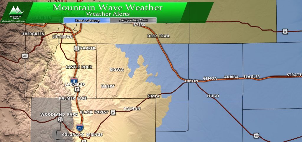
***Frost Advisory***
North and Northeast Elbert County Below 6000 Feet/North Lincoln
County-
Southeast Elbert County Below 6000 Feet/South Lincoln County-
Including the cities of Agate, Hugo, Limon, Matheson, Forder,
Karval, Kutch, and Punkin Center
321 PM MDT Sat Oct 5 2019

...FROST ADVISORY IN EFFECT FROM 3 AM TO 9 AM MDT SUNDAY...

* WHAT...Low temperatures between 32 and 38 will result in areas
  of frost.

* WHERE...North and Northeast Elbert County Below 6000
  Feet/North Lincoln County and Southeast Elbert County Below
  6000 Feet/South Lincoln County Counties.

* WHEN...From 3 AM to 9 AM MDT Sunday.

* IMPACTS...Frost could kill sensitive outdoor vegetation if
  left uncovered.
***Air Quality Alert***
...AIR QUALITY HEALTH ADVISORY FOR WILDFIRE SMOKE FROM 800 AM
SATURDAY UNTIL 900 AM SUNDAY...
A Little History…
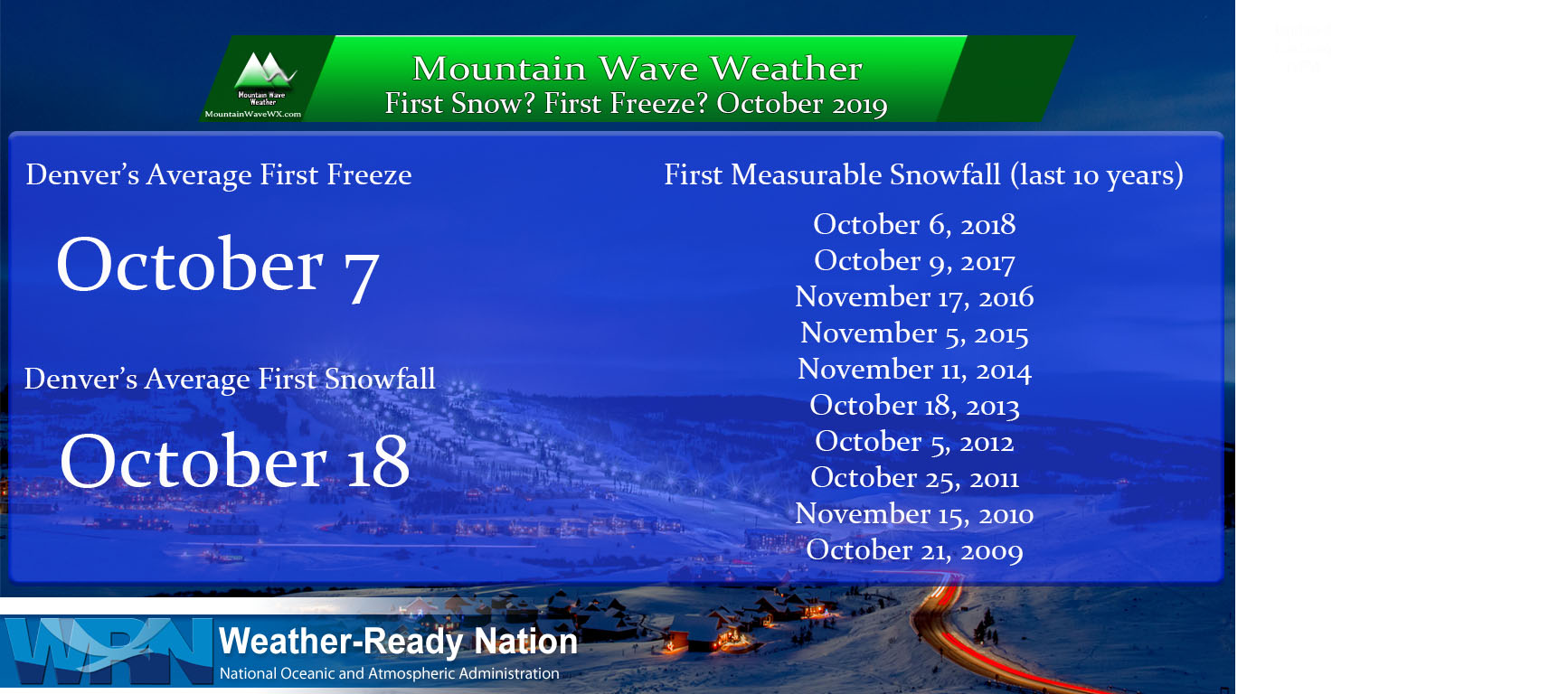
Records are officially kept in Denver so that’s what the history books will say. Castle Rock’s dates may not fit these exactly but they’re in the ballpark. Due to our higher elevation on the Palmer Divide we tend to experience frosts/freezes/snowfall events a tad earlier than Denver does.
Still, it’s always cool to see these dates and compare in previous years, as well as this year as to where/when our first freeze and snowfall hits. Speaking of which, here’s a couple of fun articles to reference from last year…
Freeze/ Hard Freeze Chances
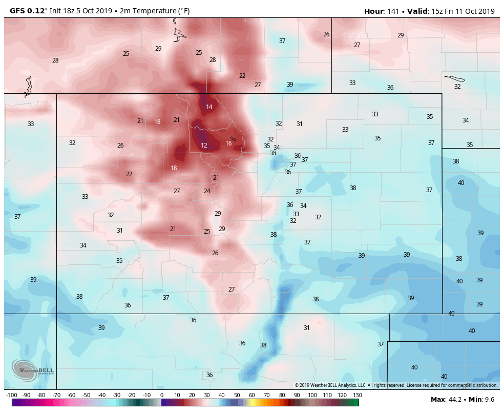
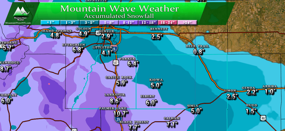
Models are in agreement that we’ll see much colder weather but you’ll see they are miles apart on how warm or cold it will ultimately get. The Euro shows extremely cold temperatures (For what it’s worth I think the EURO has overdone both snowfall and cold temperatures) so keep that in mind!
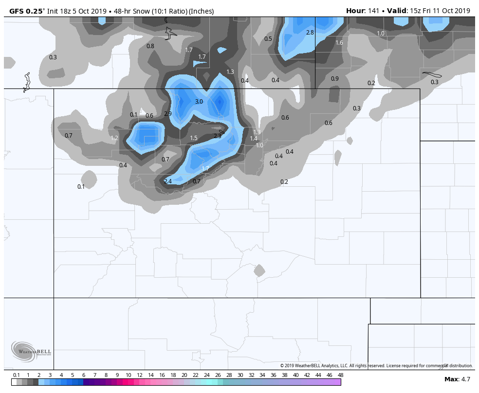
The GFS shows warmer overall temperatures. As you’ll see below, the temperature difference above will show why there is such a difference in the snowfall forecasts below.
Snowfall Chances
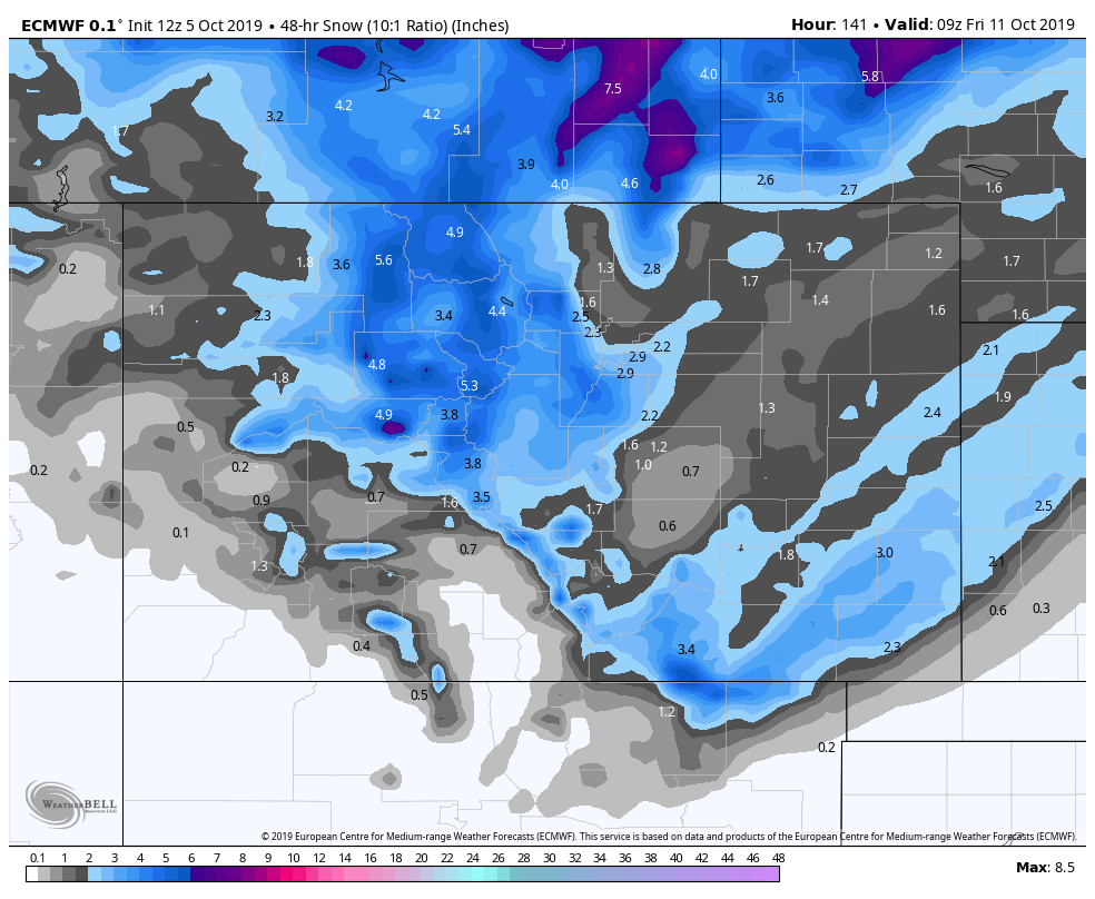
I’m going to post some weather models. As always, at this time-frame these are far enough out that you shouldn’t pay attention to the amounts whatsoever. It’s too early to tell those details, instead focus on the pattern…
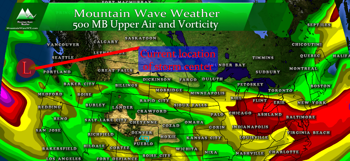
At this time I’m just posting the GFS and Euro. There are a couple of other long ranges I look at but ended up throwing them out because I didn’t like the solutions. What can we see from these models? Beleive it or not, the Euro is going a bit higher on snowfall than the GFS (surprise!) This (and the other models I did not include) still show a considerable amount of uncertainty on snowfall amounts but most models are showing at least *some* snow from this storm.
For what it’s worth, the Euro ensemble blend is showing much less snow than the operational model posted above.
So at this point safe to say snow is *POSSIBLE* but I’m not even putting it yet in the likely category. We will have to get a few more details over the next few days as to how this storm sets up. If I had to give it a probability I’d say with tonight’s data the chance for seeing snow is around 20-30%. This probability will either rise or fall depending on what other data we get in this week.
Wrapping it Up
As you can see above, the model data we have right now doesn’t really tell us a lot of anything with any certainty. This is why I caution people on what their weather app says or what one of the local news stations or social media weather sites say. I’m excited about the potential of our first snow of the year, I’m not trying to be a stick in the mud, but I’ve built MountainWave Weather on no hype, level headed and accurate forecasting. That’s not about to change, which is why I don’t get too excited about things unless there’s something to get excited about.
Here’s what we know at this point:
Chance for Freeze/Hard Freeze
LIKELY – I’d put the probability of this around 50-70% with model data tonight. That’s relatively high for this far out so that’s why we have a bit more confidence in this.
Chance for First Snowfall
POSSIBLE – I’d put the probability on this around 20-30% right now. Most models show snow but there’s still a ton of uncertainty about if the temperatures line up with the moisture and snowfall amounts. So I’d say this is still a bit up in the air.
Remember, all forecasts are fluid. We will get better data in the coming days and the probabilities outlined above will shift. Basically what I’m saying here is (shameless plug) stay tuned for more details in the coming days!




Thank you for these weather reports. We live Palmer divide area 6,875 ft south of Franktown so you report for our area is very helpful