General Summary
July 2017 saw the return of monsoon season in full force for some areas of Colorado while others were left high and dry!
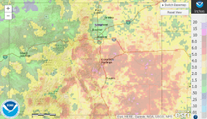
Most of the Palmer Divide Region received a ton of rain, mainly in the second half of the month. Here’s the observed 30 day total through July 2017 from the National Weather Service:
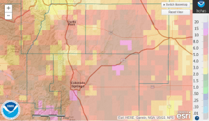
Douglas, Elbert, Jefferson and El Paso counties with other areas along the Palmer Divide saw anywhere from 2-5 inches.
If you take a full snapshot of the state, the South and Southeastern bias on monsoon moisture really shows!
Denver International Airport only recorded 0.6 inches of precipitation for the month, meaning it is very, very dry for areas in and around Denver! Colorado Springs on the other hand got over 6 inches of total precipitation!
Castle Rock Weather Summary
I’m trying some new graphics and displays with some new and fun ways to display my weather data this month, let me know what you think!
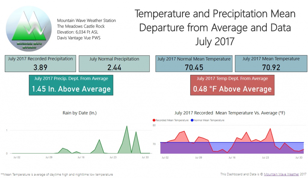
Departure From Normal Temperature and Precipitation in July 2017
Analysis
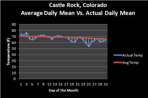
The month overall was very close to average on mean temperature… this means that the day time and night time temperatures averaged together for the month were very close to where we expected them to be with the month finishing only 0.48 degrees above average.
For precipitation, the monsoon provided ample amounts of moisture to the area. Most areas in and around Castle Rock ranged from between 2-5 inches. Some localized areas saw 5+ inches of precipitation for the month. As you can see from the graphic above, most of this came late in the second half of the month.
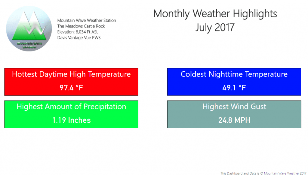
July 2017 Highlights
New Data Dashboards and Highlights
The graphics above are auto-generated by our new weather data dashboard we are building. You can see the early stages of where it’s at here.
What other data would be cool to see on this dashboard? We are planning having it update a few times a month with current data and can display a whole ton of stuff. Let us know what else you think would be fun to see on the dashboard and on our monthly climate summaries!
As always, comments are always welcome here or on our Facebook Page!

