Looks like we have an active period of weather coming up over the weekend and into next week. Still a lot of details to hash out on this one, but models are picking up on not just one, but a series of storm systems that will move through the state. There looks to be a few differences between this storm and the last one we experienced including the speed, the amount of cold air to work with, but a lot are coming into agreement at least to some degree that this could be decently spread across the front range, including the foothills, Denver Metro area and Palmer Divide.
Here’s what we know so far…
Timing
- Strong cold front
- Moves through late Saturday into early Sunday
- Currently looks like 9PM – 12AM as the first bursts of cold air, with cooler air filtering in through the overnight hours and into early Sunday morning
- Snow
- A prolonged period of snow is possible throughout the day Sunday. Be aware, heavy snow is possible later in the day Sunday, we’ll try to nail down more details on the exact when and where over the next day or two
- Additional chances for snow on Monday and late Tuesday into early Wednesday
- A couple of different waves of energy will produce the snow
- Temperature
- Most areas will struggle to reach the 30’s late on Sunday, Monday and Tuesday.
- Low temperatures could be in the single digits to near zero for higher elevation areas and in the low teens to single digits for the Denver area
- Wednesday also looks cold.
- Halloween looks cool overall but models disagree on how cold. Some models show extremely cold temperatures so this will be something we have to watch for.
Storm Energy
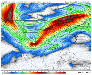
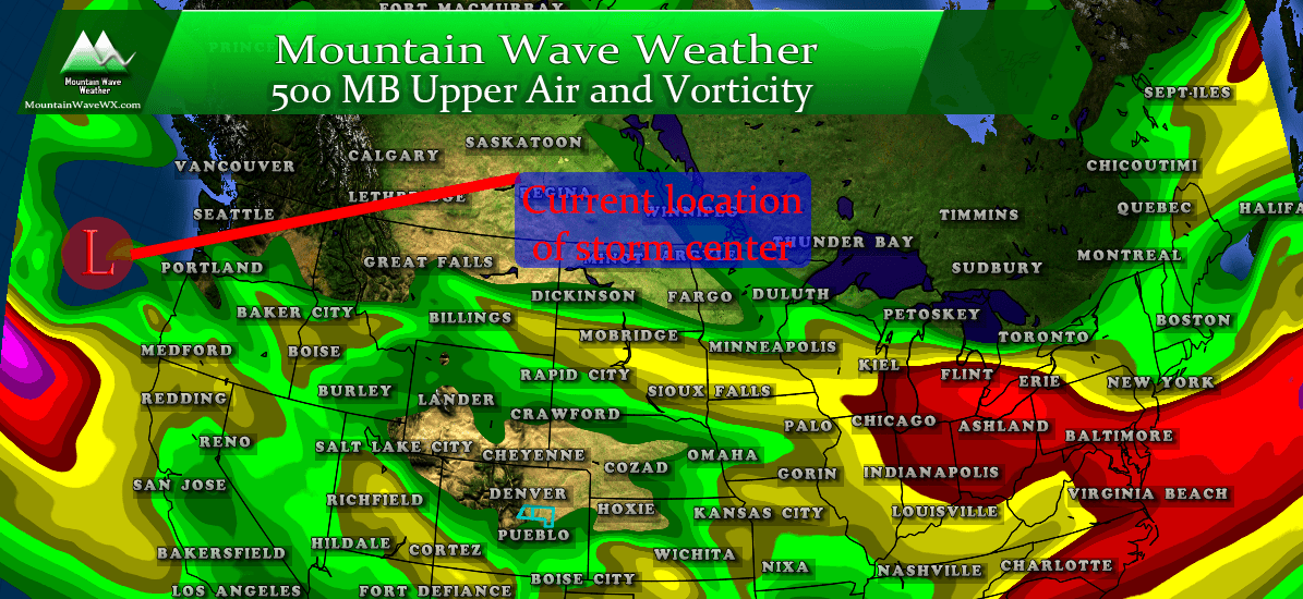
Euro 500mb on Monday afternoon. Notice the trough across the Rockies. This feature builds in through the day on Sunday and continues into Monday, this will provide our cool and unsettled weather.
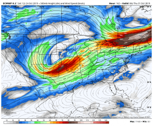
Euro 500mb Wendesday around midnight. Again a strong low pressure system is over Colorado and the overall track it takes will dictate what we see. In this model run it is a bit too far North for us than an optimal “big snow” scenario… but worth a close watch for any shift in the track.
A lot of the energy from this period will come from an active storm track that will swing a series of troughs from the Pacific Northwest, across the Western U.S. and eventually into Colorado. While snowfall amounts and these storms don’t look terrible impressive right now, we always have to keep an eye on storms like this. They will be powerful and depending on exactly what track they take could mean big differences in what we see.
I’m not comfortable saying any of these storms being a “major event” as of right now, but would like to point out the potential is there. So we will have to keep an eye on them very closely.
Morning update from the NWS:
The combination of upslope flow at low
levels with the upper troughiness over the state and the upper
level jet on top of it will generate moderate to heavy
precipitation rates Sunday afternoon and Sunday night. It is
possible that areas along the Front Range foothills and I-25
Urban Corridor could see snowfall accumulations in excess of 6
inches by Sunday night.
Snowfall
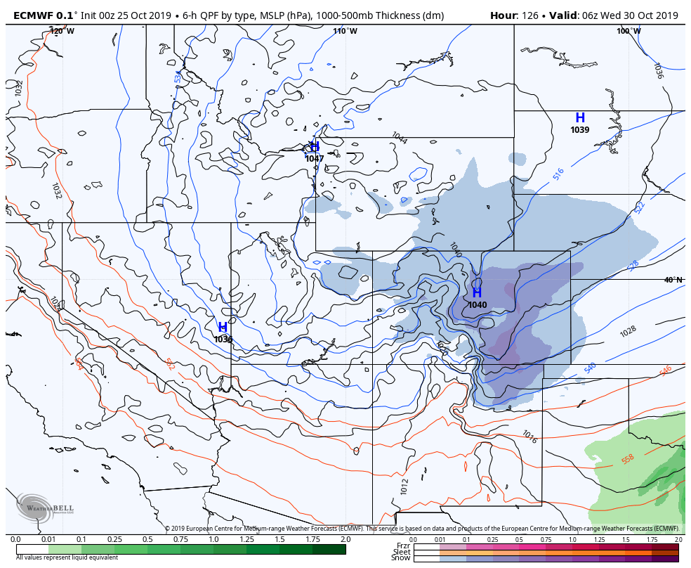
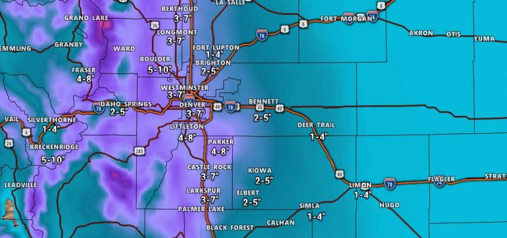
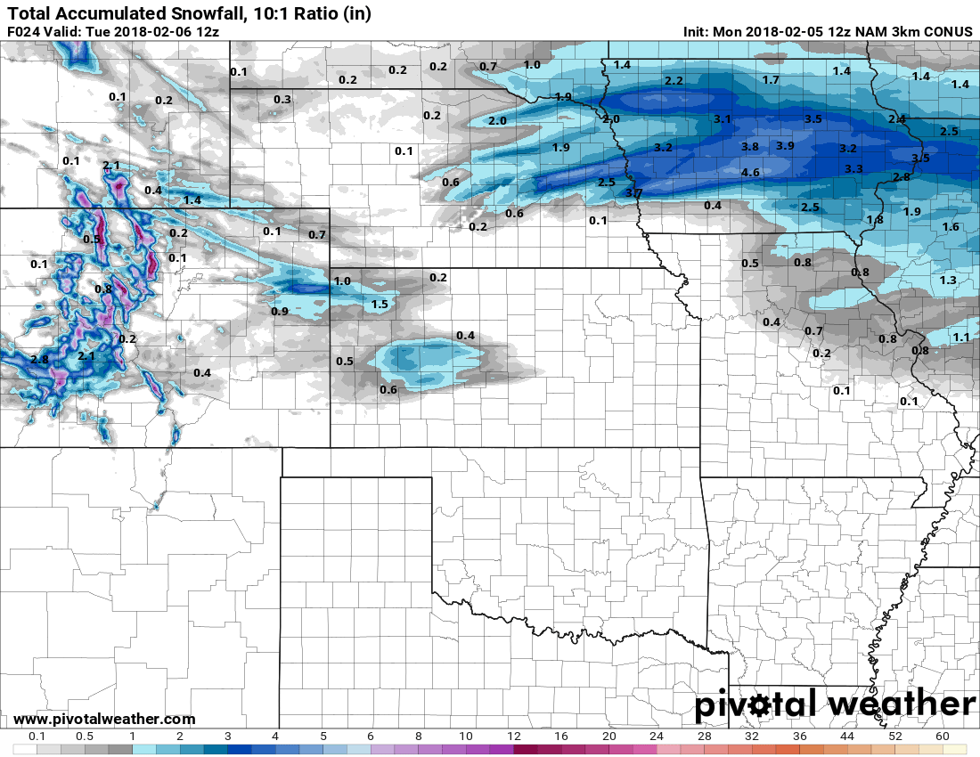
We’ve got enough information this morning to post a very preliminary guess at what snow looks like for this first series of storms. Keep in mind, this could change drastically over the next 24-36 hours. We will have a whole host of models coming into better range today so we should get a better idea and be able to refine snowfall totals with that information.
Remember, it’s early so these are preliminary and WILL change over the next 24-36 hours. This is a good first shot though!
As our friend Billy would say, there’s more!
Another wave of energy moves through late Tuesday and into Wednesday. This means additional cold air and snow will filter in the area adding on to what we already have on the ground.
Some of the models show another shot of heavy snow along the front range. So overall we will be watching a lot of things next week.
Summary
What do you need to do right now?
Nothing at the moment, just realize that if you have plans on Sunday through Wednesday they may be impacted by cold and inclement weather. Snow to some degree looks likely but we don’t know exact numbers yet. Halloween looks chilly as well (for right now, it’s at the edge of the models range so accuracy is always a question) so plan on that possibility if you’re outdoors as well.
We will have to keep a close eye on all these waves towards the end of the weekend and into early next week. Some models show a decent shot at accumulating snow in what I’d call a “moderate” range, but because of the power of the storm systems and how close their tracks will be to an “optimal” track for big snow… they will need to be watched closely over the next 24-48 hours.
Expect refinements to our snowfall forecast throughout the day on Friday and Saturday based on the information coming in. Stay tuned, we will keep you updated!



These are awesome!! I love your site and love what you do! Useing this for now on.