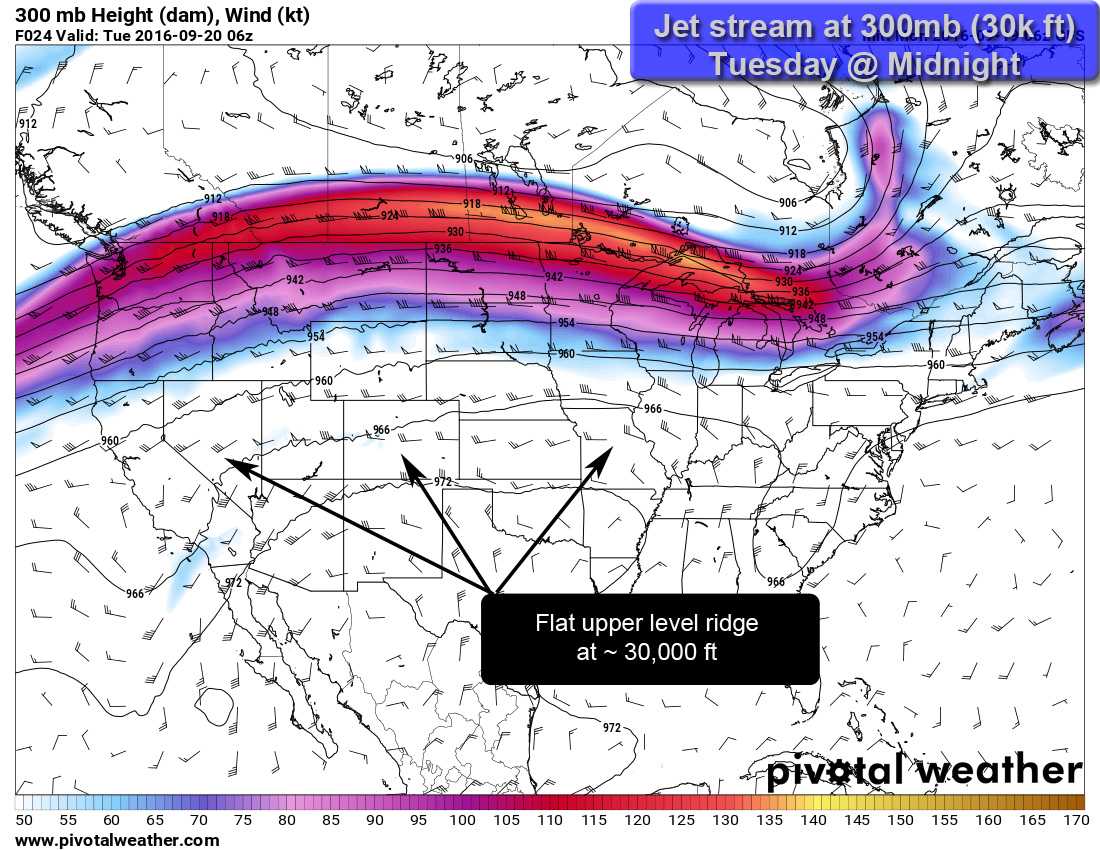
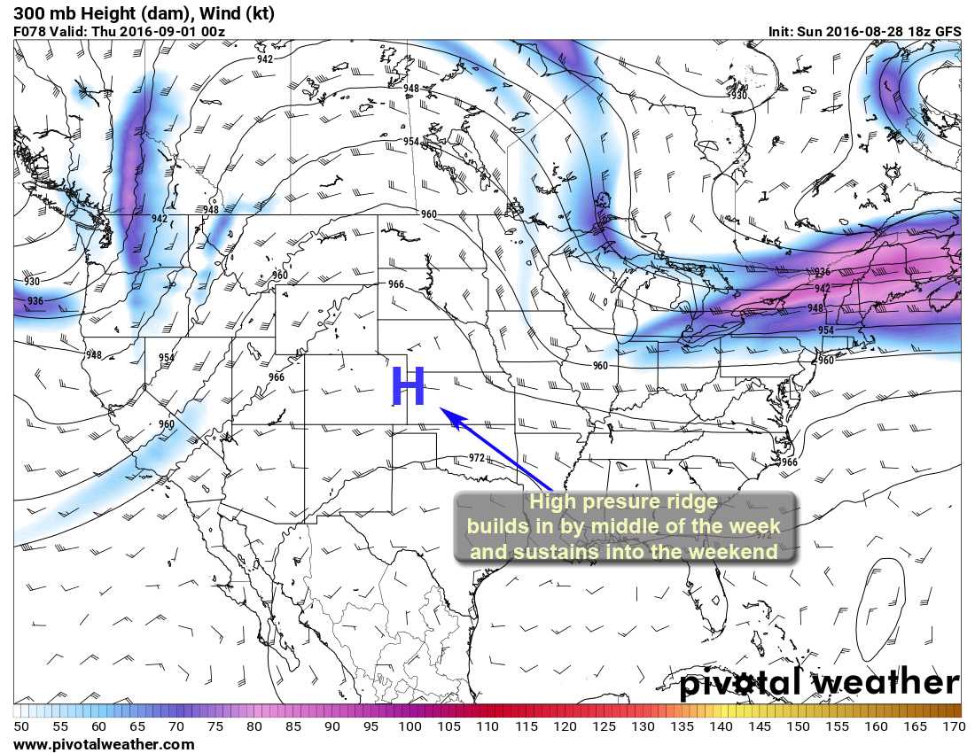
The week ahead looks more like July than late September as a large high pressure system builds into all levels of the atmosphere across most of the United States. Most areas, especially those of us in the Western half of the country will experience warmer than average temperatures with few chances for rain. For Colorado, the only decent chance for any precipitation this week looks to be the Southwestern corner, most of us East of the divide won’t see any decent chances to get wet until we get towards the weekend.
First, a quick look at the forecast and what to expect for Castle Rock this week. Please note I have added the average high temperatures to demonstrate just how much warmer than average this week will be!
Forecast for this Week
Castle Rock
Monday Sept. 19
Mostly sunny and unseasonably warm. A slight breeze may develop into the afternoon and evening hours but it will generally be dry across the area.
High temperature: 87 degrees Low Temperature: 54
Average High Temperature: 74.5
Tuesday Sept. 20
Partly cloudy to mostly cloudy through the day, cloud cover should make for slightly cooler temperatures but it will remain above average. Should the clouds not stick around through the day, expect temperatures to trend a few degrees warmer.
High temperature: 83 degrees Low Temperature: 55
Average High Temperature: 74.1
Wednesday Sept. 21
Mostly cloudy conditions early in the day should transition into partly cloudy by afternoon. Temperatures will continue to be unseasonably warm with little to no chance for rain.
High temperature: 81 degrees Low Temperature: 52
Average High Temperature: 73.7
Thursday Sept. 22
Mostly sunny with a few clouds in the afternoon. Breezy conditions may develop by the afternoon and evening hours.
High temperature: 82 degrees Low Temperature: 56
Average High Temperature: 73.3
Friday Sept. 23
Clear and cooler as a cold front is slated to move through at some point on Friday. Temperatures should reach the mid to upper 70’s with a very slight chance of thunderstorms (10% chance) as the cold front makes its way through.
High temperature: 76 degrees Low Temperature: 48
Average High Temperature: 72.9
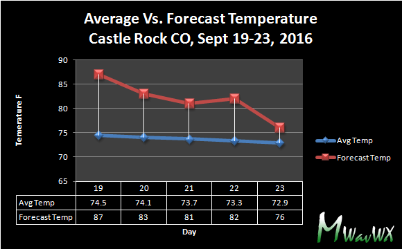
High temperatures will be well above average for most areas along the Palmer Divide this week. Should the ridge strengthen, we may trend a couple degrees higher each day!
Atmospheric Setup for this Week
High pressure will rule our skies for a large majority of the week in the western U.S. Models across the board are in agreement of relatively quiet and tranquil weather, a pattern that is quite familiar for fall across the country. In Colorado, September tends to be one of our quieter months for thunderstorms and bad weather in general.
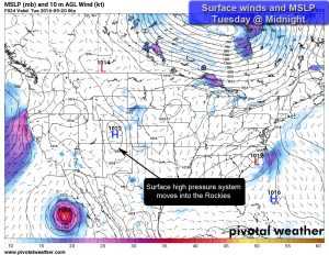
Surface high pressure builds over Colorado. This allows warm air to move up from the Southwest and keeps cold fronts and storm systems from moving in from the Northwest
This pattern will keep storms away and drier and warmer weather across most of Colorado. Notice the big dot on the surface map (top image) is a tropical storm. This system is what will keep rain chances in the forecast for Southwestern Colorado through the week. It doesn’t look to impact us on the plains this week, but we’ll keep an eye out on the track in case that changes.
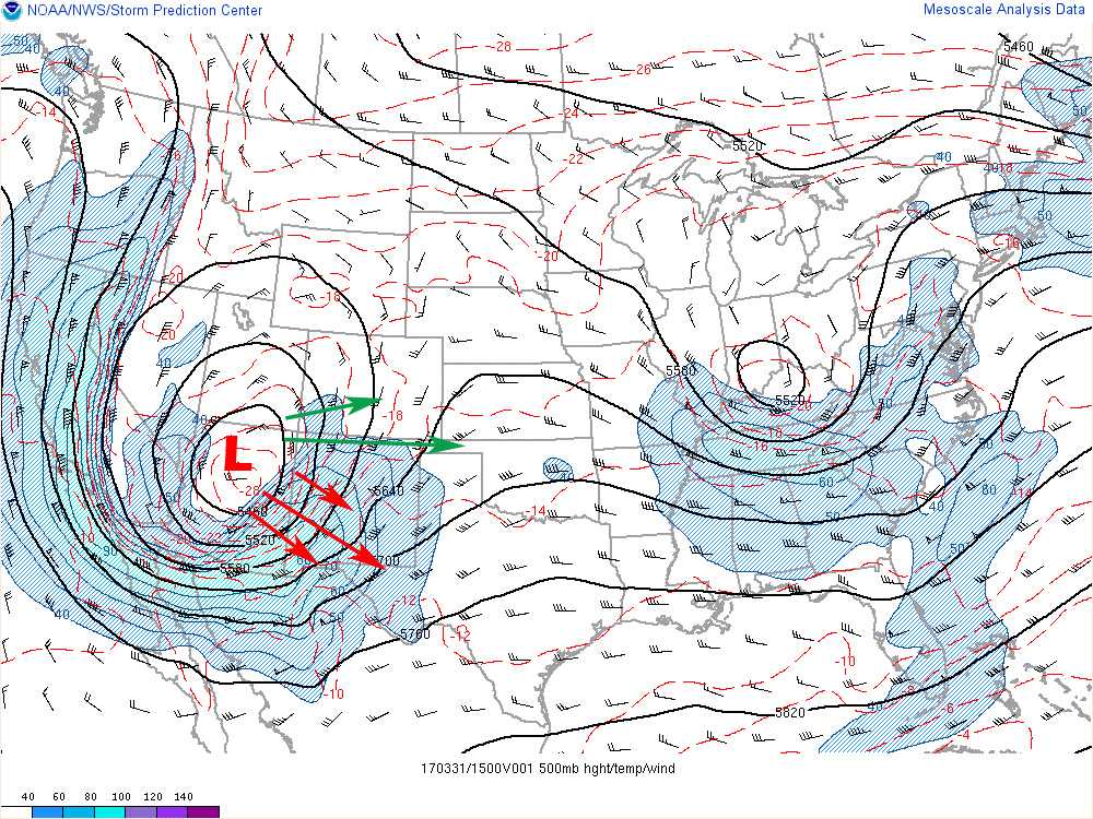
The ridge holds on from Monday through Thursday across the Western U.S. and then begins to break down by sometime Friday. Most models show a strong trough moving in from the Northwest but are not quite in agreement with how much of an impact it has on Colorado. We will be watching this feature and how it materializes through the week. For now, expect some sort of cool-down in temperatures Friday and going into Saturday.
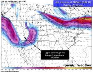
A change begins to move through on Friday. How strongly this impacts Colorado is still a bit uncertain at this time.
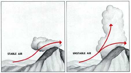
The main reason we see less storms in Colorado during September is that temperatures at the surface tend to cool down while the mid and upper levels of the atmosphere stay warmer from the heat of the summer. This means air has a more difficult time rising to form those storms and instability is generally limited.
This is a reason why our thunderstorm season begins to quickly die down in the fall months for Colorado. For many of us, this is a welcome break after the tornadoes and hail we saw earlier this season!

