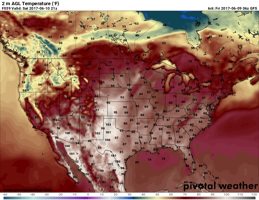
As we move deeper into December we continue to experience more seasonal weather in terms of temperatures. The last few days have been punctuated by high temperatures in the 40’s and lows in the teens and twenties, this is much closer to where we should be this time of year than the scorching heat we saw in November. The bad news is that despite the cooler temperatures we continue to be in a pattern of Northwesterly tracked storm systems that keep us cool but don’t offer much snow East of the divide. This week looks to feature a nice warm up to thaw the area out before dropping the hammer on more arctic air by the weekend.
The Rest of the Week
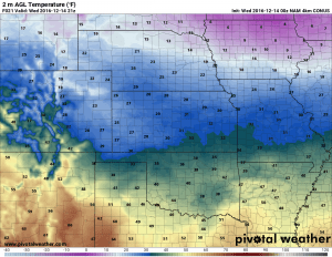
Wednesday looks to be rather chilly day across the urban corridor with many models showing the high temperature ending up somewhere in the 30’s. Not terrible but it will remain cool for most areas on Wednesday.
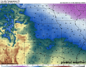
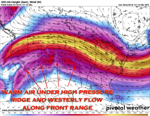
By Thursday we begin to see a warm up with a shift in the winds and a ridge build overhead aloft in Colorado. This generally means warmer but breezy days, expect the winds to pick up a bit but temperatures will be noticeably warmer, many areas will reach the 50’s or 60’s on Thursday.
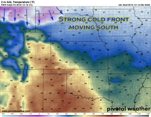
Friday will feature more of the same as the ridge remains overhead in Colorado, although it looks to be slightly cooler during the day. The other thing to notice in the Friday temperature graphic is the extreme cold moving into Southern Wyoming by later in the day. This is the leading edge of our next storm system set to move into the area late Friday and on into Saturday.
I’ve highlighted the arctic air in Wyoming, this will move South through the day on Friday and into Colorado later Friday. At this time it looks like the evening to overnight hours is when this mass of cold air is expected to move through so we’ll keep an eye on it for any changes in timing.
Another Storm System? Let’s Talk Temps and Snow!
We are just beginning to edge into the range of the medium/shorter range models with the Friday/Saturday storm system so we are close to a better look at this storm system. With the data I’ve seen right now, this storm system looks very similar to the last one.
As we move from Wednesday and Thursday into Friday we will see the changes in the upper atmosphere, our upper level ridge that established during the middle of the week looks like this:
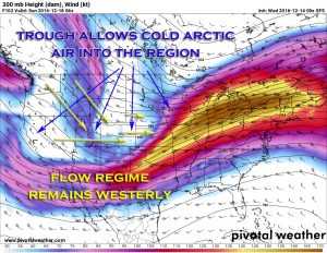
Will transition on Friday and Saturday into something like this:
I’ve highlighted some of the features on this storm but you’ll notice it has a similar setup the last one our area experienced. A dip in the jet stream and associated trough allows very cold air to filter down from the arctic into Colorado. This and the associated cold front may bring enough energy and moisture for a quick burst of snow, but just like that last one it doesn’t look to have the necessary ingredients to turn into a major storm at this time. Many models do not show the trough digging far enough South or stalling out long enough over Eastern Colorado to maintain enough strong upslope for a long enough period of time.
Yes, this storm looks very similar to the last couple of storm systems to impact our area, often referred to as “clipper” or “Alberta Clipper” type storms. The textbook characteristics of these types of storms are extremely cold air and a very short but intense burst of snow along the leading edge of the front as it enters the area. If you think back to our last couple of storm systems involving snow you’ll see this same pattern.
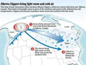
How an Alberta Clipper works. We’ve seen quite a few of these in Colorado the past few weeks. These are a trademark in La Nina years.
It’s a bit early to be calling out concrete snowfall totals, just because these types of systems are usually predictable doesn’t mean they can’t throw us a curve-ball every now and then. My concern is that we’ve seen several of these now but when does one of them dig far enough South and tap into enough moisture and or stall to give the front range of Colorado a bigger snow. The models don’t show that happening with this storm but it bares watching.
Main Impacts with this Storm
- At this time it looks like snow will be possible, if you have travel plans late Friday and into Saturday, keep a close eye on our forecast this week. We’ll pass along any updates and let you know if it looks like we will see difficult travel conditions and try to nail down a timeframe as the week goes on.
- How much show? The jury is still out on that one, but given the history and patterns of these types of storm systems I’d expect the accumulation to be similar to the last storm we had plus or minus an inch to a couple of inches. Again, too early to definitively call snow with this one, but keep an eye on our site for those in the near future.
- The cold air will be the major impact with this storm system in to Saturday morning. Some areas in and around Castle Rock could be waking up to temperatures around to slightly below zero on Saturday morning. Most models don’t have it warming up too much during the day on Saturday either, so keep that in mind if you have outdoor plans on Saturday or later that evening. Any outdoor activities going into Saturday night; bundle up! It will be downright frigid going into Saturday night and Sunday morning.
As always, keep an eye out here or on whatever your favorite reliable local weather resource is for continued updates on the storm system this weekend. We look to have a new update up in the next day or two with some preliminary snowfall totals and we will fine tune those as we go into the later part of the week.
Thanks for reading and stay tuned for further updates!


