I mentioned a couple days ago about the evolving severe weather threat along the front range setting up for today and it looks very possible that some areas will see it along the front range.
The latest Storm Prediction Center general outlook:
The Castle Rock area has been moved out of the slight risk area this morning and into the marginal risk area. I’ll explain why I think this is a bit later.
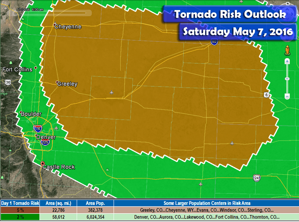
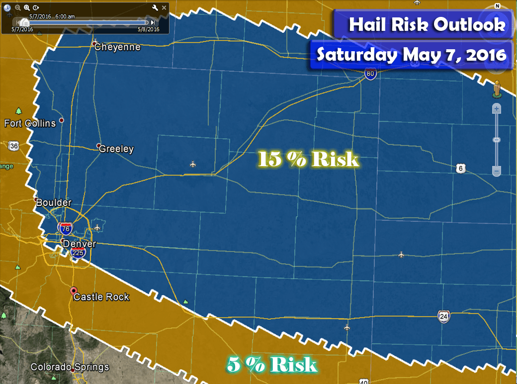
Categorical risks are also out (percentage probability of seeing a type of severe weather within the risk area):
A decent risk for hail exists today over Northeastern Colorado. The main risk area is at 15% while Castle Rock is in the 5% risk area. Hail is very possible today but not all areas along the Palmer Divide will see severe sized hail. If you live in any of these areas, keep an eye out for strong storms building and moving your way.
The highest risk of tornadoes will be in Northeastern Colorado today. I don’t see a strong chance for tornadoes for us along the Palmer Divide but we are included in the 2% chance area so the possibility exists of seeing them in and around the area today. I would be surprised to see at least a funnel cloud or two for us closer to home.
Severe Weather Threats
-
Strong to severe thunderstorms will produce gusty winds
-
Hail will be possible, sizes will be larger with areas that experience severe storms
-
Dangerous lightning will be likely with severe storms.
-
There is a small tornado threat, mainly for areas Northeast of Denver, however some models suggest a brief timeframe where they are possible along the Palmer Divide
Timing
-
Storms will begin to initiate as early as 11AM-12PM along the foothills and Palmer Divide
-
Main severe threat along the Palmer Divide looks to be between 11AM-3PM
-
Storms will generally move in a Northerly or North-Northeasterly direction
-
By afternoon and into the evening hours, severe storms will transition mainly into Northeastern Colorado
Impacts
-
Hail could be large enough to cause damage in some areas
-
Lightning will be a big threat to people outdoors caught without shelter
-
There is a slight chance for tornadoes
Synopsis
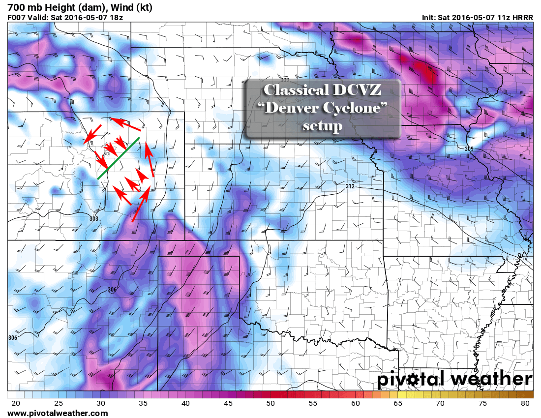
A surface low building over Colorado will transition to the Southeaster areas of the state this morning. This will allow winds to turn Southeasterly bringing in moisture and enhancing upslope flow along the Front Range of Colorado. The terrain in and around Denver will veer these winds Northerly and Northwesterly at the surface.
This is a classical setup for a pattern we call the Denver Convergence Vorticity Zone or “Denver Cyclone.” These winds will loop around the metro area and as they turn Northwesterly they will crash into the winds from the Southeast along a line from the Palmer Divide, DIA and up into Northeastern Colorado. This area will see intense areas of lift and possible vorticity (spinning motion in the atmosphere.)
Storms that form and move along this boundary area have a chance of becoming severe and combined with the enhanced lift and vorticity, they will have a chance of large and a slight chance of funnel clouds and tornadoes.
The best chance as per model guidance for severe weather along the Palmer Divide is earlier in the day, 11AM-3PM time frame. Storms should begin to form in the area between 11AM-1PM.
If we look at the supercell parameter around 1pm we see:
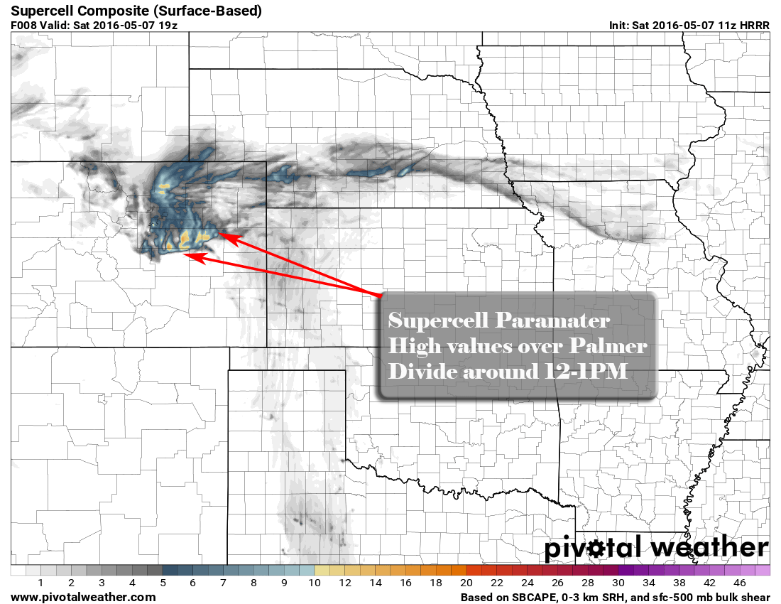
This graphic shows the supercell parameter composite. It is a measure of how favorable ingredients in the atmosphere are for severe storms. It does not guarantee storms in these areas, just shows how favorable conditions are for any that do form to become severe.
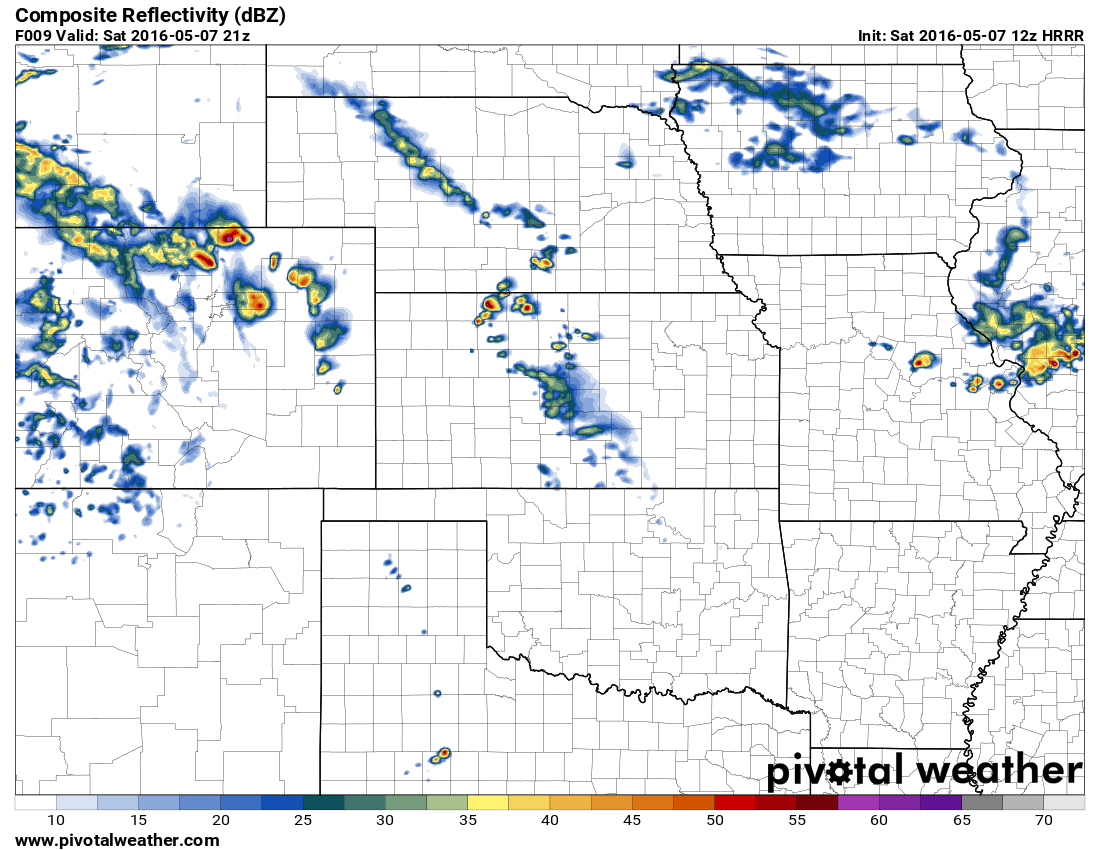
By around 3pm or so, the main threat will move off to the Northeast. This environment is much more favorable with more heat and moisture to work with. We expect storms across the Northeast plains to get quite nasty through the afternoon and evening hours.
Summary
If you live along the Palmer Divide, be prepared for severe weather to initiate as early as 12PM. The most favorable window of severe weather looks to occur between 12-3PM along the Palmer Divide, after that time the atmosphere looks to stabilize and any additional storms will have difficulty forming.
Expect the possibility of hail (in some cases larger) and a slight chance of a funnel cloud or tornado. Today will not be a widespread, damaging severe outbreak, in fact many areas will see no severe weather at all.
While we appreciate you following us for weather coverage, we are not a great source for real-time weather warnings. I do not issue my own tornado warnings or severe storm warnings, I’m generally out chasing these so I don’t always catch the stuff going on close to home. If I am online and see something building along the Palmer Divide I will relay that information if I can.
Otherwise, I suggest following local TV News stations (my favorites are listed) or the NWS:
- TheDenverChannel (Channel 7 News)
- KDVR Fox 31 News
- Watches and Warnings also appear on my Castle Rock Current Conditions page, these come directly from the NWS. (Look for the red text)
I’ll have any updates if necessary, but for today be safe and keep an eye on the sky. These things will pop up very, very quickly and if you are outdoors they will most likely have lightning. Stay weather aware!

