Advertisements
Severe thunderstorm watch issued for Eastern Colorado
URGENT - IMMEDIATE BROADCAST REQUESTED
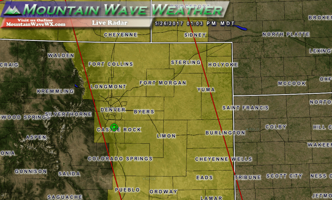
Severe Thunderstorm Watch Number 268
NWS Storm Prediction Center Norman OK
100 PM MDT Fri May 26 2017
The NWS Storm Prediction Center has issued a
* Severe Thunderstorm Watch for portions of
Eastern Colorado
Southern Nebraska Panhandle
Southeast Wyoming
* Effective this Friday afternoon and evening from 100 PM until
800 PM MDT.
* Primary threats include...
Scattered large hail likely with isolated very large hail events
to 2 inches in diameter possible
Scattered damaging wind gusts to 70 mph possible
A tornado or two possible
SUMMARY...Scattered strong to severe thunderstorms are expected to
form over the foothills of central Colorado and spread eastward
across the watch area. Large hail is the main threat, but there is
some risk of a tornado or two in east-central Colorado.
The severe thunderstorm watch area is approximately along and 75
statute miles east and west of a line from 55 miles west northwest
of Torrington WY to 35 miles west southwest of Springfield CO. For a
complete depiction of the watch see the associated watch outline
update (WOUS64 KWNS WOU8).
PRECAUTIONARY/PREPAREDNESS ACTIONS...
REMEMBER...A Severe Thunderstorm Watch means conditions are
favorable for severe thunderstorms in and close to the watch area.
Persons in these areas should be on the lookout for threatening
weather conditions and listen for later statements and possible
warnings. Severe thunderstorms can and occasionally do produce
tornadoes.
&&
AVIATION...A few severe thunderstorms with hail surface and aloft to
2 inches. Extreme turbulence and surface wind gusts to 60 knots. A
few cumulonimbi with maximum tops to 400. Mean storm motion vector
27030.

