If you’ve been following us on this storm the past few days you have probably noticed that originally we were hopeful that this storm would pan out as a big snow maker for the front range of Colorado. In the past 2-3 days you’ve probably noticed our enthusiasm waning as well, models have been all over the place and haven’t helped a ton with forecasting, but we have picked up signals in the atmosphere the past few days that dampened our enthusiasm further.
Generally when a storm system hooks this far South it has a lot of trouble coming back up enough to establish a strong upslope component for Northern and Central Colorado.
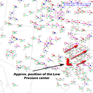
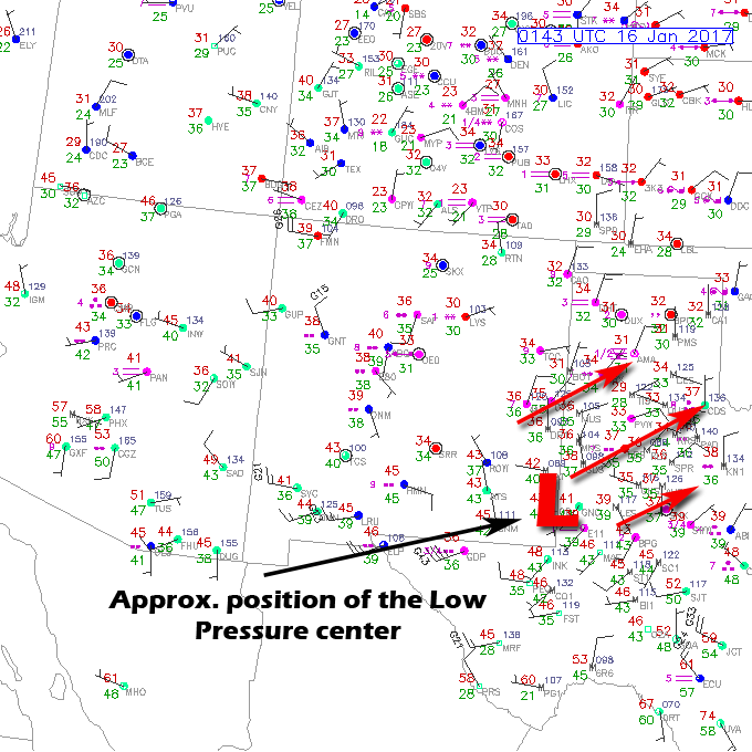
Approx. position of the low based on surface observations. Ideally we’d like to see this over the New Mexico, Colorado, Oklahoma Panhandle border regions for a major snowmaker along the front range. This setup is looking less likely tonight.
Surface observations as of 6:45PM show the low over extreme Southeastern New Mexico. We can see this due to the counter-clockwise flow of the winds on the map around a central point. The low hasn’t begun to make a strong turn to the North yet and this is a signal that we most likely won’t see a “panhandle hooker” type of storm. This thing has simply progressed too far, when it does make that Northward turn, it will move up too far East of Colorado to make a huge impact. Does this mean we see little to no snow accumulation out of this? Not at all…
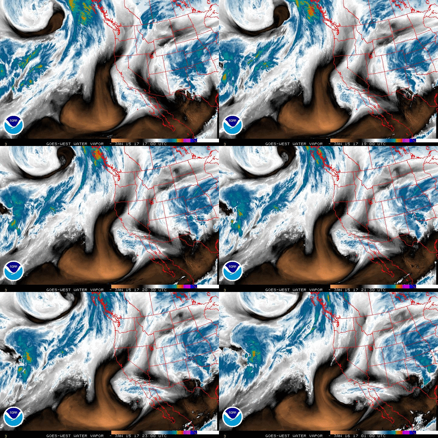
Water vapor imagery confirms the position of our thinking on the low and its motion. Notice it is still mainly moving in an Eastward direction.
You’ll notice that even though the low is still relatively far South, it it still pushing a decent amount of moisture to the North into Colorado. There is no doubt that there is a ton of moisture in the atmosphere across the Palmer Divide today, but we just don’t have a ton of strong upslope to wring more snow quickly out of that moisture.
When we look at the latest probabilistic snowfall from the WPC/NWS we see the numbers largely the same as our last post (yesterday evening) but the higher end probabilities have come down significantly. When you look at that, we are still pretty confident that Castle Rock ends up somewhere in our forecast 2-6 inch range for snowfall.
| For cities in Douglas, CO county |
| Location | At least | Likely | Potential for | 0″ | 0.1-1″ | 1-2″ | 2-4″ | 4-6″ | 6-8″ | 8-12″ | 12-18″ | >18″ |
|---|---|---|---|---|---|---|---|---|---|---|---|---|
| Castle Rock, CO | <1 | 2 | 6 | 5% | 9% | 16% | 33% | 22% | 11% | 4% | 0% | 0% |
| Deckers, CO | <1 | 1 | 4 | 3% | 16% | 29% | 41% | 10% | 1% | 0% | 0% | 0% |
| Franktown, CO | <1 | 2 | 6 | 5% | 8% | 16% | 33% | 23% | 11% | 4% | 0% | 0% |
| Highlands Ranch, CO | <1 | 2 | 6 | 6% | 11% | 16% | 33% | 21% | 9% | 4% | 0% | 0% |
| Larkspur, CO | 1 | 3 | 6 | 3% | 7% | 14% | 37% | 25% | 11% | 3% | 0% | 0% |
| Monument Hill, CO | 1 | 3 | 7 | 4% | 6% | 13% | 32% | 25% | 14% | 6% | 0% | 0% |
| Parker, CO | <1 | 2 | 7 | 7% | 9% | 13% | 27% | 21% | 13% | 9% | 1% | 0% |
| Roxborough Park, CO | <1 | 2 | 7 | 6% | 8% | 13% | 26% | 22% | 13% | 11% | 1% | 0% |
Updated Forecast – What To Expect the Rest of Tonight into Monday
Growing confidence that this storm system is a minor/moderate event for the front range. We expect some icy roads possible for the Monday morning commute and snowpack in areas but shouldn’t see anything major in terms of snow accumulation. As such, our updated forecast is largely the same as last night minus a few minor tweaks…
Timing
- Light snow has begun in the area this evening, expect this to continue on and off through the night.
- Snow bands will move through after midnight, this is when we expect to see the most accumulation.
Snowfall
- 2-6 inches is still the most likely range we see by the storm’s exit on Monday. We are seeing increasing confidence that the storm will give us a short window of upslope to deposit some snow in the overnight hours. Overall we don’t expect accumulations to be major with this storm (unless something drastic happens overnight.)
Impacts
- Some roads may be slick in the morning Monday. Keep an eye out for some travel delays due to the initial snowfall in the early morning hours.
We’ll keep a close eye out for any changes overnight, but this storm looks relatively locked down from a forecast standpoint. Note: the Euro still has significantly more snow by tomorrow, we will see but that solution looks highly unlikely given the storms position and motion this evening. Stay tuned!

