After an abnormally cool and wet period the front range (and most of Colorado) has settled into a drier and warmer period for the month of July. As we move into July we typically see the monsoon establish across the southwestern United States and with it a uptick in rain and thunderstorms across Colorado.
The weather pattern has been strange this summer though, earlier rain and cool temperatures were not related to the monsoon, more with strong cold fronts and moisture from the Pacific Northwest. As we've seen the jetstream migrate North (as it often does this time of year) we've begun to dry out.
July 2019 Was Very Dry
Largely July was a very dry month for Colorado (some very select areas were exceptions as you can see with the graphic below) The lack of a monsoon pattern establishing meant widespread normal and above normal precipitation was lacking for a large majority of the state.
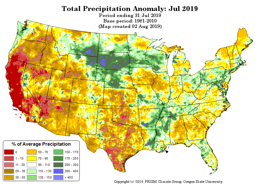
PRISM Climate Data (precipitation anomaly) for July 2018
A lot of the state experienced precipitation in the 50-70% of average category. This is not what we'd expect with a healthy monsoon setup.
Quick Note: But I've Been Hearing on the News...
I'm not exactly sure why certain TV meteorologists have been attributing a lot of ours storms in July and early August to the "monsoon." The pattern simply hasn't been there... you can argue it but the data above doesn't lie.
August 2019 - Glimpses of the Monsoon?
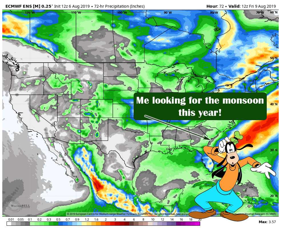
Fret not though, we are seeing glimpses of a monsoon pattern shift in the near future... but there's a catch...
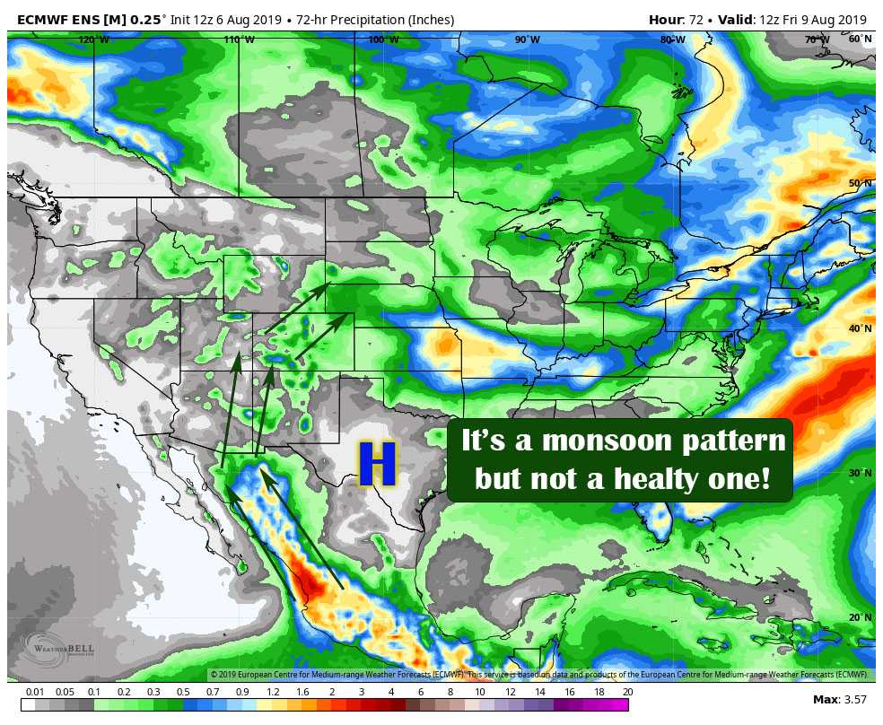
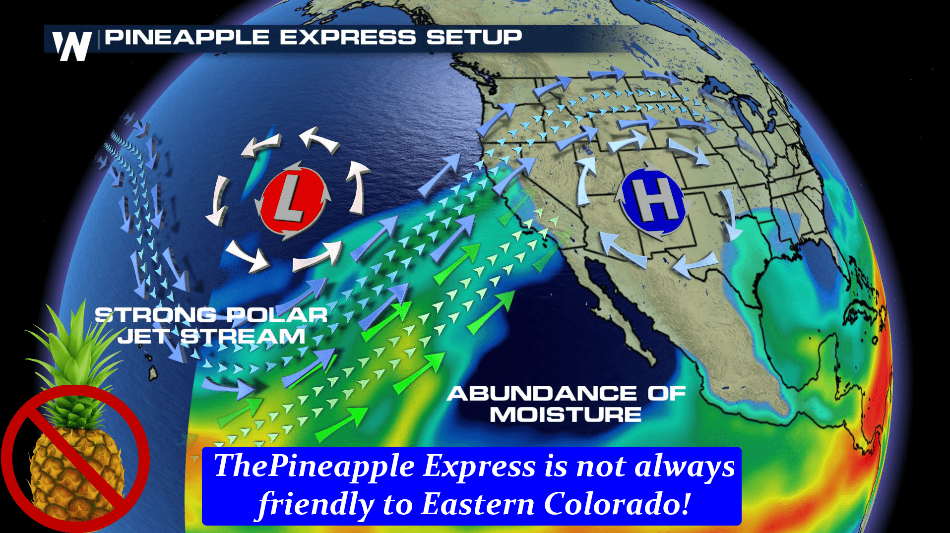
While models are pointing to a monsoon type setup over the next week or two it doesn't look all that healthy. The image above is the EURO model ensembles and shows while we see moisture from the gulf rotation around a high pressure over roughly Texas, the moisture advection is not terribly strong. In fact, there are still several key ingredients of a healthy monsoon pattern that just simply aren't there.
Here's a more ideal setup
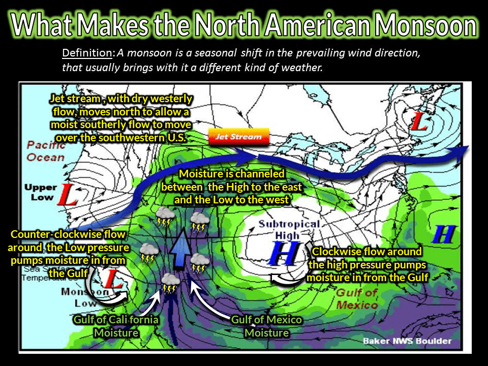
So compare the two images above and it becomes clear that what we will see over the next 7-10 days looks weak at best. Not to say this is set in gospel (models are not 100% accurate remember) but it's worth noting that the overall trend shows at least a slight uptick in moisture but not a strong monsoon setup.
What Does This Mean for the Palmer Divide?
The influx of moisture means we should see a bit more thunderstorm activity return to our area again over the next few days. Not only that, but on those days the temperatures should cool a bit so we get a bit of relief from the heat but it should stay pretty warm overall.
Here's the EURO Meteogram for temperatures at Centennial Airport for the next few days.
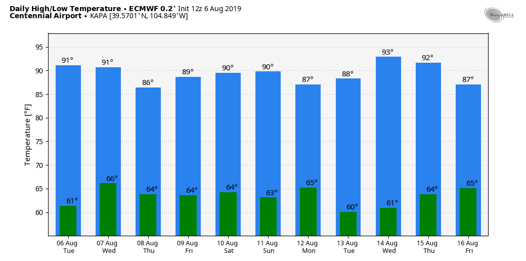
As always, add or subtract a few degrees from these depending on your elevation. The point here is you can see the cooler days above... those will be the best shots for thunderstorms with decent moisture.
With the influx of moisture and lift we will have to keep an eye on the Palmer Divide... our elevation and terrain makes us a bit of a bullseye for thunderstorm development under these conditions.
We'll keep an eye on things over the next few days to couple of weeks to see if we can spot any significant changes in the weather pattern but for now it looks like more of the same!
