A statistical look and discussion of weather recorded for Castle Rock Colorado. This information was collected and recorded via my weather station in the Meadows in the town of Castle Rock. It is in no way an “official” record, just simply what was recorded by my station.
Summary
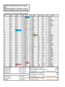
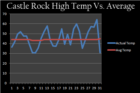
January 2016 featured a slightly cooler than normal month as far as temperatures and a drier than normal month. The cooler temperatures lingered due to a weather pattern that had Colorado on the edge of some pretty big troughs, this allowed cooler air to remain in place for longer periods of time. We only saw a major warm up towards the end of the month, right before a rather large snowstorm affected the area in February.
Due to the prevailing weather pattern in January 2016, many of our storm systems came from the West or Northwest; this was great news for our mountains as they continued to receive sizable amounts of snow through the period. Denver and the front range however, did not receive a ton of snow as we usually don’t benefit much from that type of storm track. Only a couple of days saw snow for us and none of them were large storms.
January 2016 finished relatively unremarkable overall. There were no periods of unusual warmth or cold, no periods of large snowstorms, generally it was a very average month.
February 2016 Outlook
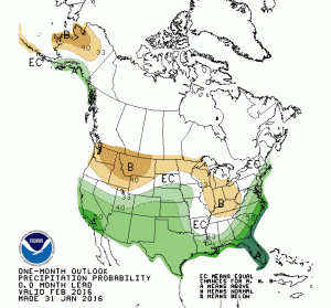
Current outlooks from the Climate Prediction Center showcase a higher than average chance of above average precipitation and a higher than normal chance of below average temperatures. In short, we expect February 2016 to be wet and cool.
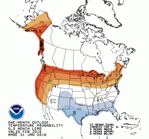
The temperature forecast is a little less certain. We have started the month of February below average, but longer range models show a large ridge of high pressure building over the Western U.S. the second week of February or so. This weather feature would usually mean we would experience warmer than average temperatures and drier weather.
It will be something to keep an eye on, the first 2 weeks of February (minus the first few days and the large snowstorm) look relatively cool and quiet with a warm up possible some time in the second week or so. After that, the forecast becomes a bit murky.
Remember, in an El Nino year, we will be watching the second part of February for any large pattern shifts that might forecast a wet March. We have a higher than average chance of larger storm systems moving through the area in spring so it is worth a close watch.
Summary
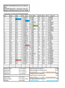
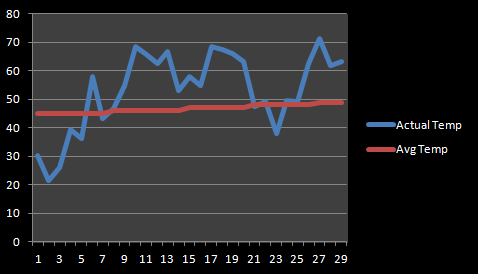
February 2016 didn’t go necessarily as planned when you look back at the outlook from the CPC at the end of January. While cooler and wetter conditions were predicted, February was neither. The month ended at 2.3 degrees above average for daily mean temperature, while not a huge over average number it was notable. In fact most of the month saw high temperatures over average, but a couple of shots of very cold weather kept the overall average from being too high.
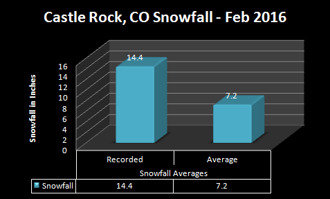
For precipitation, the month finished slightly below average on total moisture but well above average on snowfall. This was due to a single storm at the beginning of the month that dumped over a foot of snow in the Castle Rock area. From that point forward, no measurable snow storms impacted the area and the rest of the month was very dry.
February is no stranger to periods of prolonged warmth and dryness, in El Nino years especially we see a winter “lull” establish in January and sometimes last through the month of February into March. If you take away the snow storm at the beginning of the month, February would have been one of the driest on record.
No March outlook as I did not get a chance to update this until we were well into March. Sorry for the delay, but at this point we know how March is turning out. I’ll have the March update up with all the details in early April.
Summary
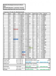
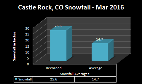
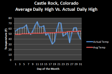
March is Colorado’s snowiest month and while it doesn’t always live up to the title, it certainly did this year. One large snowstorm and a few smaller ones pushed our snow totals well above average, the heavy and wet nature of the snowfall also ensured that with evaporation and melting we still were over average for precipitation. The month finished nearly average as far as temperatures go, here’s a closer look at the data:
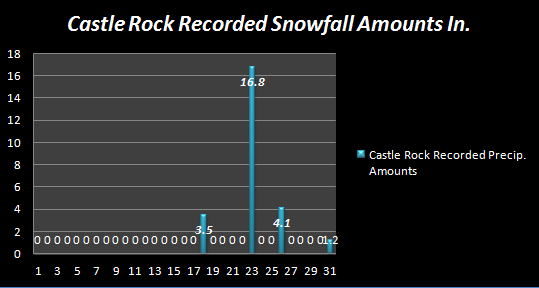
We had a few snowstorms move through Castle Rock in the month of March. You’ll notice the first half of the month saw no snowfall whatsoever, but by the second half of the month a major pattern shift began to bring more storm systems into the area. The blizzard on the 23rd of March time-frame dumped a hefty 16.8 inches at our measure, but some areas in and around town may have seen more or less.
Keep in mind, our measurement follows NWS guidelines to account for drifting so your mileage may vary.
As expected in an El Nino spring, March finished way above average for total snowfall accumulation.
Snowfall was well above average and because if its high moisture content (often the case with spring snow storms) March 2016 finished as a wet month overall.
Temperatures were relatively unremarkable for March 2016. As I mentioned above, the first half of the month saw entirely above average temperatures (minus a slight blip on March 9) but the second half of the month saw below average temperatures. When you take the average over the entire month we finished at about 0.49 degrees below average. This is such a tiny number, I’d be more inclined just to say March 2016 finished at about average temperature.
April 2016 Outlook
The latest April outlook from the CPC calls for above average chance of precipitation and average temperature to be above average. This means by month’s end we should expect rain/snow to be above average and the mean temperature (average temperature of each day and night) to be above normal as well.
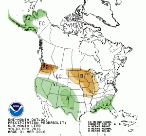
One thing I’ve noticed is the strong signal of warm weather in this month’s models. Given what we have seen the first few days and what we expect in a typical El Nino spring month, a warmer April looks very likely. Warm to the point where I’m seeing all rain with most storm systems and question if much or any of this precipitation will fall as snow. April is, after all our snowiest month but I’m not terribly confident it will live up to that this year.
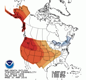
Summing it up; I agree with CPC on this one, expect a warm and wet April.


