This page will cease updates as of 3PM MST on January 22, 2019. The storm is moving out of the region.
Palmer Divide Weather Warnings (Graphical)
No active warnings for the Palmer Divide as of 3PM MST
Will allow the
blizzard warning for zones 41 and 46 to expire at 3 pm MST. There
should be some partial clearing this evening as a short wave
ridge of high pressure moves over the region.
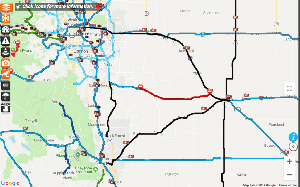
Road Conditions/Closures
Eastern Plains:
CO-86 Closed both directions from Kiowa to I-70.

I-25 Castle Rock (Wolfensberger Exit)

I-25 at Castle Pines

I-25 Larkspur
Storm Resources
NWS Forecast Discussion
Area Forecast Discussion
National Weather Service Denver/Boulder CO
201 PM MST Tue Jan 22 2019

.SHORT TERM...(This evening through Wednesday)
Issued at 201 PM MST Tue Jan 22 2019

Storm system exiting the plains this afternoon, with snow
diminishing and winds decreasing by this evening. Will allow the
blizzard warning for zones 41 and 46 to expire at 3 pm MST. There
should be some partial clearing this evening as a short wave
ridge of high pressure moves over the region. A strong
northwesterly flow aloft will remain over the cwa tonight and
Wednesday. The next system will be dropping out of northern
Rockies on Wednesday, as a strong upper level jet moves into
northwest CO by 18z. Increasing clouds from northwest to southeast
on Wednesday. Details in the long term but will issue a Winter
Weather Advisory for the north central mountains starting
Wednesday afternoon. By that time, the leading edge of the left
exit region will be over the mountains with snow increasing in
coverage at that time. Weak to moderate mountain wave development
late tonight into Wednesday morning with westerly winds possible
in and near the foothills and exposed eastern slopes of the Front
Range mountains.


