Weekend Cold Snap with a Side of Snow – Forecast Discussion 11-26-2025
Thanksgiving Weekend 2025 Storm System Continues to Evolve
Valid 11/26/2025 6AM MST
Some Trends Became More Consistent Through the day on Tuesday
Watching modeling through the day on Tuesday, there was still some uncertainty and flip-flopping but a few things became clearer. When we watch models, we don’t adjust a forecast based on a single model run or even a model suite. We look at the whole of the models (we use all the tools) and look for trends to tell us what they’re honing in on and in combination with a few other things – that’s how a forecast takes shape.
A few things became clearer through the day yesterday and into today that give us confidence in certain things (temperature, storm track) while others still remain a bit uncertain (snow timing and accumulation).
That being said, if you don’t want read through all of the information below, we have pretty good confidence in this statement: this storm is not looking like a major snow eevent for areas in Eastern Colorado (specifically East of the Contintental Divide.)
Complicating things a bit more, snow is expected to come in 2 “waves” – the first Friday night into Saturday and the next Sunday night into Monday.
For this post, we’ll focus mainly on the first event… I’ll have another post up later for the second event.
Here’s the latest…
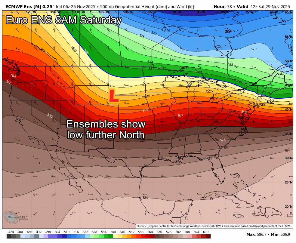
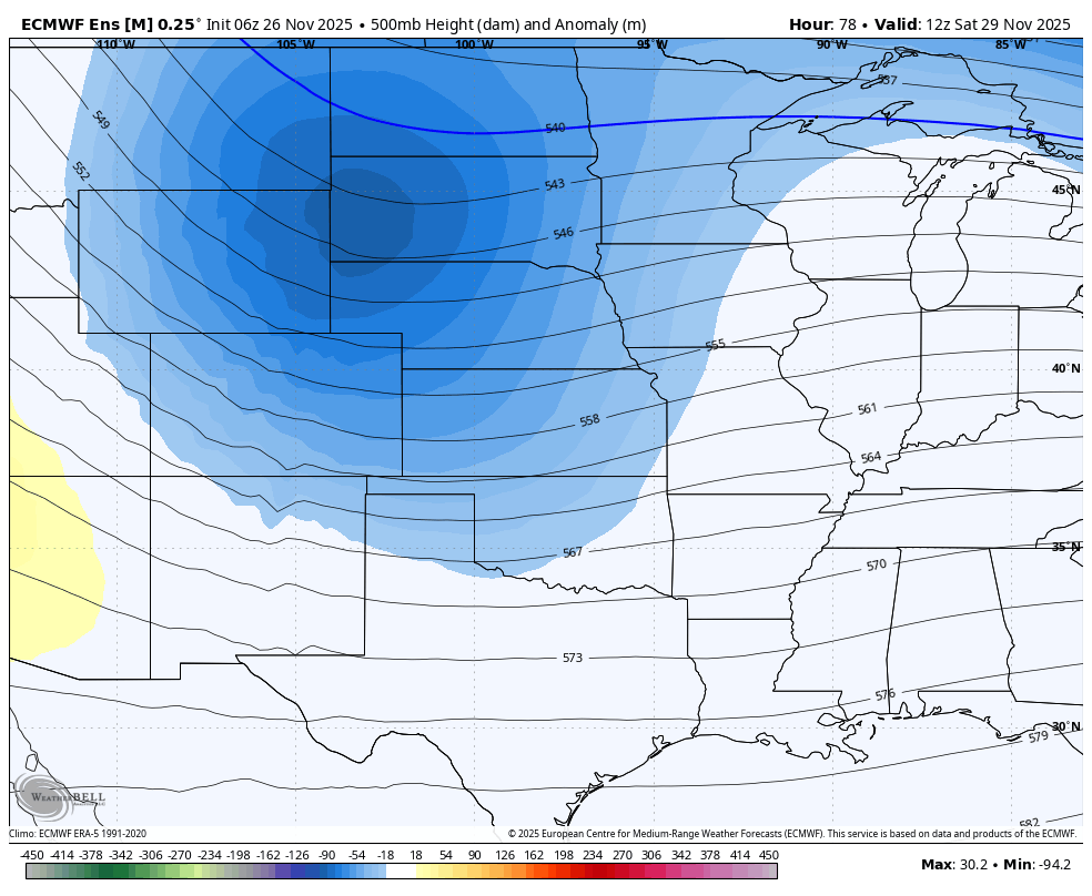
The biggest trend we saw (and we saw this actually on Monday too, Tuesdy was just a continuation of this) was the tendancy for this storm to want to stay North. Storms this year have been struggling to dig far enough South to tap into Gulf Moisture and take favorable tracks for snow for much of Colorado.
This storm system is showing the same characteristics. This is all pretty typical of late fall/early winter La Nina setups, the jet stream tends to stick further to the North, meaning we just don’t get the big storm systems. The Euro Deterministic above shows the low and I’ve added the track.
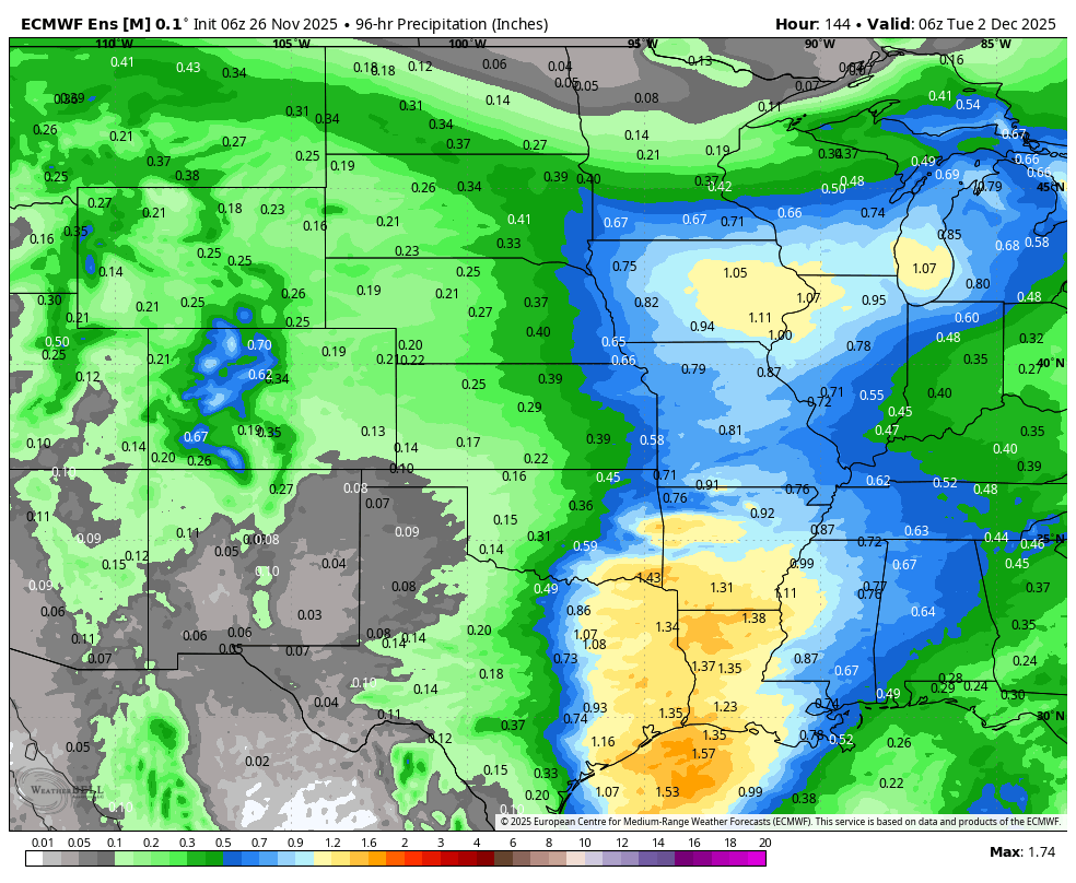
Looking below at the Euro Ensemble, I typically look at these very closely in the forecast process for everything from 500mb heights, to temperatures and snow… but for this storm cycle I think they’ve “smoothed things out” too much. Should they actually verify though, many of the ensembles are showing a complete non-event for snow for Northeastern Colorado. This would mean no snow… nada… and our snowless streak would continue.
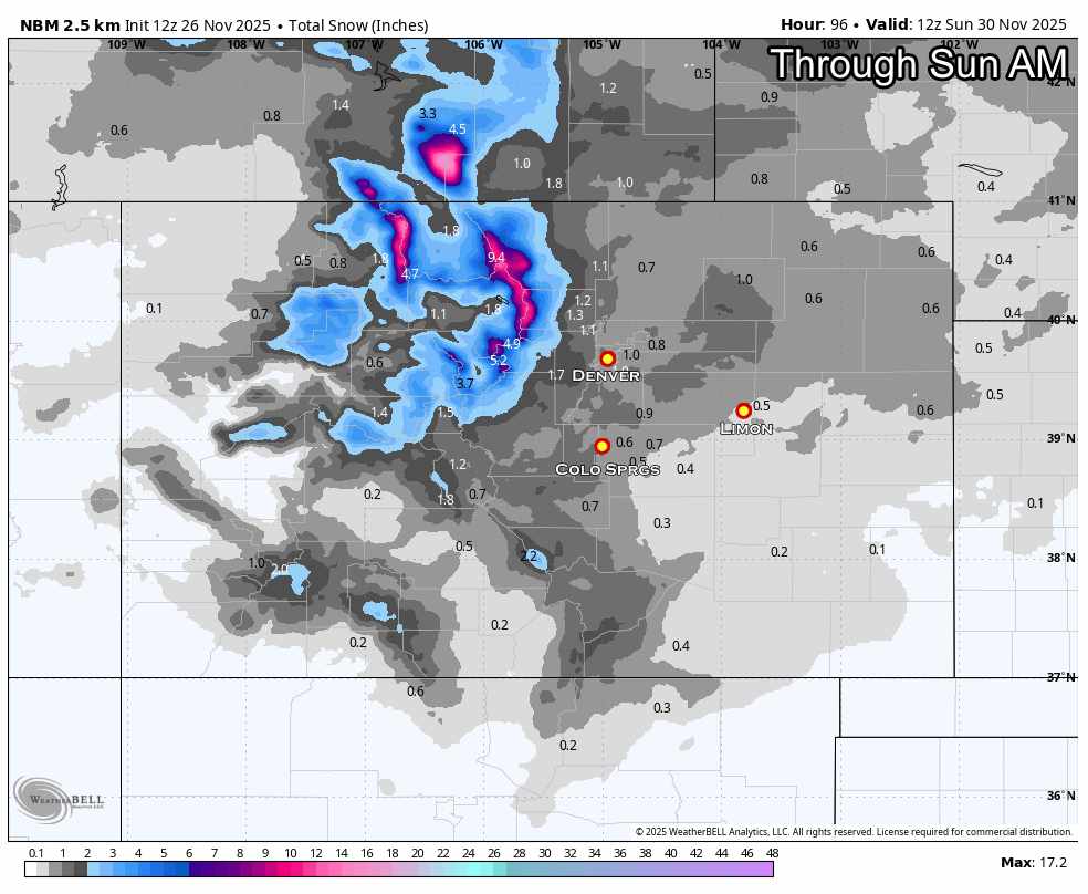
Snowfall Forecast through Sunday AM
General Thoughts on Snow Accumulation
I’ve attached the NBM product as it is the closest to my forecast thinking at this time. I’ll post up my own snowfall forecast graphics for specific Colorado areas in a bit, because I don’t think those are done moving around a bit. I think we’ll see more jumping around on Wednesday.
You can see the overall picture here is for Northwestern favored peaks in the mountains to have the best shot at good accumulating snow. As you move East of the Divide and onto the plains, only minimal amounts expected. I think that 1″ or so range for much of Denver and the Palmer Divide is a good amount to build a range around. So say 1-3″ for now.
You see less snow as you move out onto the plains and especially to the Southeast.
Keep in mind, this is just for the first wave; set to come in late Friday and last into Saturday morning.
Weather Nerd Synopsis:
Two Quick-Hitting Systems This Weekend — Coldest Air of the Season Incoming
System #1: Friday Night – Early Saturday
Setup:
A compact upper trough digs south out of the Northern Rockies Friday night, with a surface front trailing in behind it. Models bring light snow down from Wyoming after dark, mainly along and north of I-70, tapering off early Saturday morning.
Timing:
❄️ Snow moves into northern Colorado between 6PM and midnight Friday, pushes south toward the Palmer Divide by late Friday night, and wraps up by mid-morning Saturday.
Model Blend:
Operational runs (Euro, GFS, NAM) are fairly locked in on timing and general placement. But ensemble support is… meh. Euro EPS and GEFS both show wider spread and quite a few members with little to no QPF for this timeframe, so there’s still some question on how widespread precip will be — particularly outside favored terrain zones.
Confidence Level:
🟠 Moderate. This looks like a classic fast-moving clipper-style system but doesn’t linger long enough to dump much snow. But cold air and some modest mid-level lift could be enough to get a fluffy inch or two, especially north of I-70 and on the Palmer Divide, where upslope could briefly kick in.
Model Notes:
-
HRRR starting to pick it up, but may be overdoing QPF as usual.
-
NAM/NAM3k show some decent banding potential late Friday, but I’m not totally buying the totals it spits out.
-
Euro has been the most consistent,cold, fast, light snow.
-
GFS… well, it’s GFS. Okay in the big picture, weak on details east of the Divide.
System #2: Late Sunday (Still Iffy)
Setup:
A second shortwave swings in from the northwest sometime Sunday, potentially tapping into slightly better upper-level support. The cold air is already locked in by then, so any precip that develops should fall as snow.
Timing:
Best guess is late Sunday afternoon into Sunday night, but this one’s more variable depending on the model.
Model Spread:
We’ve got good clustering among ops runs, but ensemble spread is even wider than Friday’s system. The EPS especially shows a range from nothing to a couple tenths of QPF so don’t hang your hat on details yet.
Confidence Level:
🟡 Low to Moderate. This could end up being another glancing blow, or give us a broader light snow event. I’d lean toward minor impacts, but with cold ground and Sunday travel, even a dusting could matter.
Impact and Preparation Notes For This Storm System
🧊 Temperatures: Legit Cold Incoming
Regardless of snow amounts, both systems drag in the coldest air of the season so far. Expect highs struggling to get out of the 20s Saturday and Sunday, with overnight lows in the single digits for some areas (especially above 6,500 ft).
We’re watching this closely because even light snow on cold pavement can make for slick conditions, particularly bridges, overpasses, and shady spots. Be heads-up if you’re driving back into the Front Range late Sunday.
Major travel impacts from snow are not expected in Eastern Colorado are not expected at this time. However, keep checking for changes.
Want to Know More? Check Out These Related Articles!

About the Author
Meteorologist John Braddock
Position
