Colorado Weather – Short and Medium Range Forecast Discussion February 2026
Short/Medium Term Weather Outlook Feb 2026
Valid 1/31/2025 2PM MST
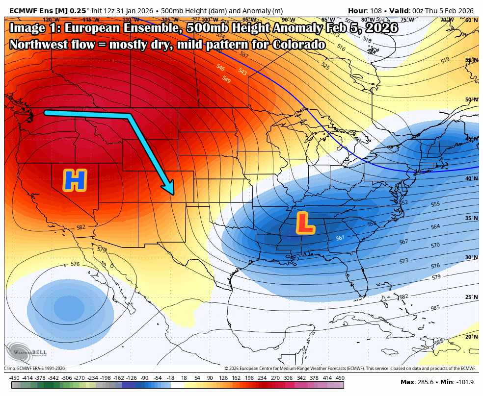
The 500mb height anomaly map below (from the 12z Jan 31 ECMWF ensemble) shows a strong high-amplitude ridge over the Pacific Northwest, locking in through the first third of February. This is a classic northwest flow regime for Colorado, and overall, not a favorable setup for significant snow along the I-25 corridor or plains.
Ridge Holds Strong
We’re looking at well-above-average heights building over the West, centered over the Intermountain West and extending into western Canada. With this orientation, the storm track is displaced north, and anything that does try to dig south tends to shear out or stay progressive.
This pattern typically brings:
-
Dry conditions east of the Divide
-
Limited snow potential for the mountains, unless an embedded shortwave manages to sneak around the ridge (possible, but low probability)
-
Mild temperatures, especially if we tap into downslope warming
Mountain Wave Potential & Wind Watch
While high pressure tends to stabilize overall, northwest flow and a decent pressure gradient create potential for wind events, especially if we see mountain-wave setups. That’ll be more of a short-range call, surface stability will be key, and we’ve seen setups like this surprise us before.
Temperatures
Temps should run near to slightly above average overall.
There’s some potential for record highs if we get a strong downslope day along the Front Range, but at this point, that’s something we’d only see coming in the shorter range, day-to-day forecasts.
Any Snow at All?
This isn’t a “no snow” pattern, but it’s not a high-yield one either.
Any snow we do see would likely be from quick, shallow disturbances; brief, low-accumulation events that clip the state. There may be something around Feb 3-4 worth keeping an eye on, but confidence is low, and guidance doesn’t show anything robust. Perhaps a “dusting type” quick hitter storm if we are lucky.
In the Medium Range (10-15 Days)
Possible Pattern Shift Mid-Month? (Feb 11+ Outlook)
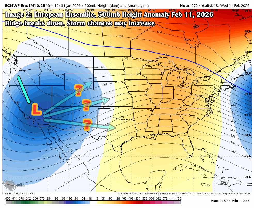
As we move into the 10–15 day range, the ensembles are starting to hint at a potential pattern shift. The ECMWF ensemble 500mb height anomaly map valid Feb 11 shows the first signs of a breakdown in the dominant western ridge, with a decent trough trying to dig into the West Coast.
We’re still a long way out, but this kind of setup could open the door to a more active pattern for Colorado, depending on how it evolves.
Trough Tries to Dig In
This isn’t a slam-dunk storm signal, but the presence of a deepening trough (and below-average heights across the Southwest and Great Basin) increases the odds of a stormier setup emerging. The key unknowns at this point:
-
Track: Does the trough dig far enough east to impact Colorado, or stay hung up west of the Divide?
-
Timing: Will it phase with any subtropical moisture, or stay progressive and undercut the ridge?
-
Cold air source: There’s no real Arctic intrusion showing up yet; we’d need some upstream help to get cold air into play.
The trough axis is still pretty far west in this frame, and there’s significant spread in ensemble members so this is more of a “watch the trend” situation rather than a targetable storm window.
Ridge Doesn’t Rebuild (Yet)
Perhaps more interesting: ensemble guidance doesn’t show the ridge rebuilding quickly after this. That could signal a more prolonged window of active or transitional weather heading into late February or even early March. If we’re going to see a seasonal flip to more snow-friendly setups, this may be the first sign.
Again no guarantees here, and we’ve seen plenty of false starts this winter. But it’s the first legit sign of the pattern loosening its grip.
A Quick Note About Weather Forecasts Beyond 7 Days
A Quick Note on Long-Range Forecasting
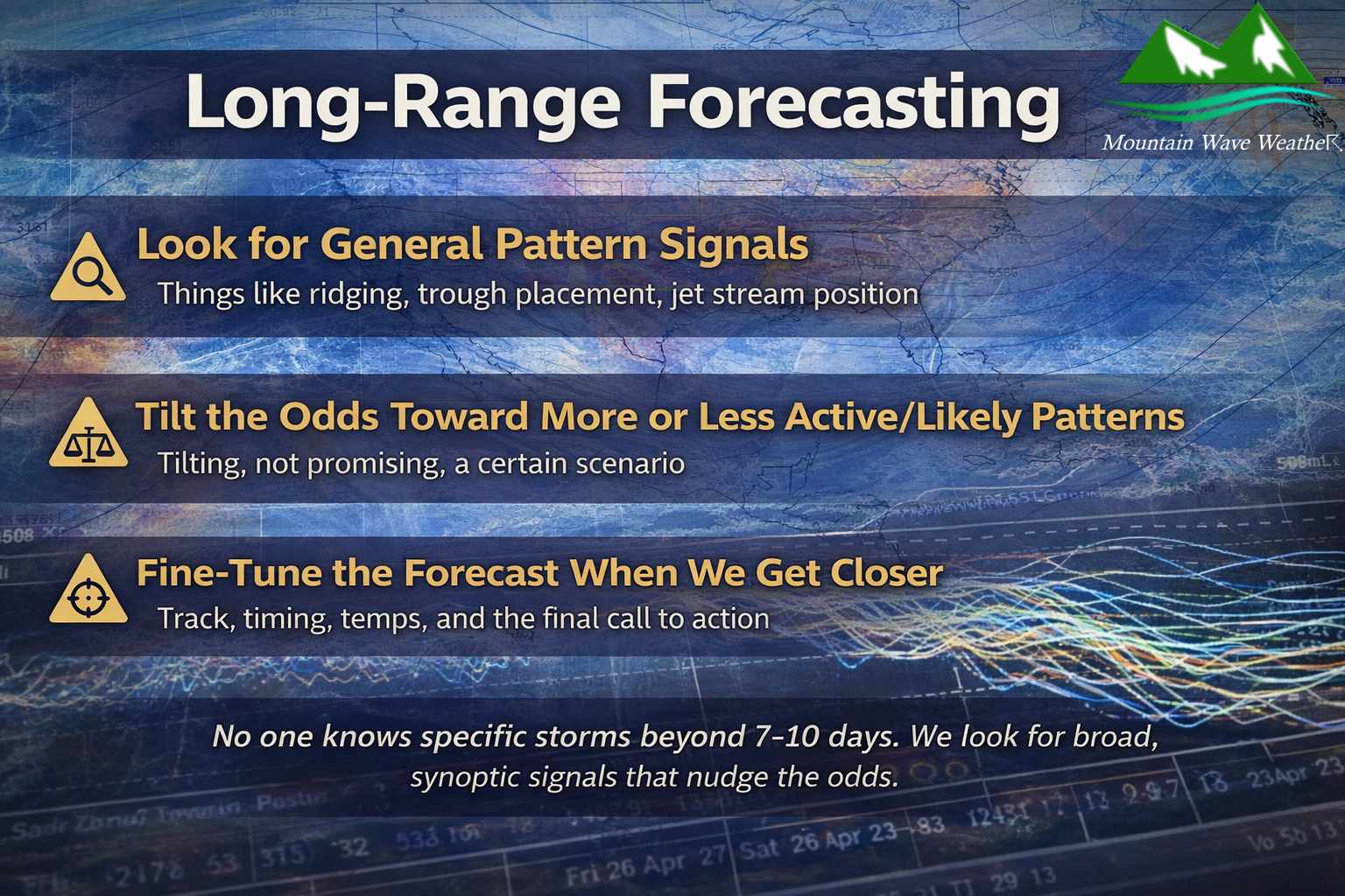
Past about day 7, forecast confidence starts to drop off pretty quickly, not just for me, but for everyone. At that range, it’s not about predicting specific storms or snow totals; it’s about looking at the pattern and how the atmosphere is likely to behave on a broader, synoptic scale. That comes from a solid education and years of experience.
At this point, we’re looking for signals — not guarantees. Things like ridging, trough placement, jet stream position, or signs that the pattern may become more active or stay blocked.
These longer-range outlooks help us tilt the odds toward one scenario or another. Then, as we get closer and models start resolving finer-scale details, that’s when an experienced forecaster can refine the picture; track, timing, temperature profiles, and issue something you can actually plan around.
So no… I don’t know exactly what will happen 12 days from now. But I can tell you if we’re more likely to stay dry… or if something’s worth watching.
Euro Ensemble Snowfall Next 7 Days
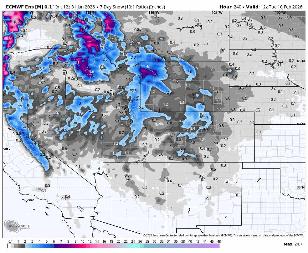
Don’t get caught up on specific amounts, just observe trends.
The trend we see here is the low snow accumulation amounts for Colorado and much of the Western U.S. for the next 7 days. Also notice how the mountain areas in the Pacific Northwest around the Northern edge of that ridge are favored for higher snowfall amounts… this is likely due to an “atmospheric river” setup in that area over the next week.
Want to Know More? Check Out These Related Articles!

About the Author
Meteorologist John Braddock
Position
