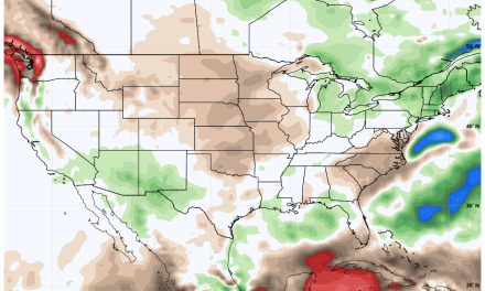
We'll cover this week's weather fairly quickly as we will continue to see high pressure in control of our weather pattern and that means warm and dry weather with a bunch of wind thrown in. The second part of the article will be centered around what we are watching for next week...
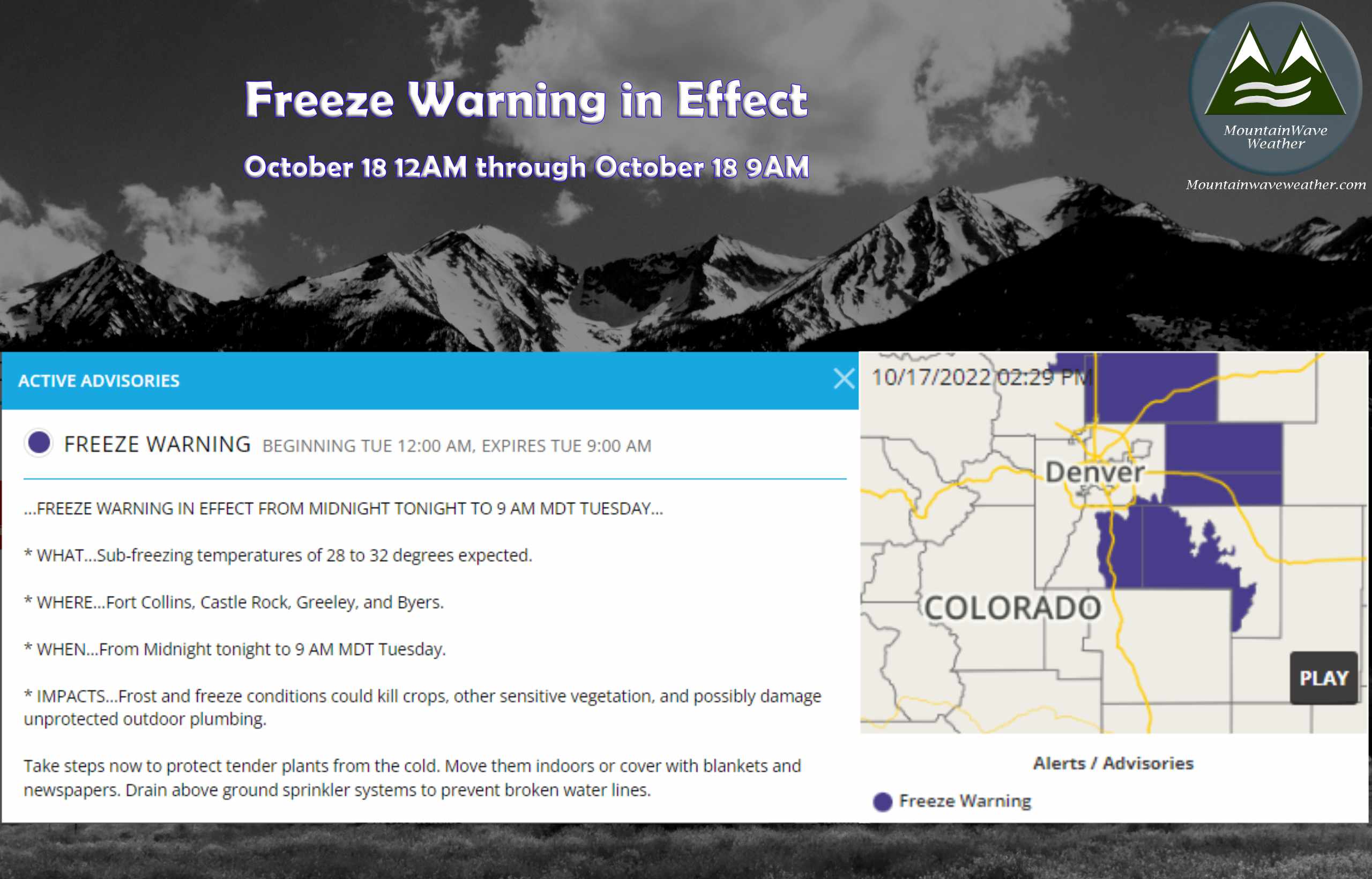
Freeze Warning in effect Tonight October 17-18, 2022
Palmer Divide Forecast and Weather Setup this Week
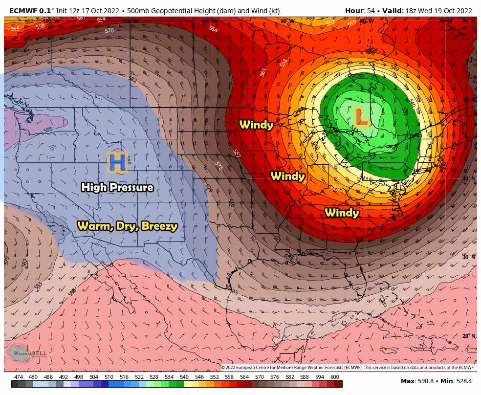 Strong high pressure will continue to dominate the pattern over the Western U.S. and Colorado for much of the week. A strong low pressure system over the Northeast will make for windy conditions out on the plains and depending on how these two features wobble and move - some of that wind may come to Colorado a bit later in the week. We will see how the wind shakes out later in the week as there is still a bit of uncertainty on how much of an impact that will have on our area.
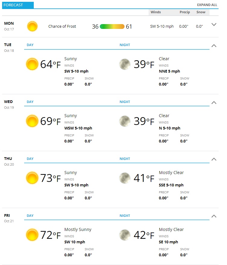
In Colorado, conditions will be very fall like with warm and dry days and cold, crisp nights. It is possible more Freeze/Frost advisories and warnings could be issued Monday night into Tuesday - we will wait for the NWS to determine that and pass along any details as needed.
The Castle Rock/Palmer Divide forecast is below - as always add or subtract a few degrees based on your elevation.
Next Weekend - The Beginning of a Larger-Scale Weather Pattern Shift?
All eyes will then be on next weekend as we start to see the jet stream wobble a bit. This could potentially send low pressure systems our way along with much colder air and the potential for precipitation - although specific details on that will continue to be hazy until we get better data and in range of more models.
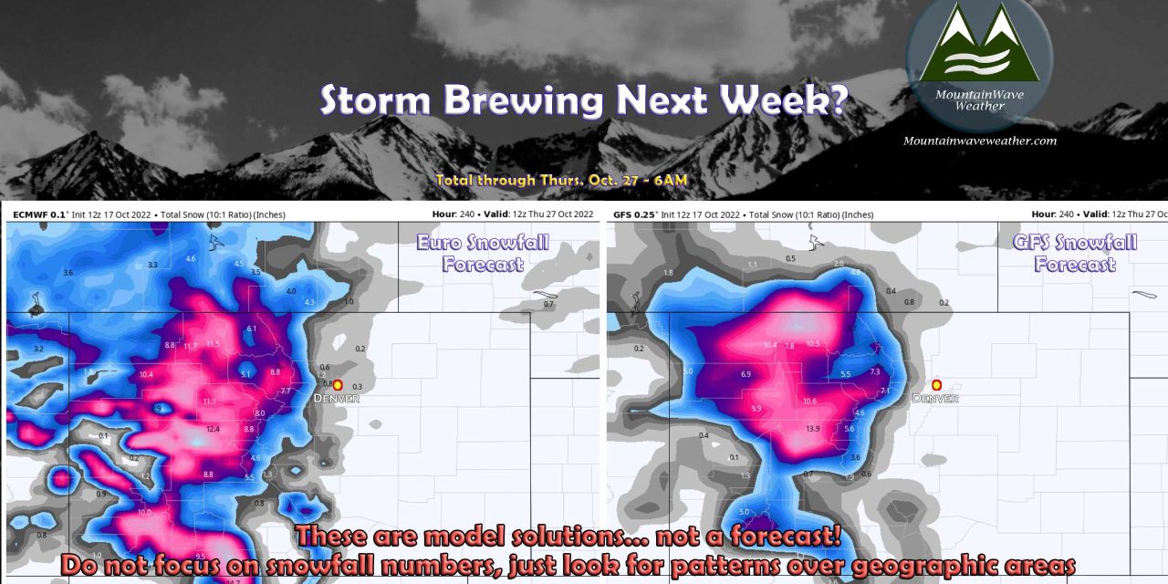
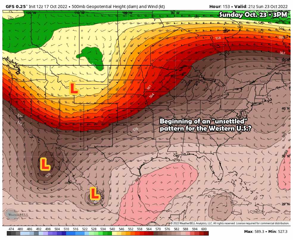
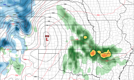
Pictured below is the GFS solution for Sunday Oct. 23 around 3PM, notice the large upper level trough to our North along with a smaller closed low to our Southwest and even what looks like a tropical cyclone down towards Mexico. This solution is so far out that you have to take the details such as how many lows, where they are and how they move with a huge grain of salt... however, the Euro also agrees on an unsettled pattern setting up durign this period with differences on track/strength/positioning of those lows.
The only details we can really glean from this at this time is that there is potential for a weather pattern shift next weekend and for subsequence days after that.
In terms of who sees snow or how much (or any at all) is still up in the air. If you forced me to pick a favored spot though, I'd put my money on the mountains seeing the best shot with the best accumulations. Again, we will have to see how this pattern evolves later this week as we get more data in.
Here's a quick look at what the models say:
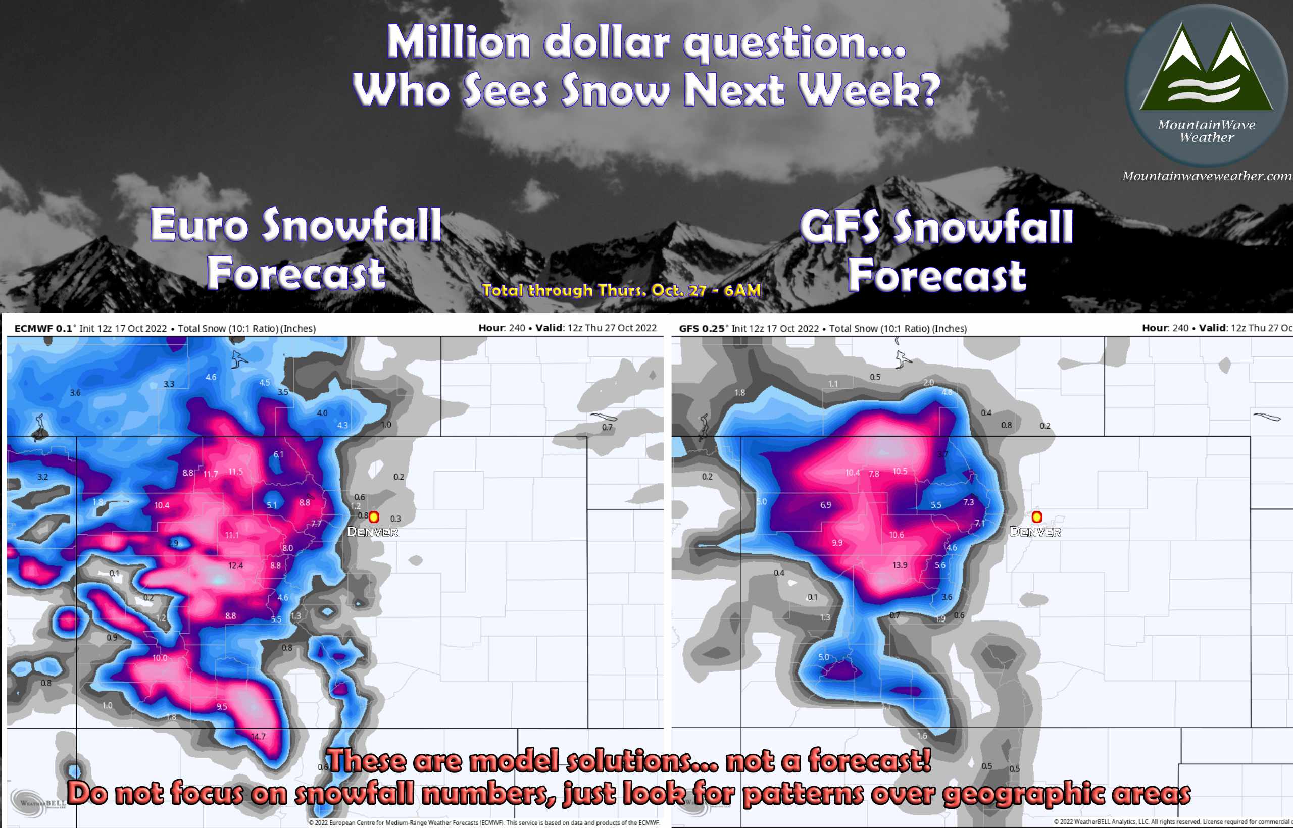 Neither of the two models we rely on this far out are excited about snow in the lower elevations of Eastern Colorado. The Euro tries to senak a bit of accumulation in the foothills and higher elevations of the Palmer Divide. As always, you can't focus on details like that too much this far out in a forecast.
I always hate showing models this early as people get too excited and either don't' understand them or take them as a forecast - so I've included a healthy dose of context here. Focus more on large scale patterns over geographic areas rather than specific snowfall totals at this point. We will get more data in later in the week, then we can start discussing how much and who sees what.
I'll have more updates/posts throughout the week as needed, stay tuned!
