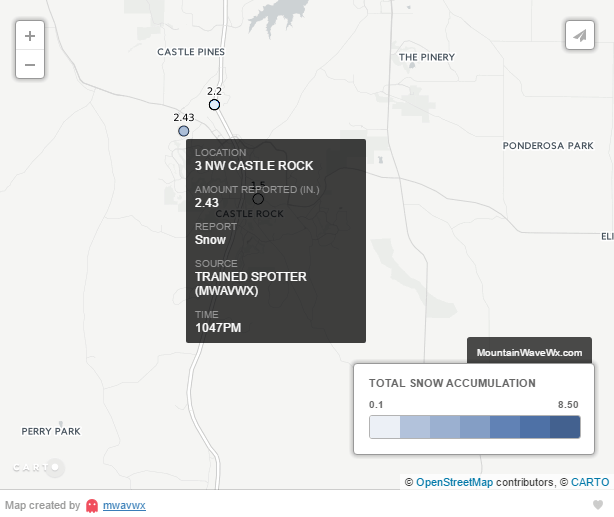
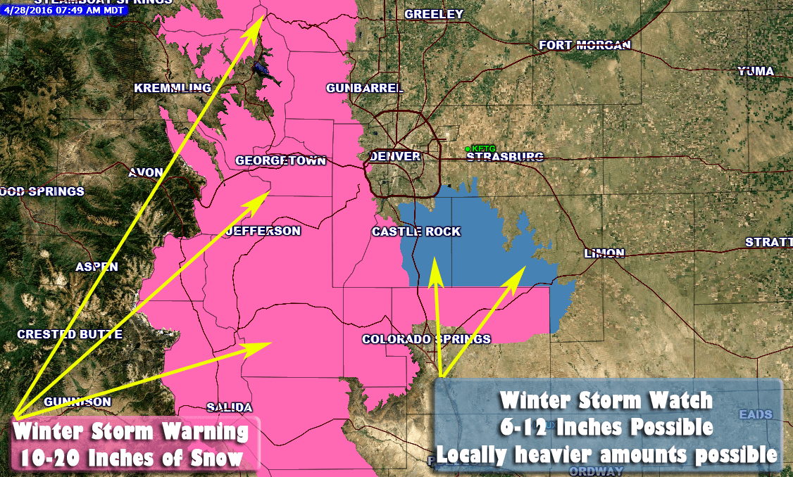
Storm Total Snowfall Map
This map is interactive, you can scroll around to see snowfall in other parts of the front range.
Storm Summary
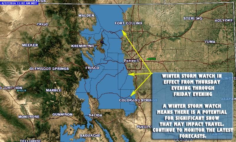
A strong storm system moved into the area Thursday, bringing strong winds for some and snowfall for nearly all areas along the front range. Snow started around the lunch hour along the urban corridor and continued into the overnight hours. The snow intensity ranged from light to moderate and this combined with quickly dropping temperatures made for tricky driving conditions in the evening; especially South of Denver over the Palmer Divide.
Castle Rock and Nearby Reported Snowfall Amounts
- Castle Rock (Meadows) : 2.43 In.
- Happy Canyon Area: 2.2 In.
- Denver: 1.7 In.
- Parker: 3.6 In.
Snowfall amounts were mixed and there was light drifting observed when I made my measurement. Here's a look at what our forecast called for and how we did...
Rain will begin in the morning hours and change to snow later in the day as temperatures drop. Snowfall accumulation looks likely, especially in areas West of Denver and along the Northern sections of the Palmer Divide. --No rain occured but snow did start in the early afternoon hours.
Winds with this storm could gust to 40MPH or higher. Be prepared for strong winds throughout the day on Thursday! --Wind was observed but turned out much lighter than originally forecast. Windier conditions in the evening established allowing for light drifting of snow.
Chance for snow falling with this storm system as of today: 80-99% chance
Given the newer model data, the chance that the Castle Rock area sees snowflakes falling today is pretty high. I have adjusted the forecast up for this. --Snow did fall with this storm system
Chance for snow accumulating with this storm system as of today: 70-90% chance
Nearly every model has some snow accumulating for us, even the NAM that has held off quite a bit shows 0.4 inches. I think it’s a pretty decent chance we see at least a dusting off snow, but it is possible that the other models are picking up on colder air that could aid in snow accumulating on the ground. --Models began to show accumulation consistently through the late evening hours on Wednesday and into Thursday morning. A stronger and quicker than anticipated temperature drop was picked up on the GFS and HRRR.
Total Snow Accumulation: 0.5-2.0 inches
Melting is still a big concern as the ground is very warm. That being said, I think snow does accumulate for the Castle Rock area, somewhere in the range above. Right now I am still leaning around 0.5 to 1 inch as the most likely range but colder air could see up to 2 inches accumulate. --Snowfall accumulated to 2.0 to 2.5 inches in the Castle Rock area. Colder temperatures allowed snow to begin collecting a bit earlier than anticipated.
This storm does not look to be a major snowmaker for Colorado at this point. We are not expecting major travel issues around the Castle Rock area as roads and the ground is still quite warm. Areas South of Castle Rock over Monument Hill may experience some slick spots as temperatures drop. Be careful when driving, if temperatures trend colder the roads could “flash freeze” at some point. We’ll keep an eye out for this! --While this storm didn't produce a lot of snow, the earlier than expected snow accumulation made for icy roads and treacherous travel conditions for a short while. I did mention concern about a "Flash Freeze" of the roadways but missed the target as I though this would occur South of Castle Rock.
My Grade for the forecasting and coverage of this storm B-
I ended up pretty close on the snowfall amounts, which is always nice but missed the mark a bit on the impacts. In my opinion, forecasting isn't so much about getting the finer details (how much snow, how big the hail, how strong the wind, etc...) it's about communicating the impacts the day's weather will have on people. While I expressed concern about a Flash Freeze of the roadways I didn't think it would get as bad as it did in the South Metro Area including Castle Rock. The signs were there though, 2 notable models had been predicting a sharper and quicker temperature drop than before, this should have tipped me off that travel difficulties could manifest themselves on the evening commute. All in all, not a bad storm to shake the forecasting cobwebs off before we get into winter.
Looking Ahead to the Weekend

After our snow storm, the weekend is actually looking quite nice. Expect a cool start on Friday under mostly clear skies. Saturday and Sunday will feature mostly clear to partly cloudy conditions with warming temperatures.
Models are hinting on another possible storm system early next week, the storm looks similar to this one so don't expect a ton out of it at this point. As always, we'll be keeping an eye on it in case that changes. Have a great weekend!
Fun Fact of the Day
Before yesterday's snow it had been 34 days since we last saw measurable precipitation in the Castle Rock Area. This makes it part of one of the driest September - November periods in recorded history!
