A large storm system is moving through California and on its way to Colorado this weekend. This storm has a ton of moisture riding an "atmospheric river" along the jet stream into the state. The good news is that it will bring decent a decent amount of snowfall to the Colorado high country, but unfortunately storms with this track don't mean much in the way of moisture for areas East of the Divide.
Let's take a quick look at the situation:
Current Winter Weather Alerts (Colorado as of 6PM Mountain Time)
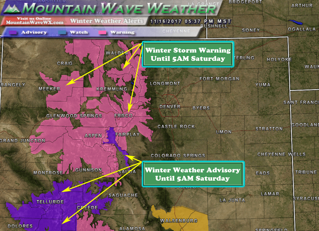
Winter Storm Warning: Areas in pink near the continental divide will generally end up with 6-10 inches by Saturday morning. Northwestern facing slopes will be favored and some localized areas could see up to 18 inches of snow. Areas in and around Steamboat, Vail and Aspen stand to see snowfall in the 8-16 inch range.
Winter Weather Advisory: Areas further South will see between 4-8 inches of snow with some localized areas seeing over 10 inches.
Impacts:
- High winds will make for low visibility and white out conditions at time. Model guidance have winds reaching 50mph over some of the higher peaks and passes late Friday.
- Travel will be severely impacted through the high country. Expect possible road closures and delays as conditions deteriorate through the day on Friday.
- Remember:
A Winter Storm Warning for snow and blowing snow means severe
winter weather conditions are expected. If you must travel, keep
an extra flashlight, food and water in your vehicle in case of an
emergency.
What About the Front Range/ Palmer Divide / Castle Rock areas?
As I mentioned above, storms like this rarely turn out to be big snow producers along the front range of Colorado. This storm will be no exception, models show many areas not seeing any snowfall accumulation at all through Saturday.
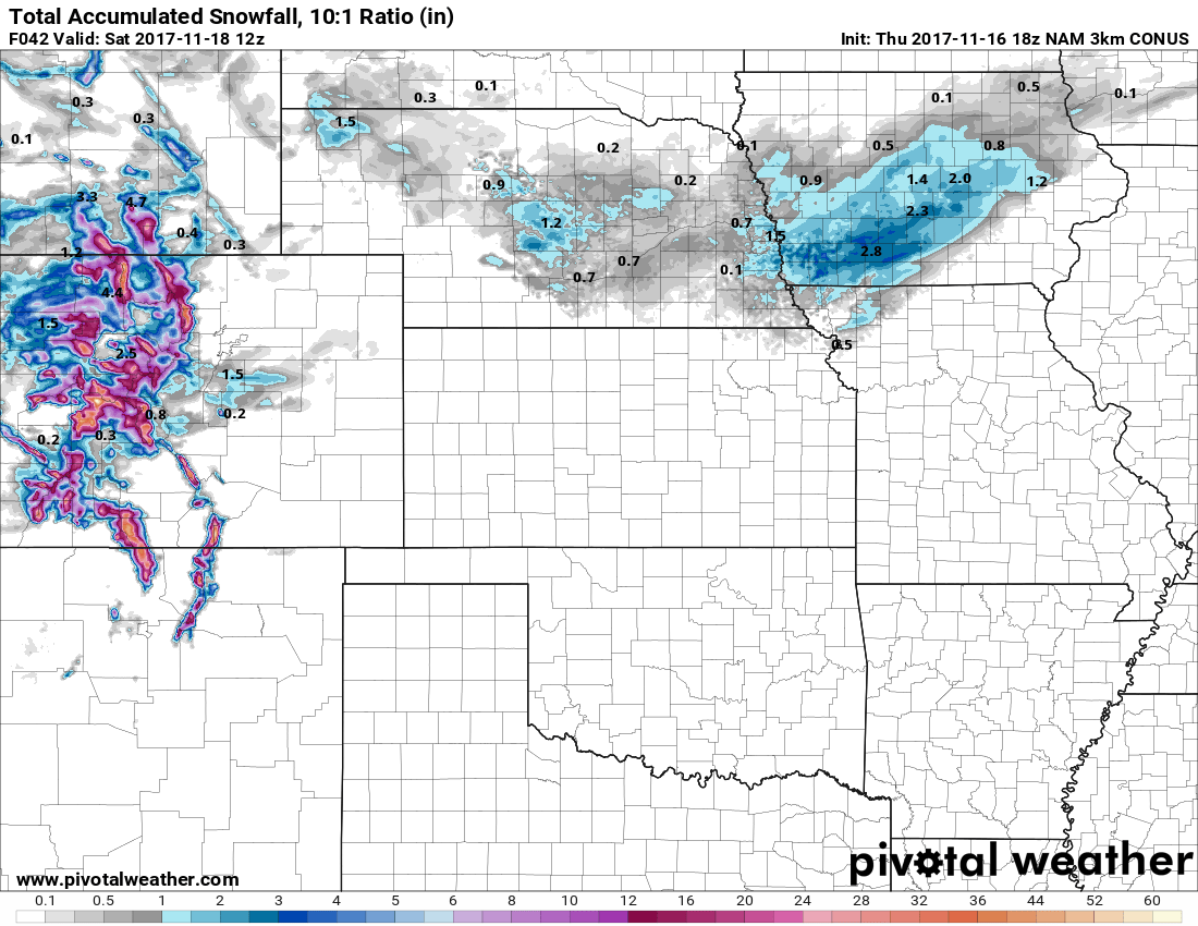
The only place models are showing snowfall accumulation is along the Palmer Divide, but I believe this may be a bit overdone...
That's not to say there won't be any moisture at all with this storm system East of the Divide. Rain showers later in the day are possible into the evening Friday. Due to the warmer temperatures and lack of cold air support, I imagine a lot of places will see rain or snow that doesn't accumulate too much.
For now, we'll stick to a good 0-2 inches of snow by Saturday morning for the Castle Rock area. I imagine we'll be closer to the 0 inch range, but we may see a dusting of snow stick if we're lucky. One thing we will most likely see with this storm system is a lot of wind. Downsloping will kick in Thursday night and last until a cold front shifts the winds later in the day on Friday.
Stay tuned! We'll pass along any forecast changes or discussions as needed. As of right now we have high confidence that this storm will be a non-event for the front range.
