If you've followed along with us last week you've probably heard us mention a few times about a weather pattern flip coming in the near future. The near future is getting quite close, we expect to see some sort of change by the latter half of this week. Let's take a look at what is expected with this week's weather.
First Half of Week To Remain Warm
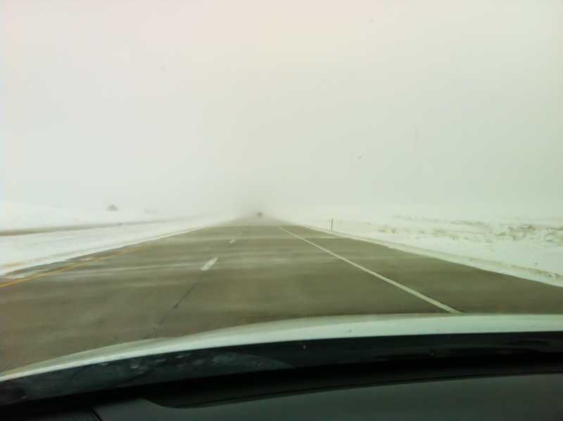
For several weeks now Colorado has found itself under a large upper level ridge. In short this means we see sunny skies, warm temperatures and dry conditions. Considering we've seen no measurable precipitation for the month of March so far I'd say this has held pretty accurate.
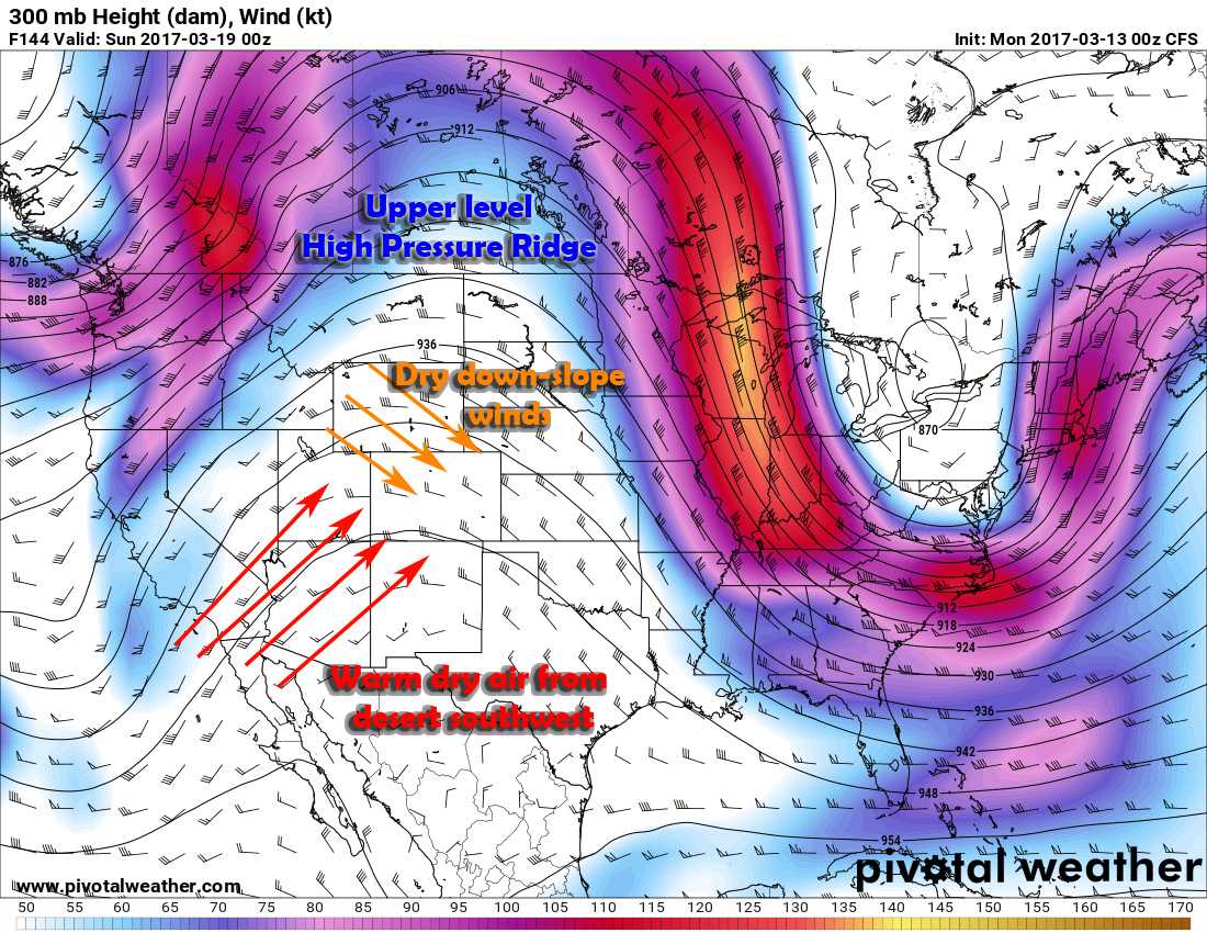
This pattern has been quite stubborn to move, but there are hints that it is breaking down and beginning to shift off to the East. This means that while we may have a pattern change brewing on the horizon, the first half of this week will be more of the same.
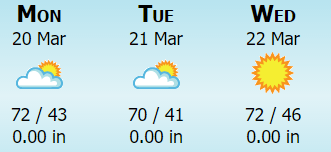
Expect above average temperatures in the 70's during the day and low to mid 40's during the overnight hours. Luckily the winds will be lighter than we've seen the past week or two, but expect them to pick up towards Wednesday and Thursday in advance of our next storm system.
Then The Change Arrives!
As with many storms this far out, it's too early to get into specifics with this one. The ultimate track and positioning will make a huge difference as to who sees what but this storm system is looking interesting.
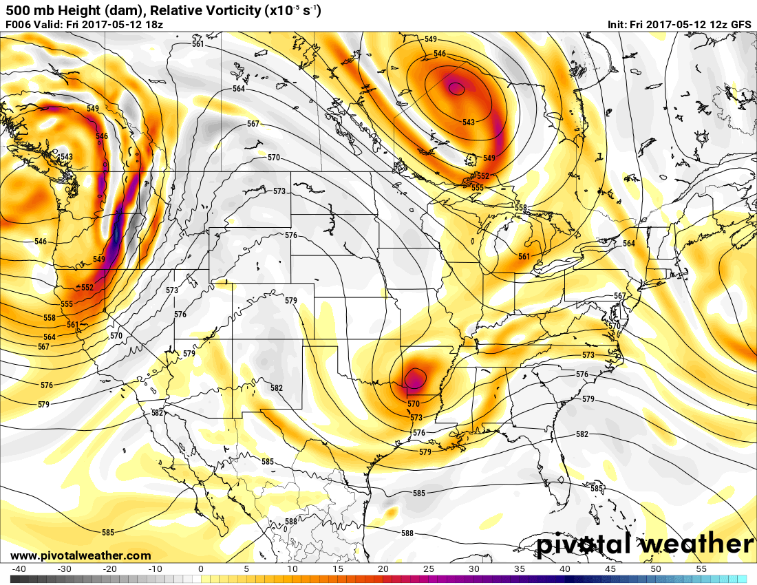
By Thursday afternoon we see a large trough developing to our Southwest over California and Arizona (notice the difference between this image and the one above?) This will increase our winds ahead of the storm as the jet stream arrives overhead.
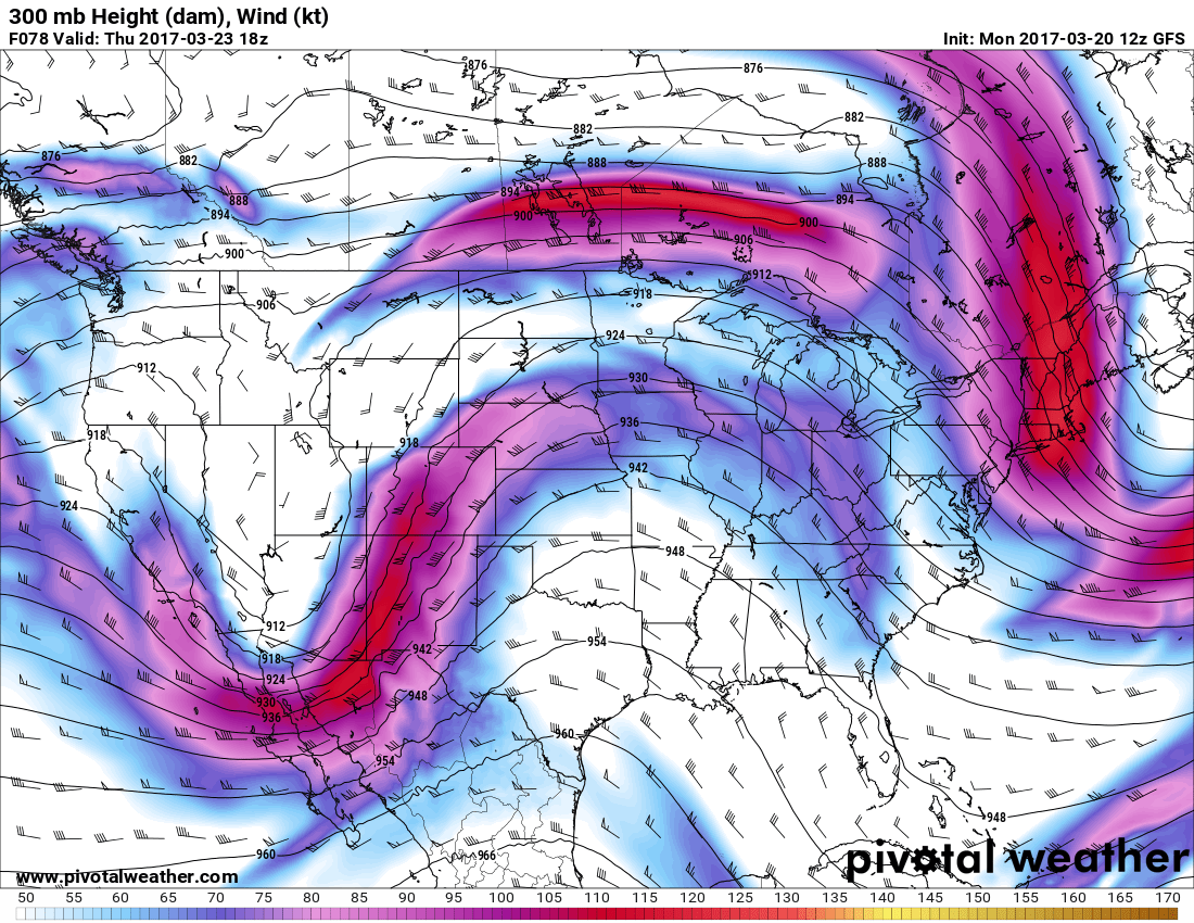
Thursday 12PM GFS Upper Level Forecast
Things get more interesting as we move later into the day in Thursday into the evening hours...
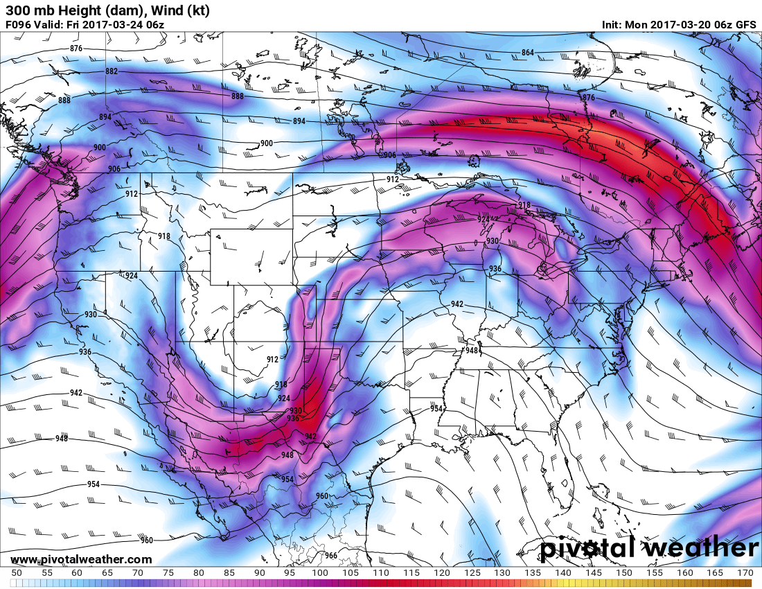
Notice the closed low pressure system developing over Southwest Colorado by late Thursday night into Friday morning. I suspect we will already see some precipitation falling as we move into the overnight hours on Thursday. The upper air support is there, but to make a storm like this tick, we also need to look at the surface to see if ingredients are lining up there.
The animated image above is a snapshot of the surface up to about 18,000 feet, in essence from the surface to the mid levels of the atmosphere. It's important that these ingredients set up with the upper atmosphere snapshot from above if we want to see a decent storm out of this.
It shows a low moving through, enhancing upslope and depositing significant amounts of moisture across the plains of Colorado. There doesn't seem to be a ton of cold air for this storm to work with so the rain/snow line will be very tight across the front range. A degree or two warmer or colder in the atmosphere could mean the difference between all rain or significant snow.
Summary
We are looking forward to some much needed moisture later this week. While this storm is still a ways out and the uncertainty is still high, we are seeing growing confidence in the models that the front range will see at least a little bit of moisture out of this storm.
Things to keep an eye on this week:
- Fire danger will remain high through Thursday!
- Strong winds could arrive by Thursday
- A storm system is expected to move into the area later on Thursday
- Exact timing is still uncertain, just expect something later Thursday or early Friday
- Storm system's strength is still up in the air
- Models have this ranging anywhere from a storm that does nothing to a significant spring "snowstorm" type system. Too early to call it yet!
- Temperatures and Track
- Temperatures may be too warm for much snow accumulationg, however a slight decrease in temps could change that.
- Some models have the storm further South which would mean less snow/rain for areas North of Colorado Springs
Lot's of uncertainty here still. We will be keeping an eye on this storm system through the week and post any updates as needed. We will especially be watching later in the day Tuesday and into Wednesday as we will get more data from more models at that time.
Stay tuned!
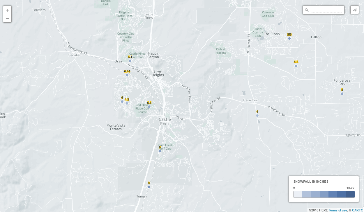
**Note: At this point, if anyone is giving out snowfall totals take it with a huge grain of salt. I'm not putting any snow totals out just yet as we don't have enough good data to make a decent forecast. Stay tuned for snowfall amounts in the coming days!
