
After somewhat quieter weather and even a warm day here and there, our pattern is about to shift again! So what does that mean for us in Castle Rock and along the Palmer Divide? Here's what we are watching over the next 24-72 hours:
Temperatures
A large blob of arctic air is slated to move down from Canada into the Central United States this weekend and with it the weather pattern in our area will become more unsettled.
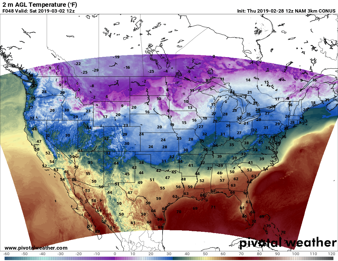
Models don't have a ton of agreement on how far West this cold air makes it or how intense it gets for a lot of Colorado. We won't mention specifics on temperatures just yet as we don't have the details just yet; but plan on much colder temperatures starting on Saturday (thinking 30's or 20's for daytime highs) and lasting through at least Monday. I would imagine the colder air may arrive a bit later on Saturday so it's possible that the first half of Saturday doesn't start off to chilly, but gets rapidly cooler as the day goes into the afternoon an evening hours.
Snowfall Chances
With the arrival of the colder air we expect to see a shift in the weather pattern as well. With that will come the chance of snow showers along the front range again. I don't know if I see a ton of snowfall for the Palmer Divide on Friday and earlier Saturday. I suspect (given modeling data right now) better chances of snow will set up later Saturday with the unsettled pattern remaining with more snow chances through the weekend into next week.
Here's a snapshot of the Nam3K for Saturday 5PM... what do you notice?
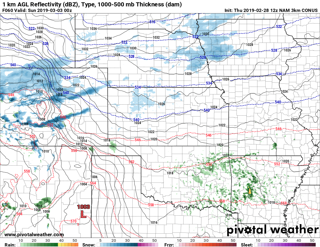
Did somebody say snowbands?
As you can see from the above image, the dreaded snowfall bands make an appearance on this model. The other models support this feature developing as well, so that's something to watch out for. As you know, this can make the snowfall forecast tricky for a lot of areas,
Does the above mean Douglas County and Denver get pounded with heavy snow? Absolutely not! I emphasize this in nearly every post because a lot of folks like to take these models as gospel. All models can do accurately istell us is that conditions are favorable for heavy snow bands... they CANNOT tell us where they will set up or how intense they will be. We just don't have the technology for that yet!
What to Expect
Like many snow forecasts, this one is likely to change based on subsequent data and model runs. Be sure to keep on eye on your favorite local, reliable weather source for updates!
Timing
Expect snow to start sometime later in the day Saturday. Models show anywhere from after 12PM to after 6PM... stay tuned for a better timeline as we get more data in.
Snowfall
A bit early for exact amounts as models still don't agree. GFS is showing a much more favorable storm track as compared to the Euro... the NAM is somewhere in the middle so we don't have great agreement yet to be able to put together a more specific snow forecast. Expect to have better details on that probably later in the day Friday.
I will say this though, there is strong evidence of heavy snowfall banding across many of the models. If your area ends up under those, expect the POTENTIAL for decent snowfall amounts. So be ready for that!
Quick Summary
- Colder this weekend, especially later in the day Saturday
- Snowfall most likely later Saturday into Sunday morning (at this time)
- Heavy snow bands look likely, this means be prepared for bursts of heavy snow in localized areas and possible travel impacts
Stay tuned, we will be tracking this storm system and will have more updates as we get more meaningful data!
